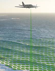
This Fugro illustration shows the airborne survey the company will be running. The image does not represent the Pacific region where the surveying will take place later.
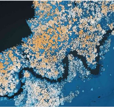
Fugro has been awarded a contract by the United Nations Development Programme (UNDP) to survey the Polynesian island country of Tuvalu. Located in the Pacific Ocean, Tuvalu is the world’s fourth smallest nation with a population of around 11,000 and a total land area of 26 square kilometers. The country is remote and, with low lying islands, is one of the most vulnerable to the effects of climate change.
The survey, to be conducted in 2019, will utilize Fugro’s airborne LiDAR bathymetry (ALB) technology, providing accurate national coverage of shallow (0-50 meters), nearshore and lagoon bathymetry and island topography. The survey data will primarily support the Tuvalu Coastal Adaptation Project’s island vulnerability assessment work and will also feed into a very broad spectrum of vulnerability, adaptation, infrastructure development, natural resource management and environmental monitoring needs.
“Tuvalu’s remoteness and susceptibility to the effects of sea level rise and tropical storms will benefit from Fugro’s advanced technology for mapping shallow water environments safely and cost-effectively. Our surveys will provide the baseline data necessary to plan adaptation and resilience responses,” commented Paul Seaton, Fugro’s Director for Business Development and Government Relations for Asia Pacific.
The provision of this data is widely seen as an extraordinary step towards improved planning, understanding resources and assessing national vulnerability. Important services, such as navigation in shallow waters, will also be greatly enhanced and the baseline data will be of key interest to development partners and local authorities. For the first time since rising sea levels have been a concern in Tuvalu, detailed and accurate information regarding the relationship between land height and sea level across all nine coral islands will be available.
Fugro is a Geo-data specialist, collecting and analyzing comprehensive information about the Earth and the structures built upon it. Adopting an integrated approach that incorporates acquisition and analysis of Geo-data and related advice, the company provides solutions.