Unmanned aircraft are not stymied by the Arctic’s thick, fractured sea ice. National Snow & Ice Data Center
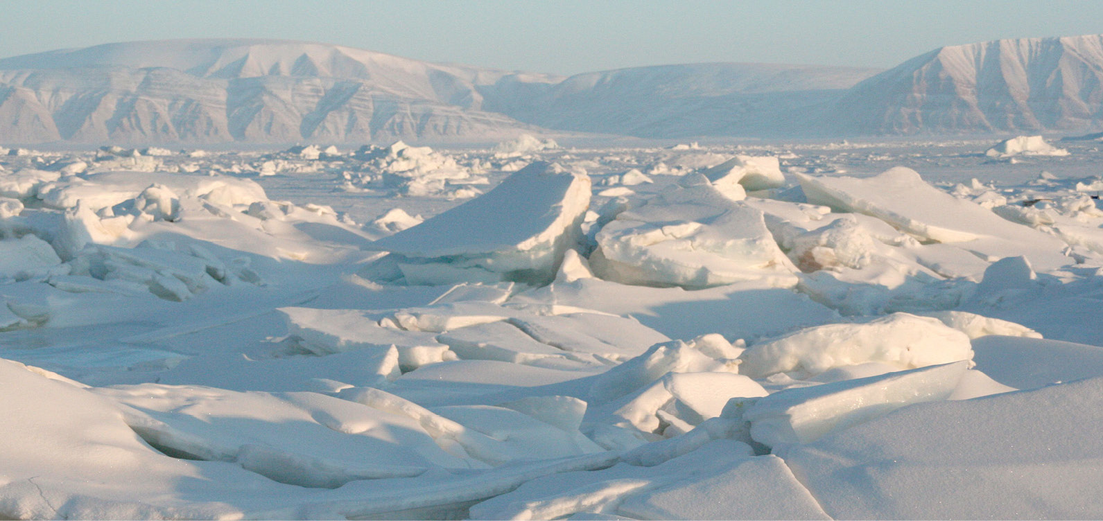
Perilous, shifting, mysterious and melting. All eyes in the Arctic are focused on the ice.
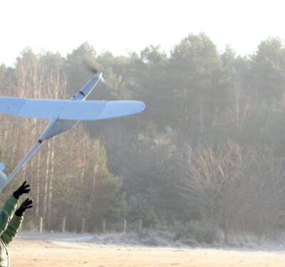
The accelerating disintegration of the globe’s northernmost ice fields is energizing Arctic nations to ease restrictions on unmanned aircraft in the region because drone flights are one of the few avenues for quickly completing vital climate change research.
The Senior Arctic Officials group, a body within the eight-nation Arctic Council, approved recommendations in October to simplify cross-border flight approvals and to allow unmanned aircraft to undertake long-range missions. Created in 1991, the Council is where countries with territory north of the Arctic Circle come to work out issues and coordinate joint efforts—including research on the impact of global warming.
If the Council’s members formalize the recommendations into a memorandum of understanding—which is the next proposed step—unmanned aircraft operators in the Arctic would have an opening for beyond-line-of-sight flights and should find it easier to get permission to cross the region’s international jurisdictions. Though not a stated goal, experience gained during such operations may ultimately help aviation officials work out how to integrate long-range flights into the regular airspace.
Research Race
The environmental changes galvanizing the Council are perhaps seen most clearly in the Arctic’s extreme reaches. At the end of the winter the northern ice cap still covers an average of 14 to 16 million square kilometers—some 5.4 to 6.1 million square miles. By the end of the Arctic summer, however, that cap has dwindled to a beanie. Every year the ice shrinks to just 7 to 9 million square kilometers on average (2.7 to 3.5 million square miles), according to the National Snow & Ice Data Center (NSIDC).
‘Dwindle’ is the operative word. As of 2015 the Arctic sea ice has been declining at a rate of 13.4 percent per decade relative to the 1981 to 2010 average. An earlier NSIDC assessment based on data from 1979 to 2002 showed a 7.7 percent decline per decade. The nine smallest September ice extents, that is the total area of the arctic with at least 15 percent ice coverage, have all occurred in the last nine years.
“The accelerating loss of ice from the Greenland ice sheet contributes to global sea level rise,” the Council says on its website. “Recent models project a rise of global sea level of as much as one meter by the end of this century. A rise of that magnitude will have severe consequences for our planet. Combating climate change is an urgent common challenge for the international community and requires immediate global action.”
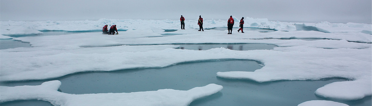
To better understand the changes in the Arctic, researchers have been using unmanned systems to study the ice and the underlying waters. (SEE New Technologies Aid Arctic Operations p. 54).
“The unique characteristics of unmanned aircraft systems, also known as remotely piloted aircraft systems (RPAS), allow for the ability to measure environmental conditions that currently pose a challenge for manned aircraft,” the Council was told in a white paper laying out the recommendations. “Issues such as geographically limited airport infrastructures, mission durations restricted by crew duty day or aircraft fueling requirements, and marginal low-altitude weather envelopes are overcome by UAS. These aerial platforms can be launched for missions from sea-ice camps, research ships, and remote field camps on islands or the mainland. Many of the platforms can operate nominally for 12–24 hours in duration. Each of these example conditions has posed extreme challenges for manned aircraft.”
The recommendations were crafted by the Council’s Arctic Monitoring and Assessment Programme (AMAP) working group and its multinational Unmanned Aircraft Systems Expert Group (UASEG). AMAP noted that the Council’s members have been using unmanned aircraft systems (UAS) for studies in the region but “the flights have been limited in number and in the scope of the area of operations.”
The newness of unmanned technology is part of what is hampering progress, AMAP said, but so are the limitations imposed by of unmanned flight rules and the need to get government approvals—especially when it comes to crossing airspace managed by different nations.
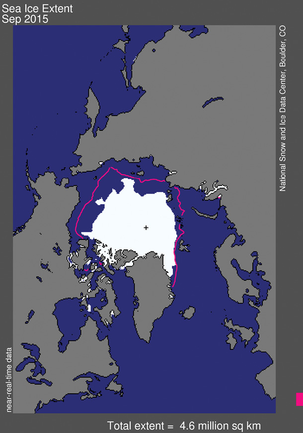
The extent of the Arctic sea ice at the end of the summer was less even than the median of previous years. National Snow & Ice Data Center
Beyond Sight, Beyond Boundaries
By international agreement the world’s airspace is divided into International Flight Information Regions or FIRs, which are set through the International Civil Aviation Organization (ICAO). Each FIR contains some form of air traffic and alerting service. Responsibility for service over international waters is delegated to the controlling aviation authority in a country on the border of the FIR encompassing those waters. Four major FIRs and three smaller ones cover the Arctic—and crossing FIR boundaries has been a problem. “All missions to date have flown within the FIRs of individual countries,” noted the AMAP team.
“Ongoing scientific questions about the changing Arctic are creating a demand for access across FIRs in order to effectively monitor and assess these changes in an efficient and safe manner,” AMAP wrote in the white paper. “The ultimate goal is to have the ability to conduct Pan- Arctic, cross-FIR scientific observations from UAS on a routine basis.”
The specific recommendations draw heavily from ICAO provisions. The Council would require UAS operators to file a flight plan with ICAO and have an ICAO-compliant operations and communications plan. They would also need a licensed pilot with proof of insurance and of training for that specific aircraft. The UAS itself would have to be registered in a national registry. AMAP recommended the UAS carry an Automatic Dependent Surveillance-Broadcast (ADS-B) transponder.
The recommendations are not aimed at flights inside sovereign borders though they do say nations would have to approve the operation of UAS of other nations over their territory—as would the nation of the pilot and the nation where the aircraft is registered.
The group recommended that countries approve pilots operating across Arctic FIRs “in a similar manner as manned aircraft operators.”
Sea ice reflects 50 to 70 percent of solar radiation while the open ocean reflects only 6 percent, according to the National Snow & Ice Data Center. National Snow & Ice Data Center
Next Steps
ICAO and the aviation authorities of each Arctic Council member have already reviewed the recommendations and their comments were incorporated into the final product. That helps clear the way for AMAP’s requested next step, which is for the recommendations to be ratified as an international agreement reflecting best practices for UAS cross-Arctic scientific and SAR (search and rescue) operations.
Ratification would effectively create a memorandum of understanding between the council’s members, said Martin Forsius, the chair of the AMAP Working Group chairman in a presentation. Without it, according to his charts, “obstacles for scientific use across Flight Information Region (FIR)s will continue to prevent efficient use of RPASs for scientific purposes”.
“Alternatively, he added, “RPAS (Remotely Piloted Aircraft Systems) will have to meet (very limiting) ICAO aircraft airworthiness requirements to operate in Arctic seas.”
To speed implementation along the working group also drafted a handbook for UAS operators wanting to fly in the region.
“The scope of this handbook,” the working group wrote, “is to give guidance on how to obtain an authorization or exemption for scientific beyond visual line- of-sight (BVLOS) operations until RPAS regulations are in place.”
The handbook notes the challenges of waiting for the full development of UAS flight rules and summarizes the regulations as they exist so far in each of the council member countries. It lays out steps for operational planning including dealing with regulatory realities, crafting a communications plan, writing an operations manual and assessing mission risk—including a table of risks, mitigations and probabilities. Described as a supplement to ICAO materials, the draft handbook even provides sample forms to help operators work through the steps they need to take.
Broad Impact
The risks of operating in the Arctic, particularly over the unpopulated areas, are relatively low—which should make ratification easier.
“There’s been several studies done that show that there’s so little air traffic up there that it’s unreasonable to have (beyond-line-of-sight) restrictions in the Arctic specifically,” said Scott Tripp, assistant chief scientist for Arctic Operations at the U.S. Coast Guard Research and Development Center.
Even though aspects of flying in the Arctic could be quite different from flying elsewhere, the experience gained on long-range Arctic missions could inform future regulations for more populated areas. This possibility is all the more likely because ICAO—which is now developing rules for unmanned aircraft—is already part of the process and because a dozen other nations with active UAS communities participate in the Council’s work as observers. Among those observers, who are allowed to participate in the working groups like AMAP, are China, Japan, India, Korea, France, Germany and the United Kingdom.
AMAP is also co-chaired by Clifford Sweatte, an official with the U.S. Federal Aviation Administration who also happens to be working on beyond-line-of-sight technology as part of FAA’s Pathfinder Program. Indeed the Council itself is being chaired by the United States until spring 2017. The U.S. is well placed to not only support using UAS in the Arctic but to apply any lessons learned in the process.
The Council committed itself to fostering a healthy Arctic environment in its May 2013 Vision for the Arctic, pledging to “strengthen our work, both within the Arctic and globally, to address the environmental challenges facing the region.” The steps being taken to expand the use of UAS should help further those efforts.
Even so there is still much work to be done, advised the chairman of the Senior Arctic Officials group in a statement.
“We’re still in the early stages,” U.S. Ambassador David Balton said.”