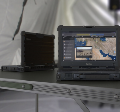
Kongsberg Geospatial, creators of the TerraLens geospatial map-engine Software Development Kit (SDK), announced today the release of the Modular ISR…
Sensors

Baseball, Boeing and BVLOS
The decision was so unheard of that The Los Angeles Times wrote about it. After hitting a terrific .387 as…
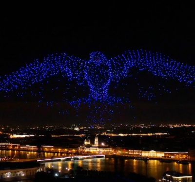
Two-thousand Plus Simultaneous Drones Position Themselves with GPS and GLONASS technology
u-blox, a provider of positioning and wireless communication technologies, announced that it supplied the high-accuracy GNSS technology that made possible…
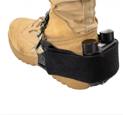
Robotic Research Honored for WarLoc: The Warfighter’s Boot-Mounted GPS Alternative
Robotic Research Honored for WarLoc: The Warfighter’s Boot-Mounted GPS AlternativeGlobal autonomy and localization technology provider Robotic Research LLC received multiple…
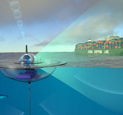
Autonomous Drifters Expand Maritime Knowledge as Part of the Ocean of Things
The Defense Advanced Research Projects Agency (DARPA) awarded a contract to PARC, a Xerox Company, for small, low-cost autonomous drifters…
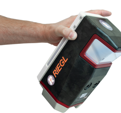
InterGEO 2020: RIEGL’s UAV-based VUX-120 UAV-LiDAR sensor
No doubt, 2020 has been a very special year, with the pandemic forcing us to think and work in new…
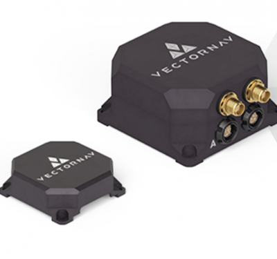
New Tactical-Grade Dual-Antenna GNSS/INS Shows Off at InterGeo and AUSA
VectorNav showcased its new VN-310 at the recent InterGeo expo in Berlin and at the Association of the United States…
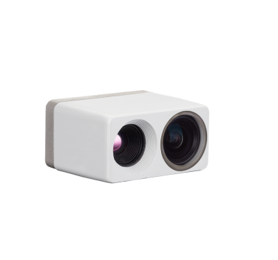
FLIR Systems Introduces Dual Thermal and Visual Sensor Module
FLIR Systems recently released what the company is calling the industry’s first dual thermal and visual sensor module for drone,…
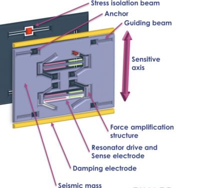
Silicon MEMS Accelerometer: the Latest UAV Navigation Disruptor
MEMS has moved into the high-end market, and the latest disruptor to take into account is silicon MEMS. That’s micro-electromechanical…
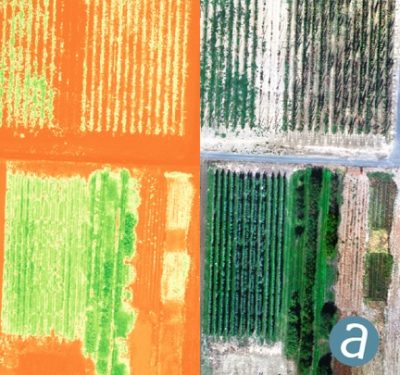
SimActive Introduces Cloud Sharing and Reflectance Calibration with New Version 8.5
SimActive Inc., a world-leading developer of photogrammetry software, announces the release of Correlator3D version 8.5. The new version allows users…
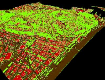
Woolpert and iXblue Partner on LiDAR Mapping Projects in New Zealand
Woolpert, Inc. and iXblue Sea Operations Division have been awarded two significant airborne LiDAR program mapping projects that will help…
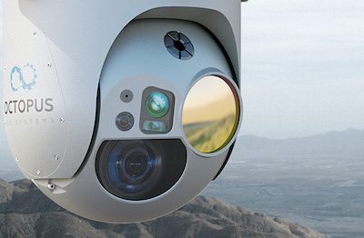
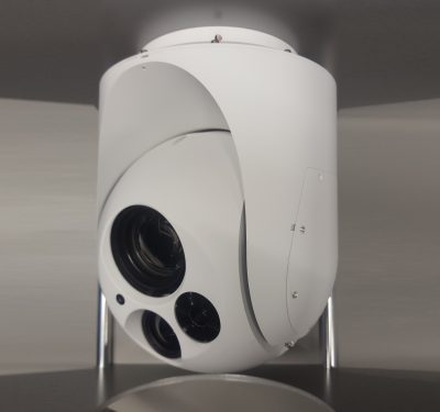
Octopus ISR Systems Launches Epsilon 180
Octopus ISR Systems recently introduced the Epsilon 180 surveillance camera system for unmanned aerial systems (UAS) and small manned aviation…
Draganfly’s “Pandemic Drone” Tests Stopped in Westport; Others to Begin Soon
After becoming the first to begin testing Draganfly’s Pandemic Drone, community push back led the Westport Police Department to opt…

EasyMile and Velodyne Lidar Announce Three-Year Agreement
EasyMile will use Velodyne Lidar sensors to enhance its fleet of EZ10 autonomous shuttles. The companies recently reached a three-year…

Quantum-Systems Offers New Camera Imaging System for its Mapping UAV
Quantum-Systems, a developer of eVTOL fixed-wing drones, is offering professional customers the latest payload option for its small fixed-wing Trinity…
Octopus ISR Systems Introduces New Surveillance Camera System
Octopus ISR Systems recently released the Epsilon 140LC Airborne Surveillance Camera System. The airborne electro-optical/infrared (EO/IR) surveillance system features advanced…
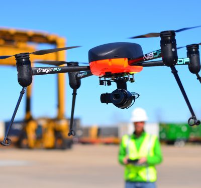
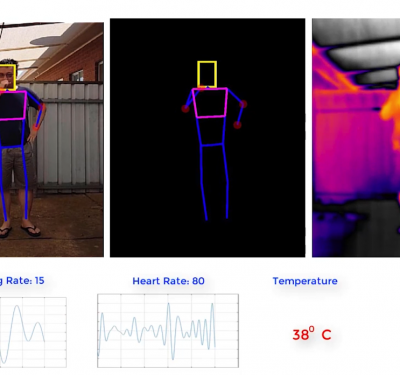
Draganfly Selected to Develop “Pandemic Drone”
The drone will have the ability to detect infectious and respiratory conditions in groups of people. In response to the…
