senseFly
The idea behind Agriculture and Space Day was to make sure everyone appreciated just how much space technologies contributed to the agriculture sector. The setting was a field of grass in the back garden of the historic natural science museum, a surprisingly quiet space in the heart of Brussels, dominated by the looming glass and steel European Parliament building.
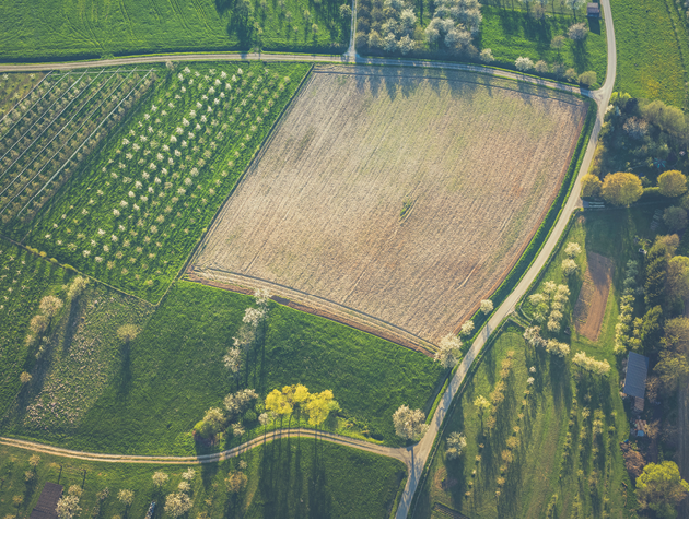
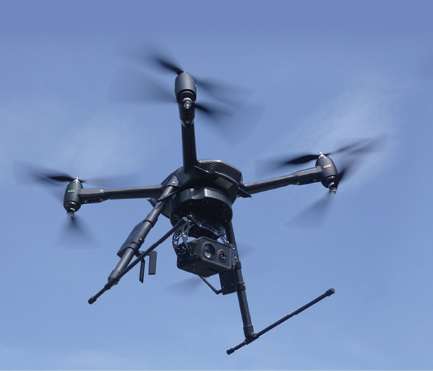
Europe’s flagship space program, Galileo, always has been advertised by the EU as a boon to farmers, enabling precision agriculture practices that save time, money and resources. Galileo’s satellite navigation signals are also used by unmanned aircraft, which can study fields from above to help trouble shoot problems and fine-tune the amount of fertilizer and water that should be used.
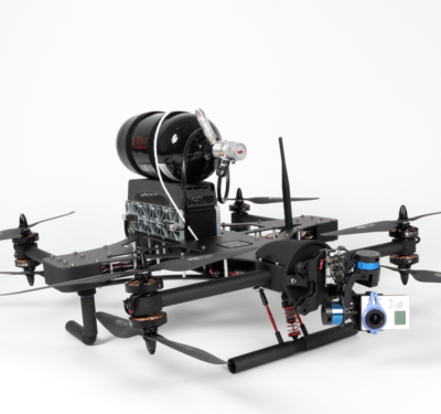
“All around the world, drone service providers deliver image acquisition to farmers,” said Tamme Van Der Wal, a partner at AeroVision B.V. That imagery, he said, can be done in natural color, which supports visual recognition, counting plants or mapping. Sensors detecting red/infrared reflectance enable vegetation indexing and thermal mapping and a better understanding of how temperature is related to evapotranspiration. Unmanned aircraft are also able to do 3-D imaging that captures the land’s contours for mapping.
“Other sensors are flown too, but only in experimental use, such as GNSS reflectometry systems for soil moisture, or LiDAR for crop height, etcetera,” he said.
There are now many different companies providing drone services, Van Der Wal said, comprising two main groups: “First, there are the drone service companies, basically pilots making a business out of their personal capabilities. And then there are the agricultural service companies that are expanding their offerings to include drone imagery acquisition. These are people like farming contractors, farm extension services, advisory companies and supply services.”
Van Der Wal said he believes there is a lot of potential value in drone-based crop monitoring, but the costs must be aligned with the benefits: “Currently, costs are very much related to the pilot and restrictive regulations and are quite high compared to the benefit to the farmer. So at this moment, I would say it is not yet a very broad market, but more a niche market, like many innovations. However, the potential can be enormous when extended line of sight is approved or even BVLOS [beyond visual line of sight] or autonomous flights.”
Regulation on the Horizon
“It’s not only a technology thing but also a legal thing,” Van Der Wal said. “Drones, of course, are very much subject to regulations nowadays. We cannot fly further than line of sight, for example, as I said. We are, of course, definitely paying attention to what’s happening with the European drone regulation. We are absolutely on top of it. We are very excited about what EASA (the European Aviation Safety Agency) is now promoting with the specific scenarios.”
EASA has been very much involved in the drafting of the EU’s soon-to-be-adopted drone regulation. Under the envisaged scheme, the creation of so-called ‘standard scenarios’ for European drone operations will allow a level of automation in the flight authorization process. The idea is to have a pre-established risk assessment ready for certain types of operations, so it’s not necessary to do a long and drawn-out assessment for every drone mission.
“With these scenarios, if you are able to get an agricultural scenario prepared, then we can say: “Listen, line-of-sight is just too short for most of these fields,” Van Der Wal said. “I’m not talking about the Netherlands and Belgium, these are small countries. But you go to France and Germany, with line of sight you do not even cover a quarter of your fields. The new technology will be able to do it. With this technology we can easily fly the whole field without interfering with anything else, and that would be the great jump forward. So, yes, 2019 I think is the year they’re going to have this new European regulation. If that comes through—I hope as soon as possible—we can convince the regulators and this agricultural scenario will roll out. And then we’ll be able to make major progress.”
Having said all that, Van Der Wal and partners are not waiting around for new regulations. His new startup, BIOSCOPE, is delivering imagery by integrating more expensive drone monitoring with less expensive satellite monitoring. The company uses satellites whenever possible and drones when needed.
“With this combination,” Van Der Wal said, “we achieve an affordable, reliable data service to farmers, providing them with fresh imagery throughout the growing season.”
Other viable business cases exist in niche markets, he said. For instance, plant breeders are using drones to closely monitor experimental plots, and agricultural insurance companies use them to carry out damage assessment. So there is money to be made now for drone operators in the agriculture sector in addition to the untapped potential that regulatory advances will open up.
And then there are those farmers who want to take things into their own hands, as has been their custom for untold thousands of years.
Markus Spiske via Unsplash
(Agri)Cultural Gap
The event in Brussels was an interesting assemblage of politicians, bureaucrats, consultants and real-life, hands-on workers of the land.
One unnamed policy type wanted to know if there wasn’t a mismatch somewhere: “Here we’re speaking about a sophisticated technology,” they said. “Is there a cultural barrier for farmers to get into these technologies?”
“Yes and no,” Van Der Wal said. “These machines here (pointing to a very big and very high-tech tractor some yards away which, by the way, can be operated in ‘unmanned’ mode) are full of advanced technologies, but farmers know very well how to use them. The problem is that we, as scientists and engineers, we have to make our new technologies understandable to the farmer. So I would say that there is a gap, but it’s more on our side than on their side.”
Max Schulman, an arable farmer from Finland, has been working with unmanned technology for a number of years.
“We started already around five years ago,” Schulman said, “first as just a fun thing, with drones on the farm, just to look at the crops at different times during the growing season and also during the off season—to learn and to see how
nature actually affects the fields when you’re looking at the crops, but also at how water was running after rains, where maybe we should put up certain buffer zones, and so on. Simple, easy things. Of course we’re doing more advanced things now, to be more precise and more efficient, and this is helping us to improve productivity.”
The new technologies are having an impact in that they are making the business more attractive to the next generation of farmers, Schulman said.
“It is more interesting to young people now. Drones have become an important part of this process in recent years. We’ve always had the big equipment,” he said, indicating the high-tech tractor. “Now we’re getting to the smaller equipment that today is even more powerful.”
Drone expert Van Der Wal said many farmers like Schulman will not be interested in the technical side of things per se, including things like location-specific signals. “What they really want to know is what they have to do with the information,” he said. “They need to use it. If they are able to use it they will invest in it. That means the software, all these new packages now coming into the market that absorb our data and translate it into required actions, that’s really important too.”
Aerialtronics
Government Business
Drones also are being used to calculate field sizes for subsidy purposes. Today, when a farmer says he has five hectares to declare, what he’s done is gone out with a GNSS receiver and walked around the perimeter of the property. Then there is the verification process, which involves an inspector coming out to make sure the farmer’s measurements are accurate. It’s a time and labor intensive process, compared to what could be done using drones.
“One of the more cumbersome things is when you have to control the area of your farm,” Van Der Wal said, “and there have been some tests with control officers using a drone. With stereo photography we can easily measure the size of the field. We can even see under the trees. With satellite photos we can only look from above.
“What I think would be interesting is if we could give the farmer a drone or let them use their own drone to measure the field. Then they submit that to the government. With Galileo you have the integrity function so we know it’s true. No further verification is needed.”
It sounds straightforward, but drone use in this way has not, so to speak, taken off. Not yet, at least. Van Der Wal said a lot of that has to do with the people involved. “The point is the farmer, like the controller, has a specific task and background. They are used to working the way they work. And now they have to learn a new way and even how to fly a drone. It takes time.”
Copa-Cogeca spokesperson Stephen Weller said there are other obstacles to drones being used to verify field sizes: “You have the question of price. Then there is interoperability with the systems already being used by the control agencies. They need time to learn and gain experience. You’ve got to test this new solution, to see if it’s accurate, and you need to understand which methods you’re going to need to use to verify the results.”
The Galician government, Weller said, has launched a public tender to do exactly this. “The first results will be ready by early next year. They also need to determine which sensors and resolution are the most adequate for the job.”
The value of such operations does seem pretty obvious. The market is as vast as the fields of France and Germany, and all the rest. Whoever gets there first stands to make a bundle, or is that a sheaf?
No Small-Time Players
For its part, Copa-Cogeca expresses particular apprehension over the plight of Europe’s small farmers, for most of whom survival itself requires at the very least joining a cooperative. Much like in manufacturing, it’s these small and medium sized concerns that play an important role in things like innovation and, in the agriculture sector, maintaining biodiversity. But they also face the greatest challenges.
“I don’t have statistics, Weller said, “but when it comes to drones being used by small farmers, we know there is a huge way to go forward. We heard from Max Schulman, who uses them. I also know that Terrena and other agri-cooperatives, possibly Gaia (Gaia Epicheirein), offer drone services to its members as a complement to satellite maps.”
In addition to the cooperatives, contractual companies do provide drone services. It is more cost-effective and “more professional” this way, Weller said, as opposed to farmers just doing it themselves. “On top of the hardware, the drone, you also need the software, and there’s maintenance and piloting skills and licenses. All this is necessary to be able to extract and process the data.”
One thing is certain—the market for drones and drone services in agriculture is not going away. Some farmers might be a little shy, but they won’t shy away forever, not if the value is clear, Schulman said, “Everybody says; ‘Do these guys know how to use this technology?’ I can tell you one thing—we know how to use the technologies. We use them every day, from the biggest combines and tractors down to the smallest sensor technologies. Every farm has its own choice, its own system, how they do it, so you will never find a one-size-fits-all solution for all the farms. Give us a choice of solutions, lift it up, make it easy to use and accessible and we’ll use it.”
Big Data – The Business Model
Copa-Cogeca General Secretary Pekka Pesonen provided a big vision for agriculture based on, you guessed it, Big Data.
“New technologies such as GNSS promise to provide European farming with the tools to compete in dynamic markets,” Pesonen said. “The technological and digital transformation of agriculture is no longer a discussion for the future. Big Data, provided by precision farming methods, optimizes the use and marketing of related tools, facilitating sales and improving the competitiveness of EU farming.”
Though Pesonen referred primarily to satellite-generated data, his argument applies equally to drone-generated information.
“These technologies improve resource efficiency and optimize the use of fertilizer, seeds, plant protection products, water and machinery, improving the financial bottom line,” he said. “Data can be safely shared between industry and authorities to help map farm land and track environmental initiatives accurately, simplifying regulatory oversight and making it more efficient, modern and fair.”
And making the agriculture sector another huge target for interests ready to step in and provide the ever more powerful data-based information services that we all know are just around the corner.