Photo courtesy NASA
You don’t have to do it all by yourself. If your project is stumbling over a technical hurdle, needs a specialized sensor or a novel material, there’s a good chance someone else has stared down that same problem and come up with a solution. A solution they’d be willing to share—for a reasonable fee.
One of the most significant providers of unmanned innovations is NASA—the agency famous for epic missions with equipment that regularly outperforms expectations well beyond the reaches of human repair. The private sector can tap into NASA’s extensive catalog of technology including inventions developed specifically for unmanned systems. The agency has patents available on ultra-light avionics, certified geofencing software, wireless sensors that don’t need batteries and designs for robots that can squeeze into collapsed buildings. They even have sensors that could enable entire new applications.
With flexible licensing options, special programs for startup firms and a variety of commercial opportunities under its emerging UAS traffic management system, NASA’s technology transfer opportunities are worth exploring.
Ahead of the Storm
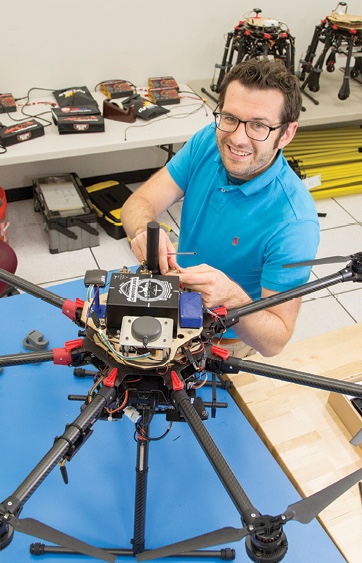
Qamar Shams is the co-inventor of a groundbreaking sensor—one that can help forewarn cities of natural disasters and take the infuriating hum out of wind turbines. The sensor detects infrasound, a type of acoustic wave at frequencies of 20 Hz or less—too low for humans to hear.
“Low frequency signals are emitted by certain tornadoes, by hurricanes, by earthquakes, by tsunamis, by wind turbines and also several other phenomenon like flying aircraft,” Shams said.
One key characteristic of such sound waves is they travel over long distances without the attenuation. If a storm were developing over Baltimore, for example, sensors more than 200 miles away at Shams’ lab at NASA Langley Research Center in Hampton, Virginia, could detect it.
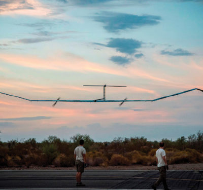
Shams is installing infrasound sensors on unmanned aircraft systems (UAS) to study tornados. These wildly destructive funnels of wind form so close to the ground they are difficult for radar to detect. Sensor-equipped UAS can give area residents as much as an hour’s advanced warning that conditions are ripe for tornado formation. Just as importantly, a triangulation formation of three or more such drones, flying at least 100 feet apart, can be used to tell the direction of the tornado, perhaps even track where it’s headed. Though the sensors could be installed on the ground, putting them on drones offers the flexibility to shift them as different weather fronts move through.
Unmanned aircraft with infrasound sensors can be used in a similar way to help predict the impact of other types of severe weather including hurricanes. Currently, the National Oceanic and Atmospheric Administration (NOAA) assesses hurricanes by sending manned aircraft (and more recently a NASA Global Hawk drone) over hurricanes to launch dropsondes—sensor packages on parachutes that take measurements of temperature, pressure, winds, and humidity as they drop.
“What we expect is that if UAS can really stay a couple of hundred miles away, equipped with some of these sensors and then it can provide useful information about (a hurricane’s) strength and about direction,” Shams said.
Commercial pilots could also benefit from infrasound triangulation by having trios of sensors installed on planes. The sensors could detect clear air turbulence and alert pilots so they are able to steer clear. Though Shams declined to give details, he said NASA is already working with one company that is looking at this idea.
Earthquake Warnings
Infrasound is useful for more than detecting atmospheric disturbances. The same low frequency sounds have also been found to signal imminent earthquakes, aftershocks and tsunamis. Drones with sensors could be deployed to spot check or monitor trouble-prone areas.
Though humans can’t hear such low frequencies that animals can, which help explains why animals often seem forewarned of natural disasters.
“In Java in 2011 a tsunami came but there were very, very few animals killed and the reason for that—these elephants and other animals—they sensed these signals before the earthquake, before the tsunami hit,” Shams said. “And those elephants and those animals started running toward the mountain area and climbed it and this saved their lives and even some people who followed them.”
Infrasound has additional potential as a tool to help reduce industrial noise. One firm has already licensed the technology in hopes of pinpointing and reducing the sound from wind turbines, thereby reducing resistance to the installation of wind farms.
“We want to measure the exact location from where these signals are coming from and at what frequencies those signals are coming from,” Shams said. Once the source is identified, there might be ways to reduce it or cancel it out.
Evan Dill with a Safeguard-equipped drone. Photo courtesy NASA
Let’s Make A Deal
Firms interested in tapping NASA’s technology catalog have several ways to search for patents. Langley and each of the NASA centers has a technology transfer web page with a search option. The agency as a whole has its own search page, which should include the centers’ patents and more from other NASA facilities. You can scroll through categories of technology or do key-word searches.
The first step after finding an interesting technology is to contact the tech transfer office of the appropriate NASA center with any questions. Jennifer Viudez, a Langley technology transfer specialist, suggests both calling and emailing using the contact details given online. A technology portfolio or licensing specialist can get you more information and, once you feel confident enough to proceed, you can submit a license application online.
There are three types of licenses, Viudez said, including special options for small companies.
The license familiar to most people, she said, is the standard commercial license, which requires the company to submit a business plan. The tech transfer office weighs the business plan and looks at factors, like whether the technology is already licensed, to decide whether to go forward with the application and, if so, for what kind of royalty. The royalties and the terms of license are the product of negotiations.
“Each one of those are customized,” Viudez said. “They’re definitely not cookie cutter. We negotiate back and forth with the licensee—a lot of communication between my office and the potential licensee to come up with the financial terms of the license.”
If the technology is promising but it’s not yet clear if it’s suitable, a company can request an evaluation license. For a flat fee of $2,500, the firm gets the same access to the intellectual property as a holder of a commercial license but for only roughly one year. Evaluation licenses are also non-exclusive, Viudez said, and are “only awarded to U.S. companies, where commercial licenses could potentially be international.”
Startup Support
NASA introduced a third option about two years ago—a startup license geared specifically to small firms.
“The company needs to have been in business for less than a year,” Viudez said, and have less than 50 employees and less than $2 million dollars in the bank.
“The good thing about the startup license is you don’t have to pay NASA an upfront fee, you don’t have to pay any annual minimums for three years, and there’s a set royalty rate versus sort of a negotiated royalty rate. And so it keeps all the money in the startup’s pocket for them to get going for at least the first three years—and that tends to be very attractive.”
The set royalty rate is currently 4.2 percent, she said.
If you only looked at the tech transfer website, however, you’d likely get the impression the startup has to be launched exclusively for the purpose of commercializing the NASA technology—a deal seemingly intended for NASA scientists with entrepreneual asperiations.
“That is in the strictest sense of the program,” Viudez said. “Here at our center we’ve been a little bit more flexible. So, for example, if a company has started six months ago and they found a technology from our center and said ‘Okay, well we want to refocus our business line to look into this technology and make this work. We have granted startup licenses to a company like that, that wasn’t necessarily started around NASA technology.”
It is also possible, she said, for an otherwise qualified firm to license a technology that is intended only to be part of a larger project—a battery with exceptional endurance, for example—and not the focus of the firm.
“We have to look at each application on a case by case basis,” Viudez said, “but generally I would say that the company would be able to use the startup license.”
Langley has been granting 15 to 30 licenses annually, some of which can take as little as four weeks to complete. The center has an SBIR / STTR (Small Business Innovation Research / Small Business Technology Transfer) program through which qualifying companies might win government grants or contracts. Finally, Langley can offer firms access to the researchers to help them get started.
“We’ll often, very often, hook up inventors with the licensees and they can have a one hour phone conversation,” Viudez said. “Sometimes we have licensees actually come to our center and go to the lab and spend the day in the lab with the inventor—something along those lines to help them out. (For) anything that’s kind of past a very short period of time the licensee can also enter into what’s called the Space Act Agreement, and a Space Agreement is just a document that allows NASA to partner with outside entities.”
Shams will be working with a firm that has licensed the infrasound technology to tackle the issue of air turbulence. Under their Space Act Agreement, NASA will be able to provide engineering and technical support to the company on a reimbursable basis.
“We can help them,” Shams said, “until they are really expert and they feel that, ‘Yeah, now they can handle everything.’ Whatever they need to diversify, to commercialize this technology.”
Safeguard
One technology UAS firms may be interested in exploring is Safeguard, a certified and secure system for enforcing geofences—borders marking no-fly zones around areas like government facilities and stay-in areas of operation.
Geofences are one option for addressing broad concerns about security that have become a central issue for the unmanned industry. Worries about nefarious actors are hamstringing progress toward allowing flights over people and beyond visual line of sight. There are also the concerns about uninformed pilots operating in off-limits areas or accidents where, for example, a lost communications link results in a flyaway drone—as reportedly happened when a small quadcopter landed on the White House lawn in 2015.
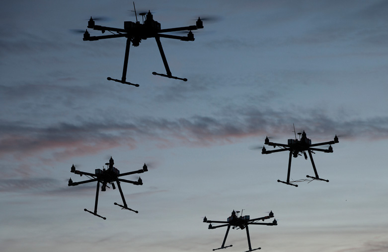
Photo courtesy NASA
To prevent such problems Safeguard incorporates a number of fail-safes.
First, the system operates independently of the rest of the unmanned aircraft, including having its own hardware. This addresses any potential glitches in either the UAS’ systems or flight software.
“We essentially separate the hardware such that if there’s any sort of failure on the autopilot, whether it be hardware or software, our system can still perform its intended action properly,” said Evan Dill, a Langley research associate on the team that developed Safeguard.
By not relying solely on GPS or other satellite navigation constellations (collectively called GNSS) to determine its position, the system also avoids being spoofed or hampered by GNSS signal problems caused by, for example, jammers or sunspots.
“So if you have another positioning system available to you, whether that be some sort of vision system or a local positioning system—anything that you have available to you—you can use that in conjunction with GNSS,” Dill said.
The Safeguard software is also especially robust. “A lot of our core algorithms have been formally verified,” Dill said, “and we’ve designed our software to meet safety assurance standards all the way up to those for commercial manned aircraft.”
In fact, Safeguard is certified and that certification sets it apart because, as yet, there are no standards to enable such certification through the usual aviation process. NASA, however, has standards of its own and Safeguard has achieved a NASA class B certification, “which means that it is up to a level to be mission critical for unmanned spaceflight,” Dill said.
A Safeguard-equipped drone also cannot be taken over in flight and directed over a geofenced area. Information on no-fly zones is uploaded into Safeguard from an up-to-date database before a flight and can’t be updated wirelessly.
“Once Safeguard begins operation there are no inputs into it,” Dill said. “So it is, while it’s in operation, for all intents and purposes, hack proof.”
If a drone gets too close to a geofence Safeguard sends a warning to the aircraft to perform some sort of contingency maneuver, Dill said—perhaps a soft landing or a return-to-home order. If the drone continues toward the geofence, Safeguard—which, again, is a completely independent system—will terminate the flight, for example, by stopping the rotors. The software can bypass the drone’s other systems to end the flight thereby preventing flyaways when the pilot no longer has control or the drone has been co-opted.
Stopping the flight doesn’t necessarily mean the drone is lost. It could be equipped with a parachute for a relatively soft landing—but the flight will be stopped.
“So with Safeguard, what we’re essentially saying is you’re not going to ever cross your boundaries,” Dill said.
UTM Opportunities
Safeguard-equipped drones are already being used to assess vehicle-to-vehicle communications as part of the testing of NASA’s UAS Traffic Management (UTM), one of the most ambitious drone-related programs underway at NASA.
Building on its decades-long relationship with the Federal Aviation Administration (FAA), NASA is developing an air traffic management system capable of handling what is expected to be an extraordinary volume of drone flights.
“There are projections for how many drones or UAS—unmanned aircraft systems—are projected to be flown commercially in just the next few years. It’s on the order of millions,” UTM Project Manager Ronald Johnson said. “And so the paradigm of having a human air traffic controller in communication with an aircraft for separation and such, it’s just not going to work in terms of trying to scale up for the projected commercialization of drones. And the FAA realizes that. NASA recognized that a while back. So the idea is that the UTM system is software based on the traffic management side of it and there’s enough automation in it so that there’s a minimal amount of human involvement in actually reviewing and approving operations.”
As currently envisioned UTM will be a federated system. The FAA will produce and manage the Flight Information Management System, which sets the overall airspace constraints and can provide information on what drone is flying where. Industry will be providing services such as UAS Service Suppliers, services that drone operators will use on a subscription basis to do flight planning and deconfliction. NASA is developing a prototype of what industry will be doing that it will transfer to participating companies in the form of specifications and APIs (application programming interfaces) for the USS system. APIs are the connective software necessary for different elements of the UTM to communicate.
Alphabet (the parent company of Google) and Amazon are among the firms already working on becoming USS providers. There also will be commercially run supplemental data service providers, or SDSPs, that will supply information to support USS operators.
“Weather is an example of supplemental data service that could be a third party or a commercial firm,” Johnson said. The weather firm or firms would generate the information, providing it under contract to USS operators like Google or Amazon. SDSPs could also provide maps of terrain information or operate ground radars to provide survelliance.
Time Sensitive
Though the APIs are not yet available for third-party data suppliers, NASA is counting down to its final round of tests next year—so it’s not too early to be participating.
“Getting involved starts with sending a 2-page expression of interest that describes your firm and what your company would be interested in doing. Those two pages will get you on the mailing list for future meetings, announcements and opportunities,” Johnson said. “It’s a research transition team construct where you have working groups and the working groups have different technical areas and they are made up of NASA and industry people that are interested—and the way we find out about this is through the (letters) that they submit.”
Information on how to submit an expression of interest is found in Fed Biz Opps (fbo.gov) under sources sought solicitation number UTM-FY2018 from NASA’s Ames Research Center—the lead center for the UTM program. The solicitation has a link to a document describing the UTM program.
For industry partners interested in participating in UTM, working with NASA could require a Space Act Agreement, Johnson said.
“Essentially it’s non-reimbursable, so there’s no money transfer between NASA and the partner—just in-kind contributions,” Johnson said. Those who send in expressions of interest, if they want to do things like testing, should ask to set up a Space Act agreement, he said.
Some of the UTM technology being developed is being published and is accessible through technical papers, Johnson said. NASA is also doing a lot of its testing through the FAA’s seven unmanned aircraft test sites, which also can be an avenue for plugging into the research.
The majority of the testing will be completed in 2019 and then the current program will wrap up in 2020, Johnson said. After that, some of the current work will be transitioned into other projects that are just getting started including UAM, or urban air mobility (See page 34 for a related story).
Johnson suggested the letter of interest doesn’t have to be about participating in building the UTM. It also can be about testing a new drone or application to be sure the structure of the UTM is flexible enough to enable innovative use cases.
“When you’re designing a system (you) want to try to make it as flexible and inclusive as possible,” Johnson said, “and if people can come up with these far out things, that there’s some plausibility to them, then, yeah, that could help us make a more robust system.”
Anyone who’s interested, however, needs to get involved soon.
“It’s not too early,” Johnson said. “I mean we’re doing testing now but next year, 2019, is our last major round of testing. So if somebody wants to get in the game they need to get in the game. That (expression of interest) is a first step.”