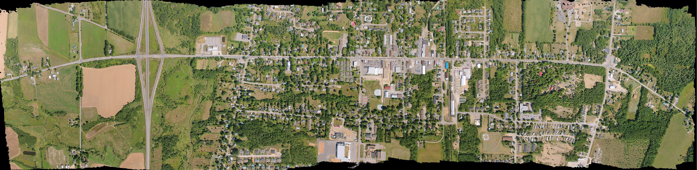
Orthorectified image of 27 individual images compiled and shot over Brunswick, Nova Scotia, Canada. Photo courtesy of Paul Illsley
For years, geospatial professionals have relied on satellite imagery and imagery from manned aircraft to perform their jobs. While these methods provide the information necessary to create detailed 3D maps of areas as varied as forests and construction sites, they tend to be costly and time consuming.
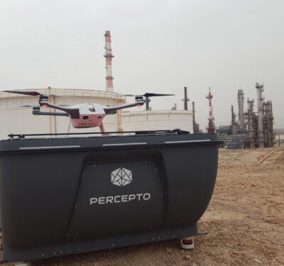
That’s why these Aircraft professionals are excited about the changes Unmanned Aerospace Systems (UAS) can bring to surveying and mapping. Once fully integrated into the national airspace, small, lightweight UAS have the potential to cut costs and streamline the imaging process.
Full integration in the U.S. is pending, awaiting final operational rules from the Federal Aviation Administration (FAA), which will be some time in coming. In the meantime, companies are applying to the FAA for Section 333 exemptions so they can fly commercially and they’re taking their aircraft to countries with fewer restrictions to test them in surveying and mapping applications. Those who aren’t yet familiar with UAS are learning how to safely operate them, and industry leaders are talking to state legislatures about how using UAS to collect this kind of imagery not only benefits the mapping and surveying profession, but also the public.
“There’s an extraordinary amount of interest on the part of our members,” said John Palatiello, executive director of MAPPS, a national association of firms in the surveying, spatial data and geographic information systems field. “They see this as another tool in the toolbox. It’s not going to replace manned aerial photographs but it certainly will supplement it. Our members see the potential and are very anxious to get into the business.”
The Benefits
There’s no shortage of industries that could use UAS for surveying and mapping, said George Southard, principal consultant and owner of GSKS Associates LLC, a company that specializes in geospatial business development.
Aerial imagery from UAS can enable miners to see how much material they’re pulling out of the ground on a weekly or monthly basis, and can help construction site managers record a project’s progress from beginning to end, whether they are building a new mall or a large highway interchange.
UAS will also make it easier to obtain the images used to create maps. Rather than scheduling a manned aircraft to take the images professionals can launch their UAS whenever they want. This not only gives them complete control of the process, it enables them to easily collect data from the same place at different points in time—and to do it faster than any traditional method allows. That data also comes at a much lower cost. Southard said it costs between $5,000 and $10,000 just to get an aircraft flying and that does not include the expenses associated with collecting and processing the data.

The team at Woolpert chose the Altavian NOVA F6500 for its UAS research projects for many reasons. Image courtesy of Woolpert
The Challenges
While most list regulatory constraints as the biggest challenge to deploying UAS for surveying and mapping, there are a few others the profession will need to tackle. Training is one.
Surveyors are experts in their field. The traditional methods they’ve used to collect imagery and data have been around for 100 years. Now they’ll need to learn how to safely fly a UAS, how the sensors onboard work, how to operate the UAS to deliver the accuracy they need for a specific application and how to integrate the new capability into their workflow, said Todd Steiner, product marketing director for Trimble’s Business Imaging Area. Trimble recently received an exemption from the FAA to fly its UX5 fixed-wing aircraft.
“A lot of it is just simply learning how to use the systems for technical work,” Southard said. “It’s a lot different from flying a system as a hobbyist. Flying for recreational purposes is one thing, but when you’re doing precision mapping it’s a whole different ball game. It requires a lot of testing, experience and practice to do it well. Processing the imagery is complicated and detailed, and it takes an expertise and a special software to create maps from photos. So the challenge is learning. That’s why companies are using them now to learn about them.”
Proper training can be difficult to find, Southard said, and that’s mostly because everyone is waiting for the official FAA regulations to be put in place. Some colleges offer limited training, but the manufacturers are the best place to turn, experts told Inside Unmanned Systems. Most companies selling UAS offer customers training on how to operate the systems and how to process the data they collect.
Trimble provides training both in how to operate their unmanned aircraft—something that takes about a week or so to learn but many flight hours to master—and in how to take the data and turn it into something useful.
“You have customers out there using other software who need to understand how to combine data types and massage them to fit together,” said Todd Steiner, product marketing director for Trimble’s Business Imaging Area. “Our effort is to make that process seamless, to strip away that complexity and allow them to spend more time focused on the quality of the data as opposed to making it fit.”
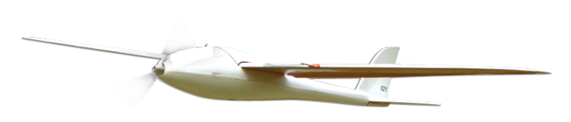
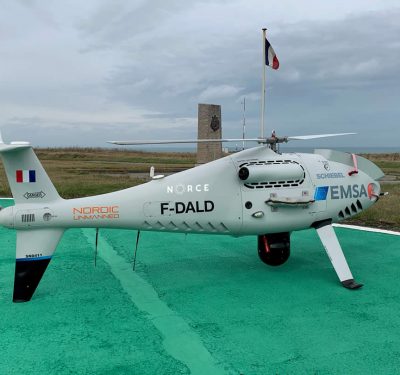
AeroHawk RQ-84Z: Merrick bought this platform in 2012 to learn how to plan, collect and post-process terrain and imagery data collected from a UAS.
Mapping Without a License
A development that could hurt the industry is people entering the market who don’t have a background in mapping and photogrammetry, said Brian Raber, vice president of Geospatial Solutions for Merrick & Company. Licensed mapping professionals adhere to certain standards, he said, and if people flying UAS for mapping and surveying applications aren’t aware of those standards, it could undermine the community’s reputation.
“Unless you hire folks who understand image quality, radiometric balancing, geodetic surveying and reading accuracy reports, you may not be getting things that are up to the standards we’re trying to hold ourselves to,” Raber said. “You have a lot of people entering the market who may not have that same background and know the ins and outs of being able to fix some of the data that spits out of the push button workflow many manufacturers are selling.”
Even so, there’s a lot of excitement in the industry right now, Raber said. In the long run the changes unmanned aircraft are bringing will enable the profession to grow.
UAS can take images with 2cm resolutions.
Fear of Falling Behind
While mapping companies have to go through the long process of applying for a Section 333 exemption to operate UAS, also called UAVs, unmanned aerial vehicles or drones, government agencies don’t have to do the same—and that’s something both Southard and Palatiello see as a potential problem for the industry down the line.
“There’s a lot of competition being created right now for the commercial companies because the regulations are cutting them out,” Southard said. “State and federal agencies are going to have 3 to 5 years more experience than the commercial guys. Many companies are using UAVs as hobbyists to learn how to handle the systems, but they can’t do money-making projects because they’re forbidden from doing that by the government.”
Even when the commercial side is given permission to fly, Palatiello fears government agencies will have such a head start on the market that they won’t need to work with private contractors for mapping and surveying applications. They’ll just do the work themselves, and may even try to market their services.
Palatiello has pressed the FAA on this several times, he said, and has tried to get them to define the difference between a commercial and a public aircraft. He hasn’t gotten an answer to that question.
In the meantime, even though it’s a tedious process, manufacturers can apply for Section 333 exemptions to fly their systems, and they can also establish partnerships with state agencies and universities. Woolpert has done that and it’s a win-win, said Matt Hutchinson, a research scientist at the firm, which has more than 50 years experience performing surveying and mapping services.
They partnered with the Army Corps of Engineers to help them map a research facility in North Carolina. They were able to provide data using the most current and efficient cameras, sensors and platforms.
“By using private industry, the government can have access to the most relevant technology,” Hutchinson said. “It means engaging with the commercial industry rather than using their own assets. It means not having to purchase it themselves and just have it sitting around when no one is using it. They don’t have to worry about maintaining it or training their staff.”
Regulatory roadblocks won’t always be a factor, Hutchinson said, and the FAA is making strides to help get manufacturers in the air. In March, the FAA announced a blanket Certificate of Waiver or Authorization (COA), giving companies that already have a Section 333 exemption the ability to fly anywhere in the country as long as they don’t fly above 200 feet and follow other established safety rules—meaning they can forego the extra paperwork and the up to 60-day wait every time they put in a request to fly. The FAA also recently announced it was easing the process by adopting a policy of issuing summary grants of exemptions in cases where it has previously granted a similar request.
Hutchinson sees the blanket COA as a very positive step forward, and one that will help give companies the flight time they need to research and develop UAS technology.
“The blanket COA means a much quicker turnaround. It allows us to get out the door and fly easier,” Hutchinson said. “Someone can walk in the door and say we need you to fly this week and we can help them out.”
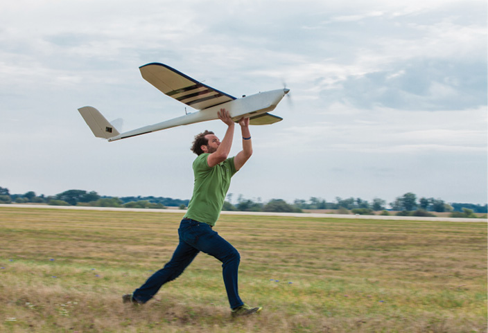
A Woolpert team member launches the Altavian NOVA F6500. Photo courtesy of Woolpert
International Flights
To be better prepared for when the regulations are finally in place, some firms have taken their unmanned systems to countries with fewer restrictions to test their capabilities and fly them in different scenarios.
Merrick has been flying through its subsidiaries in Colombia and Mexico, said Raber, who is president of Merrick Mexico and Merrick Colombia.
“Each time this bird goes up we learn something about the field and office operations, and that’s our goal,” Raber said. “We’ve been collecting aerial data for almost 60 years with traditional fixed-wing planes and sensors and LiDAR. We know how to do it traditionally. We want to understand what market and field operations are like for what is perceived to be a disruptive technology in our field, but I think it’s just complimentary.”
They’ve used the Hawkeye AreoHawk RQ-84Z UAS to perform assessments of landslides, collect post-hurricane imagery and even provide an “engineering design quality” terrain data set for a rail improvement project in Colombia. Merrick integrated several technologies to complete this project, including GPS for photo-control and construction monumentation, mobile LiDAR mounted to an all-terrain vehicle, and orthophotography and digital surface models from the UAS.
INCOPLAN, a transportation planning and engineering company in Colombia, contracted Merrick for the railroad rehabilitation project, which took place in a mix of dense urban, mountainous and rural areas, spanning 164 miles from Bogota to Belencito.
Merrick used its Hawkeye platform to collect the aerial imagery because they knew the project would consist of long flight times and large elevation changes, and that there would be limited landing sites as well as windy conditions. They were also flying in a cloudy area, and if they wanted to keep to their schedule, they needed to the capability to fly under the clouds—something the AreoHawk made possible.
Not only that, using the UAS and this combination of technology rather than traditional mapping methods cut project costs by more than 50 percent.
The project was not only a huge success for the client, the team from Merrick also walked away with many valuable lessons about the use of UAS technology, Raber said. Each time they take their UAS out they learn more about the aircraft, from how long its battery lasts when it’s climbing mountainous regions to some of the operating parameters you can only learn while out in the field.
After performing UAS operations in another country, they also learned how important it is to have a local team to communicate with community members about what the UAS is and why they’re flying it. Unlike a manned aircraft that flies for 5 or 6 hours thousands of miles away from people, there’s actually fieldwork involved when you’re flying a UAS. There are pick-up trucks. There’s a base station. There are people chasing the UAS when it doesn’t land exactly where expected. A good local staff can communicate with nearby residents about the project and address any concerns they might have.
And then, of course, there’s processing the data, Raber said. A UAS collects a lot of data, and they initially thought they’d begin processing while still in the field via laptops and a portable workstation. It seemed like a great idea, but the team quickly ran out of disc space.
“You have a very well designed workflow for a traditional photogrammetry product,” Raber said. “UAS product work at Merrick is still being defined. With all the overlapping photography and correlations to tie photos together so they geometrically fit to create the mosaic, it’s a very interesting workflow. We’re still trying to figure out if the manufacturer software is the best tool. We’ve gotten demo versions from a variety of packages to see which one generates the quality and accuracy we’re expecting and in a reasonable amount of time.”
Working With the Army Corps of Engineers
Not all commercial work is being done outside the U.S. Companies that received FAA exemptions, like Woolpert and Trimble, have begun or will begin testing UAS platforms in the U.S. Woolpert recently used its UAS to map the infrastructure of a research station for the Army Corps of Engineers in North Carolina, and has talked with the oil and gas industry about taking on possible projects.
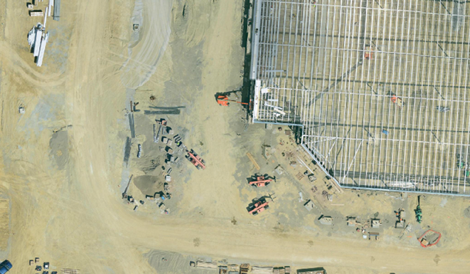
Woolpert used the Altavian NOVA F6500 during the North Carolina project last September. With the images the UAS collected, the team created an aerial map of the facility.
“The imagery we collected was nicely tiled together into an aerial map. It’s an ortho-rectified mosaic,” Hutchinson said, noting the images’ spatial resolution was 2 cm. “The imagery has consistent scale and the final product can be used for measuring. It can be brought into the computer system for mapping. They can bring it in as a base layer and then can drop on other spatial data they have on top of that, for example. It has a lot of different uses.”
Both the Woolpert team and the client were happy with the results, Hutchinson said. The UAS was able to complete the flights and collect the imagery in about half a day, and provided high-quality imagery and spatial accuracy.
The Future
As this technology continues to develop and manufacturers become more familiar with how to best use it, geospatial professionals see a lot of improvements and changes on the horizon. While small, lightweight UAS seem to work best for mapping and surveying applications today, someday we may see bigger UAS performing the same kind of work, Hutchinson said.
“For the foreseeable future we’ll still have Cessnas and aircraft that companies like Woolpert fly with large cameras. UAS will be another tool for surveyors, but will be complementary to traditional aircraft,” Hutchinson said. “In the much longer term, one day many, many years down the road, we could see larger unmanned aircraft with larger sensors flying, possibly akin to the traditional aircraft we fly now. But because of technology, legislative and societal concerns, that’s a long way away.”
Southard expects the biggest nearer-term advancements will be seen in the cameras and sensors onboard the UAS. Their accuracy will continue to improve, resulting in even higher quality data and images.
And as time goes on, the software used to process the data collected will become more advanced and industry specific, Southard said. While a variety of industries can benefit from using imagery to gather data and create 3D maps, the actual information they need for their specific application is very different.
Such specific software applications are already in the works, Southard said, but until regulations are in place he expects they’ll be slow to develop.
“More specialized software would pull the information they need for the specific application,” Southard said. “Right now it’s complicated. There are bits and pieces of software available, making it kind of cumbersome. You have to use multiple pieces of software to get what you want. The really good application-specific software is coming, but it’s just not there yet.”
For now, manufacturers and geospatial professionals will continue to learn about UAS technology and prepare for the day the mapping and surveying sector can truly start benefiting from what these systems have to offer.
“With any kind of technology there’s a learning curve,” Steiner said. “Customers are still figuring out how to use it, what to use it for, and how to operate business models based on this technology. We have to understand what expertise it takes and how to get data out to our customers. There are still some unknowns. We’re on the front end of the technology curve with UAS, but it’s certainly accelerating across the industry.”