Multivista, part of Hexagon, will join forces with DroneDeploy to bring advanced project management capabilities to the construction industry via advanced drone mapping services.
The platform integration will give Multivista users access to a variety of DroneDeploy’s unmanned aircraft system (UAS) resources, according to a news release.
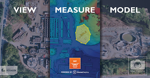
“This is the most robust and dynamic integration Multivista has developed to date,” Multivista Chief Technology Officer Graham Twigg said, according to the release. “We’ve created a platform that serves up our captured aerial data in the most appropriate form for each project stakeholder – those who need to inspect can view, those who need to quantify can measure, and those who need to model or report can export into dozens of formats.”
Users can access orthomosaic maps of their project sites and have access to web-based tools that make it possible to annotate maps to determine distance, area, volume and elevation. They also can export detailed progress reports as well as 2-D and 3-D file formats.
This combination of professional UAS services and integrated software is available to Multivista clients across 50 metropolitan markets in North America, South America and Europe. Other markets are expected to be added soon.
“Drones already make construction sites safer and more efficient,” stated Mike Winn, CEO and co-founder of DroneDeploy. “This integration will help more contractors benefit from drone data, providing increased visibility and measurement of what’s happening across their projects.”