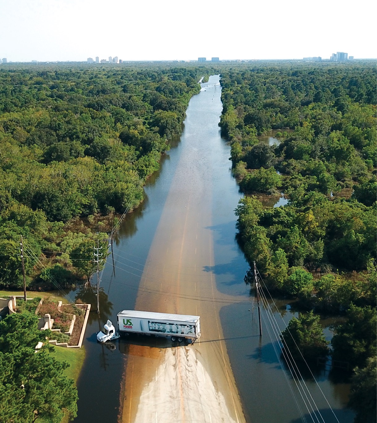
Gene Robinson and his team from Drone Pilot, Inc., dealt with impassable roads and other obstacles as they flew UAS to help with the recovery efforts from Hurricane Harvey. Photo courtesy Gene Robinson
When hurricane Harvey hit Texas last August, drone operators became an integral part of the recovery response, flying missions to inspect critical infrastructure, assess damage and map flooded areas. This marked the first time unmanned aircraft systems (UAS) were deployed on such a large scale after a hurricane and was a huge step forward in illustrating the type of good drones can do.
UAS also played a vital role in recovery efforts after Hurricane Irma, which made landfall in Florida shortly after Harvey left its mark on Texas. Now, nearly a year later, operators and emergency personnel are taking lessons learned from these responses to prepare for the 2018 hurricane season, which officially began on June 1. There’s no doubt drones will once again be deployed to help speed up recovery efforts, but next time, operators will be even better prepared.
“We’re just in the first inning,” said Christopher Todd, who is the founder/president of Airborne Response and director of the AUVSI Miami Satellite Chapter. “Drones are going to revolutionize storm and disaster response.”
Organizing UAS Efforts
One of the biggest challenges during Harvey, at least at first, was receiving emergency COAs COAs (Certificates of Waiver or Authorization), said Jamie Moore, who is head of the Public Safety UAS Response Team out of Johnson County, Texas, which is near Dallas. Even though his team members were covered by Part 107 and could deploy UAS in their jurisdiction, they didn’t have authorization to fly in areas that needed their help after Harvey. The team was grounded for a day and a half before they could perform their first mission—time that could have been spent helping with search and rescue and a variety of other missions.
After the initial wait, the process became much smoother, with approvals coming quickly after requests were made to the FAA representative in charge of managing UAS flights through the state operations center. Moore’s team of public safety workers collected data on levees in Missouri City so officials could make sure they were holding and that unreachable pumps were still functional.
“Since then the FAA has streamlined the process and we’ve gotten multiple emergency COAs in jurisdictions other than our own in East Texas,” Moore said, noting the approval time typically takes an hour and a half, though some approvals have come in as quickly as 30 minutes. “That process was so frustrating at the time, but it’s been resolved with a positive outcome. That makes a huge difference.”
A team from the Lone Star UAS Center of Excellence and Innovation at Texas A&M University–Corpus Christi, led by Executive Director Jerry Hendrix, performed several missions across Texas in the days and weeks following Harvey, including flying over the Port of Corpus Christi to identify any hazards that would make opening it unsafe. They also worked with Robin Murphy and her Roboticists Without Borders group, which is part of the Center for Robot-Assisted Search and Rescue (CRASAR) at Texas A&M University. The team deployed UAS in Fort Bend County to survey dams, levees, roadways and to assess water levels.
Though the process was slow at first, they received permission to deploy in areas with temporary flight restrictions (TFRs) and were able to fly over people and beyond visual line of sight (BVLOS).
The view from a drone in Homestead, FL. Complex power restoration work performed by crews in southern Miami-Dade County during the aftermath of Hurricane Irma is documented by a UAS flight team from Airborne Response. Photo courtesy Airborne Response
To help better coordinate future UAS disaster recovery responses, the Lone Star UAS Center of Excellence now operates under FEMA Texas Task Force 1 and is designated as Air Wing 1. The team will be responsible for controlling UAS operations during any type of disaster situation in the state as well as establishing operational procedures.
“We’ve already been sent out on one rotation with Texas Task Force 1 after Harvey,” Hendrix said. “We went to a FEMA exercise with an earthquake scenario for six days. We flew the aircraft and provided data. We’re even more prepared to assist our citizenry during the next disaster.”
More Training
Many drone operators who tried to help after Harvey and Irma weren’t trained in disaster response and didn’t have permission to fly. While their intentions were good, they just got in the way.
To be effective, those who come out to fly after a disaster should be working with an organization and tasked with a specific mission, and they should also be trained in emergency response. Drone pilots have to know how to communicate with first responders and how to coordinate with manned aircraft. Anyone who wants to help in these situations should take online FEMA courses to learn how incident command is structured, Hendrix said.
Operators must be prepared for the conditions as well. Debris, dead animals and any number of other obstacles can slow you down, making it difficult to get from point A to point B. Water, food, batteries, gas and power aren’t readily available, so responders have to be self-sufficient. Then of course there are the people who are affected by the disaster. Maybe they’ve lost their home to flooding or can’t find a loved one. Drone operators have to know how to communicate with the victims, and to always respect their privacy. That comes from proper training, Hendrix said.
Todd, whose team was hired by an energy company to help with damage assessment and to provide images for marketing, said it’s important to know storm victims are stressed and overwhelmed, and they all react in different ways. Drone operators have to be prepared for that, staying professional and helping however they can, which could mean offering someone a bottle of water or a snack.
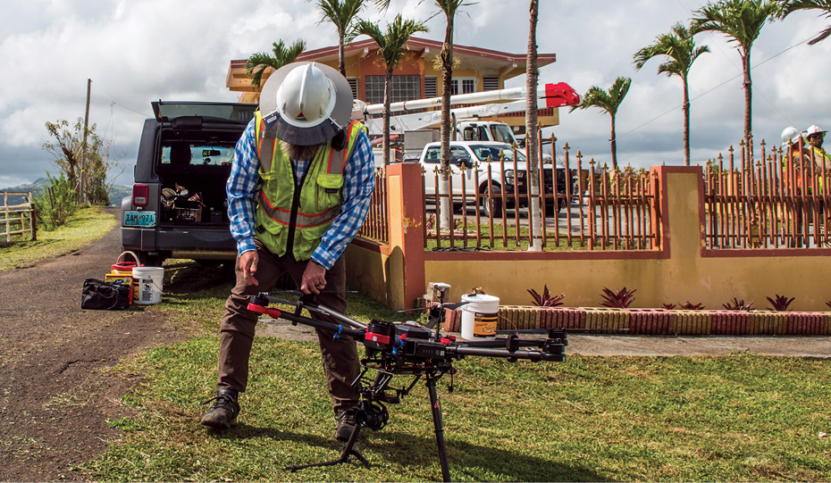
Cory Hitchcock prelflighting the M600 for a rope pulling mission in Puerto Rico after Hurricane Maria hit. The team used drones to help restore power after the storm. Photo courtesy EEI
“There’s going to be a lot of curiosity from the public. If you’re flying a mission for a power company and they’ve been without power for days, they want answers. If they see a drone pilot wearing a yellow vest and a hard hat, they’re going to start asking questions,” Todd said. “We don’t have the answers but we have to be empathetic. We represent the first semblance of hope they’ve seen since the storm.”
It’s also crucial for operators to have the appropriate skill level to complete what can sometimes be difficult missions, said Gene Robinson, vice president of flight operations for Drone Pilot Inc. After Harvey, his Texas-based team primarily flew flights for the EPA to inspect water treatment facilities for damage that could contaminate drinking water. Just because someone has a Part 107 doesn’t mean they have the ability to fly in such extreme conditions to collect necessary data.
“It would be great to have a clearing house from a national agency that you can call and determine what a pilot’s skill level is,” Robinson said. “During Harvey, you couldn’t tell if a pilot had zero training hours or 10,000. You had to take people’s word for it, and many times we had rogue operators where we were the only ones authorized to fly. We need to have a way to vet people.”
Mission and Data Management
Communicating and finding a way to quickly get emergency personnel the information they needed was one of the biggest challenges, said Jarrett Broder, director of special projects for the Emergency Management and Homeland Security program at Florida State University and deputy director of the Center for Disaster Risk Policy (CDRP).
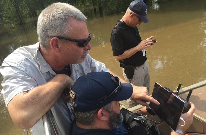
Broder and his team deployed as part of Florida Task Force 8 and helped with search and rescue missions right after the storm hit in Putnam County. Once they were released, they moved to Collier County to assist with critical infrastructure inspections. They provided data for close to 200 structures, including power substations, fire houses, prisons, airports and water treatment facilities. They also worked with CRASAR during the Harvey response.
“Mission management was difficult mostly because we didn’t have reliable communications. Cell phone systems were down so that meant no voice phone calls could be made and we couldn’t pass data over mobile networks. It was difficult to keep track of the assets and pilots and the status of the mission they’d been assigned,” he said. “Data management was a huge issue because we didn’t have access to the Internet. Data had to be moved from computer to computer via our own internal WiFi network or with USB drives. We were literally doing data dumps at the end of the day and walking drives over to the GIS guys at Collier County. And we couldn’t just give them the data. It had to be in an organized manner.”
Operating a UAS in Fort Bend County after Harvey. Photo courtesy Jarrett Broder
During emergency responses, UAS teams can’t rely on systems that rely on the Internet, Broder said. Even if there is Internet access, it will be spotty and connections will be slow. One solution is using offline software to create assets such as orthorectified maps. Todd suggested mesh networks and microwave Internet links as options, and Hendrix said a tethered UAS could serve as a hot spot.
Moore and his team were able to live stream many of their missions to the emergency operations center, and when they couldn’t they’d make sure a USB drive with the data was sent to the correct people right away. They used DroneSense, which provides both airspace and video management. Through DroneSense, the live video stream goes to a secure server that officials can access with a login. The team now uses cell signal boosters. These big antennas allow them to reach cell sites that are further away if the closest ones are down.
“If you don’t have a plan to validate that data was captured properly in the field, you’ll be in trouble,” Todd said. “And if you don’t’ have a way to get the data where it needs to be in a timely fashion, the value of the data will diminish. You have to have a plan for that. It’s a challenge a lot of folks are working on. There are different solutions but none of them are perfect.”
Working more closely with the experts the data is being collected for will help, Robinson said. If experts travel with drone operators and are there during the missions, they can look at the images as they’re coming in and tell right away which ones are useful and which ones are not. If necessary, they can even communicate what they’re seeing to the command center via radio.
Traveling with local reps also can help save valuable time. Broder and his team traveled with water management district employees during Harvey. The employees could suggest alternate routes when main roads were unpassable and knew how to get into neighborhoods that might be flooded. They also had access to restricted areas, enabling the UAS team to capture data they needed from the best locations.
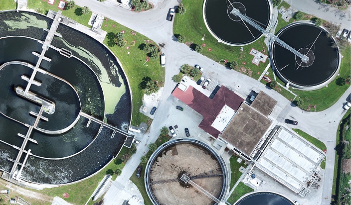
An orthomosaic of the Collier County Water Treatment Facility. Photo courtesy Jarrett Broder
The Importance of Pre-Positioning
Just like with any first responders, properly trained drone operators need to be able to deploy as soon as possible after a storm hits. The quicker they can respond, the quicker they can remediate, which is why pre-positioning is so critical, Robinson said.
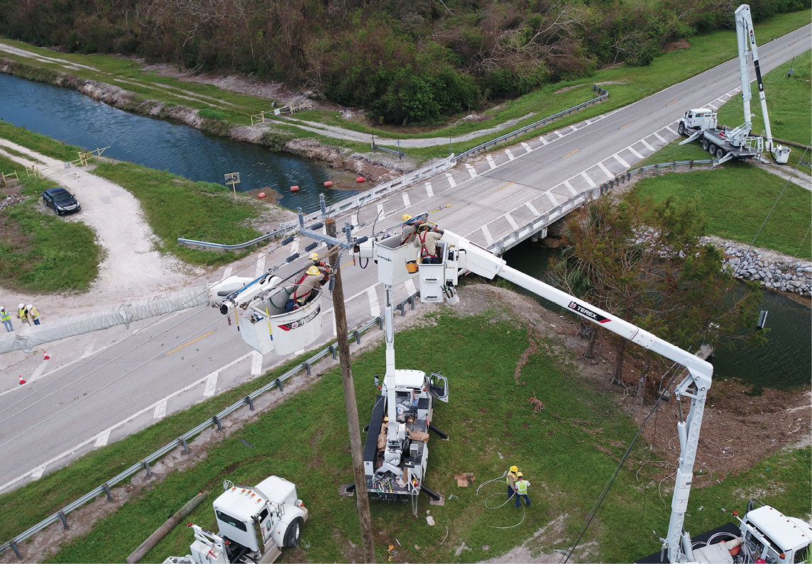
Southern Company flew drones during Harvey, Irma and Maria, the storm that devastated Puerto Rico, to help restore power faster. During Harvey, they received a mutual assistance request to fly drones for CenterPoint Energy. Corey Hitchcock, UAS standardization pilot for Southern Company, agrees that pre-positioning with assets ready to go before landfall is key to an effective response.
Hitchcock and the Southern Company teams used drones for a variety of applications, including transmission inspection, right of way inspection and situational awareness, helping crew members know exactly what repairs were needed and allowing them to more easily navigate to the location of the repair.
“When we stand up a storm team we automatically include a drone asset like we would include a bucket truck or a mechanic,” he said. “We’re also trying to identify personnel inside the company who don’t normally have storm jobs and train them how to use UAS so we can mobilize them during a storm. That way we don’t have to tie up engineers or linemen.”
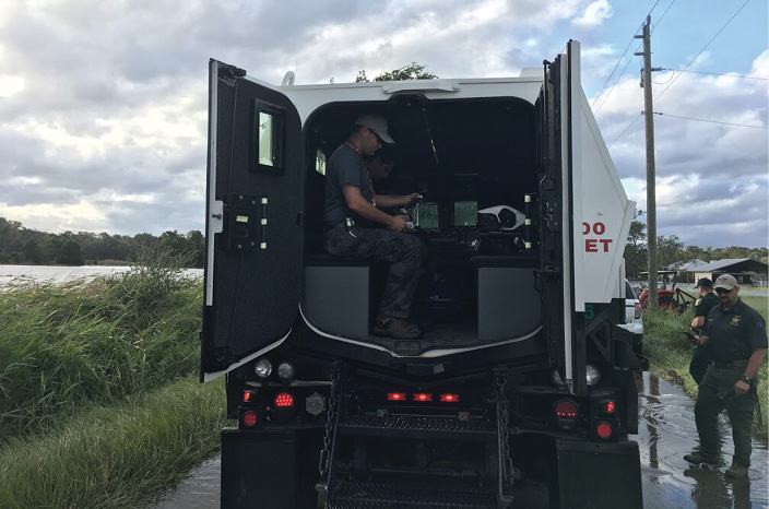
Putnam County Sheriff’s Office responds to Irma.Photo courtesy Jarrett Broder
The Future
Drones will continue to be deployed to aid in disaster response, and will have the ability to perform missions we can’t even imagine today, Moore said. But for UAS to be as effective as possible, there will need to be even more coordination.
During Harvey, there weren’t many official public safety organizations flying missions, Moore said. Since then, more agencies in Texas have adopted UAS programs and will be ready to help after the next storm. These are resources that didn’t exist during Harvey, and will require additional coordination of airspace to determine who has jurisdiction and to ensure there’s no overlapping, for example, two teams performing the same mission in one county while no one is flying in another county that also needs help. Standardizing the type of equipment used and the procedures will also help streamline the response.
There will likely be a drone seat from now on within state operation centers and local incident command centers, Robinson said. This person will coordinate approvals and keep operations running smoothly. A representative from the FAA also will be on site to focus more on UAS operations rather than overall air operations, which is what happened during Harvey.
In the coming years, Moore sees caches of drone equipment being created that first responders can access during a disaster situation. This is something AT&T is doing in the Dallas Fort Worth area now, he said, with equipment such as battery charging stations, phone charging stations and portable towers stored away and ready to be used when needed.
UAS capabilities will also continue to improve. After Harvey, first responders realized having PA systems and spotlights on the drones would be beneficial, and there are drone manufacturers, such as DJI, working to make those additions now, Moore said. Virtual reality is another area that Moore sees greatly enhancing how first responders can use drones in an emergency. By integrating this technology into a drone, anybody can put on a virtual reality headset and see what the drone is seeing, no matter where they are in the world.
“It’s different than just a 2-D image on a monitor. It’s not just a video; they’re being immersed in it,” Moore said. “If a fire chief can’t get to a structure fire, for example, he can put on the VR headset and direct how to fight the fire.”
The technology will continue to advance. More pilots will receive the proper training to operate drones for disaster response, and more public safety workers will learn how to use drones so they can fly as well—allowing manned and unmanned aircraft to work together to quickly and effectively help the people impacted by large storms and other disasters.
“The biggest hurdle for us is to overcome the integration with manned aircraft,” Broder said. “A lot of the push back we get is people think we’re coming in to replace manned aircraft. I don’t see that happening any time soon. I see UAS being used as a way to alleviate some of the stress and strain that’s placed on manned assets. They can perform the more important, life-saving missions while UAS is used to augment and help with the tremendous workload that’s placed on manned aviation after a disaster.”