The Alaska IPP team is focused on developing the technology and the safety case for beyond-visual-line-of-sight flights but they’d also like to build on that to eventually complete deliveries and help keep Alaskans safer by taking some of the risk out of operating
in the state’s most remote areas.
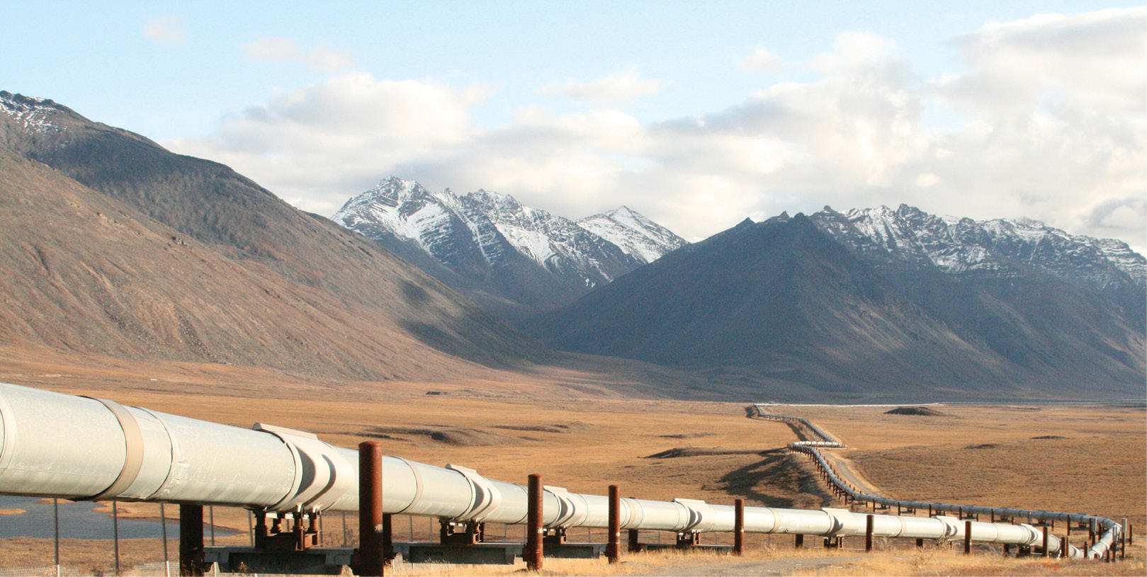
The Alaska IPP team is working on the safety case for beyond-visual-line-of-sight flights so drones can be used to inspect the 800 miles of the Trans-Alaska Pipeline.
Alaska is one of the most challenging environments for drone operators. It has five different climate zones, gaps in GPS coverage and stretches of poor communications across much of what is the least densely populated state in the country.
Cathy Cahill believes, however, that those challenges are a good part of the reason the University of Alaska-Fairbanks (UAF) was tapped by the Department of Transportation to be one of the 10 teams in their innovative Integration Pilot Program (IPP).
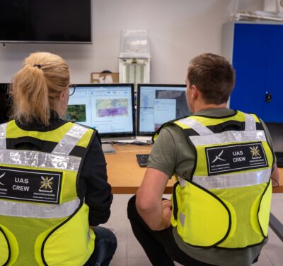
Cahill is the director of UAF’s Alaska Center for Unmanned Aircraft Systems Integration (ACUASI) and Alaska’s point person for the IPP. Her team will be doing testing to develop the safety case for 24/7 monitoring of long line linear critical infrastructure—specifically oil and gas pipelines.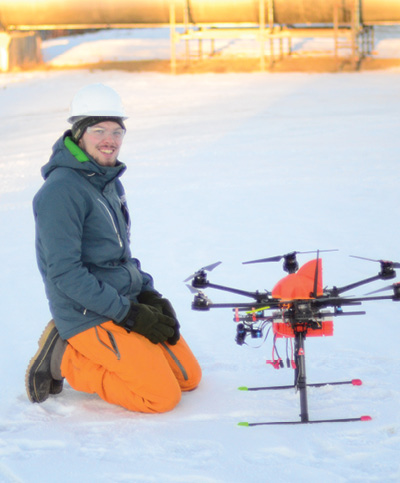
“Our goal,” Cahill said, “is to prove to the FAA (Federal Aviation Administration) that we know that it can be done safely and to allow them to formulate regulations to allow this technology to move forward.”
Those regulations will open the doors to beyond-visual-line-of-sight (BVLOS) flights, a difficult but essential step to performing missions like drone delivery, precision agricultural services, emergency support, asset tracking, disaster recovery and inspections of other types of critical infrastructure.
TRANS-ALASKA PIPELINE
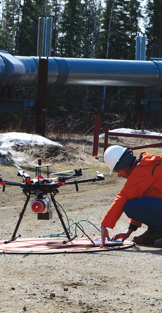
ACUASI has already done an extended visual line of sight flight along the Trans-Alaska Pipeline System (TAPS) and, as of press time, had plans to do its first true BVLOS flight along TAPS in August.
The demonstration will likely involve flying approximateley seven miles from a control station and then back again, said Jacques Cloutier, an expert on drones for the Alyeska Pipeline Service Company, which operates TAPS.
That’s just the sort of long-distance operations that Alyeska would like to see a lot more of. Now one of the IPP team members, Alyeska first began working with ACUASI to use drones for pipeline inspection in 2013. They moved up to an extended line of sight flight in 2016 and will be supporting BVLOS research for the IPP.
Making BVLOS work will require repeated real-world flights and trouble shooting the inevitable issues that crop up.

Gaps in communication and GPS coverage are a challenge for drone operators in Alaska.
For example, like large spans of rural America in the lower 48 states, Alaska has limited cell phone coverage. Satellite communication can be used but it needs to be incorporated with proven techniques to handle problems. ACUASI, for example, has developed mitigation techniques for things like breaks in communication service.
“The good news is if we can make it work in Alaska, it can work anywhere,” Cahill quipped.
And throughout the process the team will be gathering data that shows how well things work and when they don’t perform. That data is the raw material the FAA needs to build the regulations that will, hopefully, enable regular BLVOS flights throughout the U.S.
“Our pipeline is 800 miles long,” Cloutier said, “and to be able to fly that distance would be a great benefit for us.”
SENSE AND AVOID
As part of advancing BVLOS flights, ACUASI has already done a sense and avoid flight “where the aircraft autonomously responded,” Cahill said.
Sense and avoid is a key technology for long linear inspection flights and will be one of the capabilities for which the IPP team will be gathering safety-case data.
“The technology is there to fly these long ranges,” Cloutier said. “We just need to make sure we have the correct sense and avoid aircraft detection protocols in place.”
Trumbull Unmanned will be one of the firms involved in furthering sense and avoid technology.
“On the pipeline portion there is an 800 mile corridor and a 60 mile corridor that we are going to be working on where we’re flying, collecting data, analyzing that data. And so that’s part of beyond visual line of sight,” said Trumbull CEO Dyan Gibbens. The firm will be integrating, testing and deploying sense and avoid technology, she said, including different software.
Insitu, one of the most experienced members of the IPP team, also will be addressing sense and avoid as part of an overall effort to make BVLOS flights safe enough for the National Airspace. A wholly owned subsidiary of Boeing Defense, Space & Security, Insitu has been doing long distance flights—really long distance flights—with its ScanEagle unmanned aircraft system (UAS) for years. It flew a ScanEagle from Nova Scotia to Scotland in 1998 and supported the Marine Corps during the Second Battle of Fallujah in 2004. A ScanEagle flew the first commercial drone flight in the United States in 2013, the first of several missions done for ConocoPhillips in the Arctic. Three years ago the firm flew some 130 miles of rail line in support of Burlington Northern’s BLVOS pathfinder project for the FAA and now Insitu flies BVLOS with ScanEagles daily for client in Australia.
“Because of our range and endurance on our platforms and our expertise there, it makes a lot of sense for us to be on the team,” said Paul Allen, key account manager for commercial solutions at Insitu. “There are a couple of things that come along with the beyond visual line of sight operations, that is detect and avoid and then just ensuring the beyond-visual-line-of-sight is done in a safe manner. So we bring expertise in beyond visual line of sight and then, just like everybody, (our) people are working on detect and avoid solutions. And so I know the University of Alaska-Fairbanks has been looking at some things. We’re looking at some things. And so we hope to be able to collaborate on some of those technologies as well.”
In addition to doing inspections along the TAPS, the Alaska team will also be monitoring several smaller pipelines including natural gas infrastructure in the Cook Inlet—looking for leaks and things like people in the area, Cahill said.
“There’s some 40 and 50 mile stretches where we’d like to go beyond line of sight along those pipelines,” Cahill said. Cook Inlet is one of the big fjords that run north to Anchorage. “There are some protected populations of whales in there, Cahill added, “so some of what we’ve talked about doing is monitoring of whales using unmanned aircraft.”
MORE MISSIONS
Though the BVLOS work is now the clear focus, it may only be the beginning of what the Alaska team will be tackling.
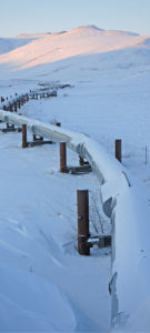
Alaska has five climate zones.
Alaska submitted five areas of endeavor when it applied for the IPP program. Working with the FAA, the UAF team decided to concentrate on BVLOS for long line linear inspections—but once that work is done the team should be able to expand their activities to encompass more of their original proposal.
Part of that plan was combining the pipeline monitoring with monitoring of other things along the way, like checking for problems with the roads.
“For example, up in Thompson Pass, which is down by Valdez, (the Department of Transportation) is concerned about avalanches. They’re concerned about deteriorating roadways, asphalt, etc. They’ve got an airport that they need to survey for obstructions,” Cahill said.
Bad roads are one of the reasons the team also wants to work on drone delivery of medical necessities between the towns of Indian and Hope, which sit six to seven miles across from each other across the Turnagain Arm fjord.
“This is going to be something in Alaska that’ll be very important,” Cahill said. “We have very few roads and often the roads are in terrible condition in the middle of winter. So this would be a case where the highway that goes around Turnagain Inlet frequently has rockslides, avalanches, etc. that close it. And even if it’s not closed it’s over an hour around—if the roads are good. Of course, worse and it’ll give you a longer time. But we could go to the little town of Indian and fly something across.”
The team also would like to tackle developing the safety cases for night flights, particularly because of the long nights in the northern regions, and for operations over people. The latter, Cahill said, would support urban law enforcement in Anchorage and enable drones to be used to film things like the start of the Iditarod—a use case cited by Secretary of Transportation Elaine Chao when she announced the teams selected for the Integration Pilot Program.
Finally, Cahill is hoping to develop BVLOS capabilities to expand the uses of drones in remote areas in Alaska where just getting to a job site can be deadly dangerous.
There are things like fish and wildlife counts that need to be done in the canyons and other remote areas, she said, but there are few roads and flying people in can be risky. Doing search and rescue operations in these areas also can be perilous.
Many of these tasks could be done, or at least supported, with drones, she said, and working up the concept of operations for doing such remote operations will improve safety by taking pilots and biologists out of manned aircraft.
“We lose a lot of pilots and biologists to crashes in Alaska,” Cahill said.
IPP team member Alyeska began trying pipe inspection with drones in 2013.