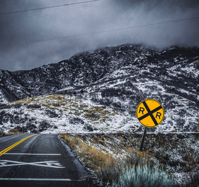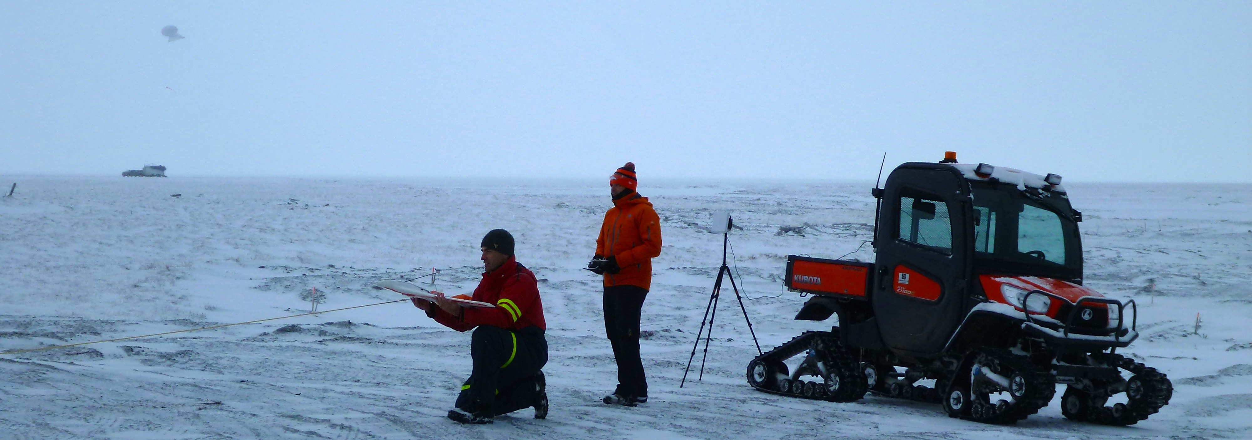
The team deploys the DataHawk at Oliktok Point, Alaska last October.
In just a few weeks, a team of scientists will make their way to Oliktok Point, Alaska, where they’ll begin the first of two campaigns designed to demonstrate how small, low-cost UAVs can be used to study and measure the atmosphere in this harsh Artic environment.
Scientists from the University of Colorado Boulder, the Cooperative Institute for Research and Environmental Sciences (CIRES), the National Oceanic and Atmospheric Administration (NOAA) Earth System Research Laboratory (ESRL) and NASA have come together for the U.S. Department of Energy (DOE)-funded Evaluation of Routine Atmospheric Sounding Measurements Using Unmanned Systems, or ERASMUS project.
Their goal is to not only demonstrate how low-cost UAVs can be used to continuously study the atmosphere in the Arctic, but to also understand the different processes that go into the cloud life cycle—information CIRES research scientist Gijs de Boer says can help improve short-term weather models as well as help scientists understand how the climate is evolving.
“There are many things that go into cloud formation and the lifecycle of clouds. A lot has to do with the presence of moisture, aerosol particles, having the right thermodynamic conditions,” de Boer said. “Really getting at the details of the individual processes is quite critical. We’re trying to understand the processes that go into the creation of clouds and their lifecycle.”
The team will use two UAVs, the Pilatus Porter kit aircraft and the DataHawk. A team at the university, led by Aerospace Engineering Sciences Professor Dale Lawrence, designed the DataHawk specifically for this type of project. Both UAVs will be deployed from the DOE-operated facility at Oliktok Point, Alaska. The Department of Energy is funding the project.
What They’ll Study
During the first mission, set for April 6 to April 20, the group will use the Pilatus to measure temperature, humidity and pressure, as well as atmospheric radiation and aerosols from the surface up to 1 kilometer in altitude. The Pilatus has a 3.2 meter wingspan and can carry the heavier radiation and aerosol instrumentation payload that is necessary to provide insight into cloud formation and the impact of clouds on atmospheric radiative transfer.
The DataHawk will be used for the second mission, which de Boer expects will be sometime this summer, and will measure wind speed and direction as well as temperature, humidity and pressure.
Why UAVs
To really understand what goes into cloud formation and lifecycle, you need a longer term observation, Lawrence said. The harsh Arctic environment makes this difficult, but using UAVs enables scientists to take round the clock measurements in frigid, remote locations like the one they’ll be headed to later this spring.
“In the past scientists would put up observation systems and then camp out for weeks or months to take these measurements, but that’s expensive and dangerous,” Lawrence said. “As you can imagine you can only do that in a few places and a few times. The idea is to use the UAS and its automation capabilities to take these measurements in a more persistent way.”
Unmanned aircraft are also a great tool for profiling the atmosphere, de Boer said, and enable scientists to more frequently study areas they couldn’t reach before. The UAVs make it possible for them to measure aerosol particles and radiation between the surface and the top of the atmosphere, giving them an even more in-depth look into atmospheric energy transfer and cloud formation.
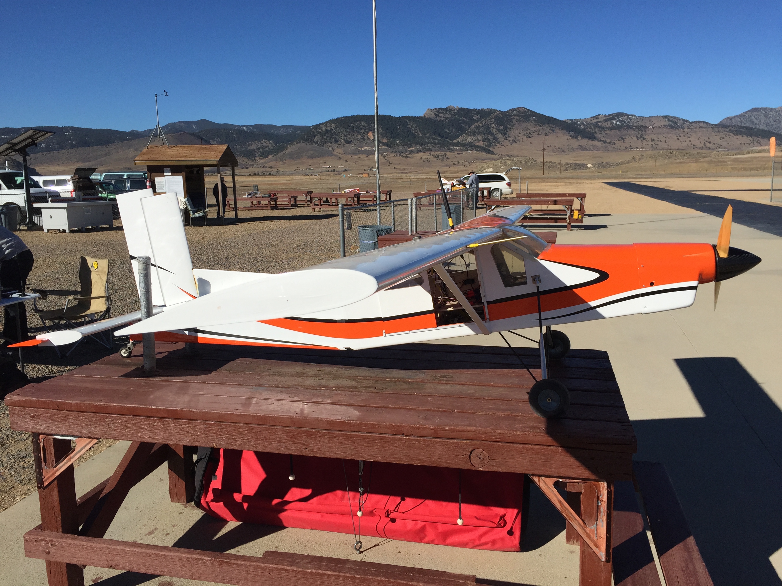
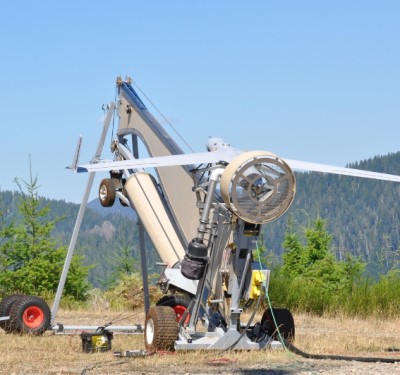
The Pilatus.
The CU-Built DataHawk
Lawrence first began working on the DataHawk UAV, which will be used in the second campaign this summer, about 10 years ago, and was founded on ideas the team had on autonomy and the ability to operate multiple vehicles simultaneously.
As that technology became proven, Lawrence said, they shifted their focus to better understanding what scientists need to complete projects like ERASMUS. They’ve been working closely on developing these capabilities in the DataHawk with scientists for about five years.
The DataHawk is designed to have the duration, range and altitude capabilities needed to perform atmospheric profiles in the lower part of the atmosphere, known as the boundary layer, Lawrence said. It’s also designed to be low cost and easy to field, two vital characteristics for this type of mission.
“Scientists don’t want to have to have additional personnel and expensive equipment with them in the field to operate a UAV, they just want to take their measurements,” Lawrence said. “With DataHawk they don’t need a lot of special training or aerospace personnel to get out there and get their measurements. We designed our system to be autonomous so no one has to pilot it.”
The vehicle is 1 kilogram and features a 1 meter wingspan. It is mostly foam, making it soft and resilient, Lawrence said. It’s easy to transport, easy to set up and doesn’t need any special preparation to operate—all key characteristics when flying in such remote locations.
For now, the DataHawk’s flight time is about an hour, Lawrence said, but they’re hoping to extend that before this summer’s two-week campaign.
“We’ll launch a DataHawk, which will fly for about an hour, then as soon as it lands we’ll launch another one. We’ll keep doing that over a long period,” he said. “How long we can do that is a function of the amount of crew we can put up there. We can’t have a crew of two doing that for 24 hours. And that’s part of what we’re exploring with this project—how much effort does it really take to maintain that type of continual measurement.”
The Challenges
One of the challenges the team faced while developing the DataHawk was keeping the aircraft small, cost-effective, easy to use and safe, while also making sure it was able to carry the instrumentation required to take measurements, Lawrence said.
“That’s really what we’ve been addressing primarily with our design and our technology development. We’re trying to make it affordable,” Lawrence said. “Generally going smaller helps you in all respects, but if you get it too small you won’t have the duration, range or altitude capability you need to make the measurements. You won’t be able to get into the location you want. We’re trying to understand that sweet spot.”
Weather is also a challenge with this project, de Boer said, noting the North Slope of Alaska is not necessarily a great place to visit during the spring. But because the area is known for being more polluted during that time of year, creating what is known as Arctic haze, the team will be able to study the higher particle concentration and different particle types that occur during the spring, making it well worth the harsh conditions they’ll face.
“It will be cold and potentially windy, so our operation will be impacted by weather,” de Boer said. “But we’re doing our best to gear up so we’re ready to fly in most conditions.”