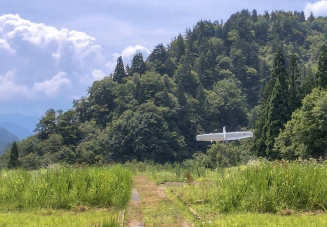
Swift Engineering’s Swift020 unmanned aircraft system (UAS) recently completed flights over densely forested areas in Japan.
The company worked with the Ishikawa Prefecture Research Center for Agriculture and Forestry, the local forest cooperative association and key forestry industry leaders during the mission, according to a news release. The flights were completed within the Ishikawa Prefecture, where the density of the trees, size of the area and topography make sustainable forestry management challenging.
“The beautiful forest terrain of Ishikawa is a great environment to showcase the fully autonomous capabilities of the Swift020 UAS,” said Rick Heise, President and CSO of Swift Engineering, according to the release. “We were able to take off and land vertically in a small restricted area. Our ability to quickly transition to efficient horizontal flight enables us to cover a vast amount of area in a short amount of time.”
The Swift020 drone is created for these types of missions. It can take off and land like a helicopter and then transition to horizontal flight. The UAS features X-Blade Technology™ and vertical take-off and landing (VTOL) technology that enables it to take off and land anywhere and transition to fixed-wing forward flight without additional launch and recovery equipment.
Some of the oldest cedar trees in the Ishikawa Prefecture are located in this area. Culling old growth is one of the conservation methods used to ensure the environment remains healthy.
“In less than a 15-minute demonstration, which is barely 10% of the endurance of the Swift020 UAS, we were able to collect over 180 acres worth of high fidelity data to support sustainable harvesting plans for the forestry industry,” said Alex Echeverria, Director of Business Development for Swift Engineering. “By utilizing cutting edge data collection, analysis and reporting technologies, we are able to provide a full turn-key service model that provides our customers with the right information when they need it.”
The company used its proprietary software to collect high-definition imagery. The team was able to provide 3-D imaging that showed the forest’s overall health the next day.
“We provided a 3-D point cloud, 2-D Geo referenced Orthomosaic imagery, as well as elevation and terrain data for the site,” Echeverria said. “The imagery we provided can be easily shared among decision-makers to aid in greater collaboration across all organizations. This type of fast response and collaboration will provide forestry officials on-demand, real time actionable data to help manage resources in an efficient and cost-effective manner.”