
Drone service providers are bringing new capabilities and benefits to all who will have them, making UAS a ubiquitous global technology.
Inspections
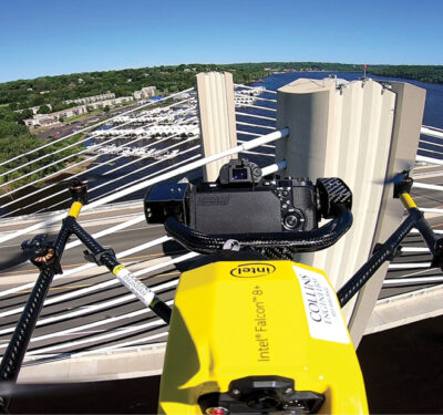
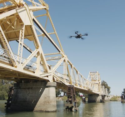
No Bridge Too Far: Drones Find a Niche in Bridge Inspections
Minnesota, considered a leader in using unmanned aircraft to conduct bridge inspections, has now instituted training classes for state inspectors to he help them learn to use the drones and, more importantly, to use the data.
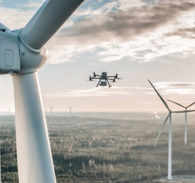
Wind Inspection Evolves
As the U.S. and the world move toward sustainable power solutions, windfarms have become a familiar site across parts of…
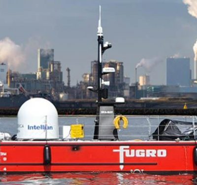
A New Generation of Uncrewed Surface Vessels Cruises the North Sea from the Netherlands
Fugro’s Blue Essence, an offshore certified uncrewed surface vessel (USV) with an electric remotely operated vehicle (eROV), will begin its…
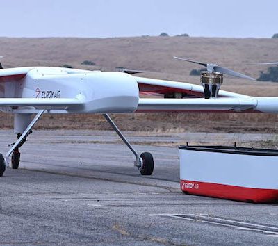
Long-range Cargo UAV Uses Inertial: Webinar Now Available On Demand
We take a close-up look at inertial measurement and inertial navigation in autonomous cargo transport. High standards for technology in…
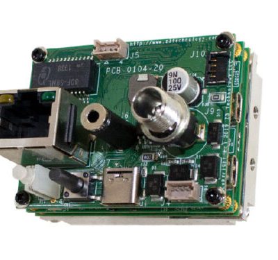
Compact Video Camera Encoder Designed for Remote UAV Operations
A new compact H.265 video encoder system capable of supporting 4K and HD resolutions, suited for UAV, surveillance and industrial…
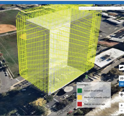
Transforming Building Inspection in NYC
Y Bird Airways is putting unmanned technology to full use in a challenging metropolitan environment; regulatory authorities scramble to keep…
Trends: Invaluable Insights
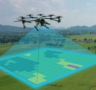
Drones are increasingly being deployed for inspections, efficiently and safely gathering data from assets, buildings, construction sites and confined spaces.
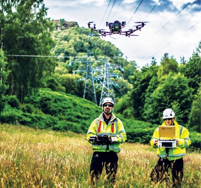
Scottish Utility, Cyberhawk Fly Tower Inspection Software
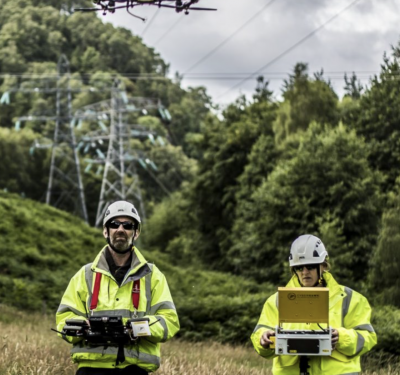
Aerial drone firm Cyberhawk and Scottish and Southern Electricity (SSE) have launched software to improve transmission tower inspections. Their product,…
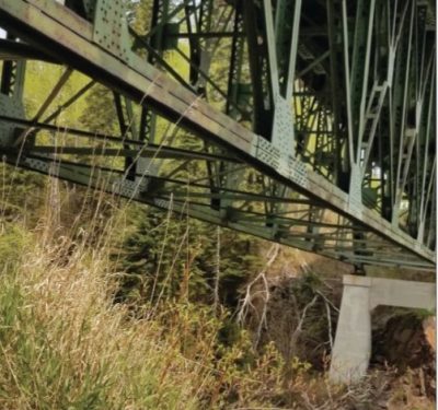
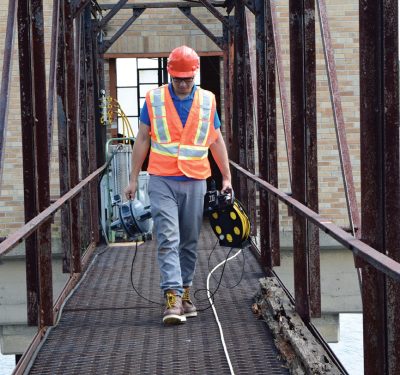
High-Resolution 3D Modeling For Bridge Safety Inspections
Collins Engineers, Inc. is using the latest drone technologies in the inspection and modeling of bridge structures.
Renewing Drone Inspection
Whether in the air, on land or in water, renewable energy companies are seeking groundbreaking autonomous solutions for inspections in…
Applanix Enhances POSPac Trimble Post-Processed CenterPoint RTX Correction Service to Support UAV Mapping Without Base Stations
Applanix, a Trimble Company, announced Tuesday that the POSPac Trimble Post-Processed CenterPoint RTX™ (POSPac PP-RTX) correction service has been enhanced…
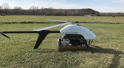
Kansas Researcher to Measure Greenland Ice Sheets with Next-Generation Radar Flown Aboard an Unmanned Helicopter
A University of Kansas aerospace engineer has earned the National Science Foundation’s most prestigious award for young faculty to design, build and…
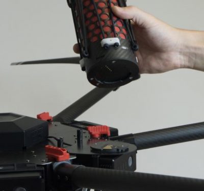
Drone Rescue System Meets ASTM Standards, Important FAA Criteria
Drone Rescue Systems GmbH tested the parachute safety solution DRS-M600 this summer according to the specifications of the ASTM F3322-18…
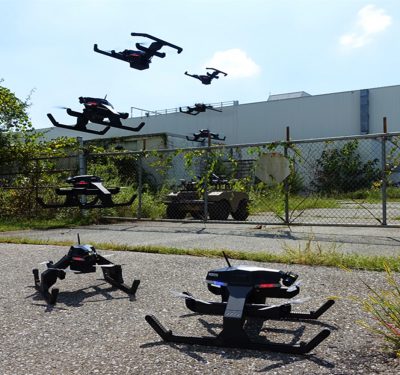
Pegasus Multi-Domain Can Fly and Operate On the Ground
Robotic Research LLC introduced anew multi-domain vehicle Tuesday that is capable of doing mapping or searching out chemical weapons from…
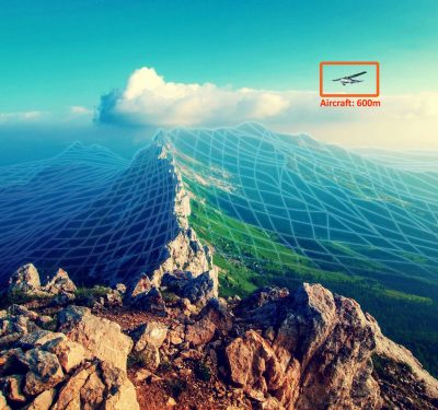
With First-Ever FAA Waiver U.S. Closes In On True, Commercial BVLOS Operations
FAA Approves Relying Only on Onboard Collision Avoidance System For Long Flights Aviation regulators have granted the Kansas Integration…
