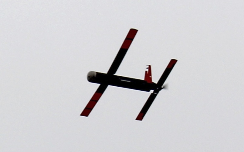
The National Atmospheric and Oceanic Administration (NOAA) is using unmanned aerial vehicles (UAVs) to improve its understanding of hurricanes, collecting data from areas unsafe for manned flight. Known as the Coyote UAS (Unmanned Aerial System), the drone is released mid-flight from a parent aircraft and provides real-time data on atmospheric air pressure, temperature, moisture, ocean surface temperature, as well as wind speed and direction. According to the NOAA, the UAV is capable of maneuvering in the most violent regions of hurricanes, flying in conditions that would be too dangerous for pilots to operate in. (Source: NOAA) “NOAA is investing in unmanned aircraft and other technologies to increase weather observations designed to improve the accuracy of our hurricane forecasts,” said Joe Cione, hurricane researcher at NOAA’s Atlantic Oceanographic and Meteorological Laboratory and chief scientist of the Coyote programme. “This successful flight gives us additional confidence that we will be able to use this unique platform to collect critical continuous observations at altitudes in the lower part of a hurricane, an area that would otherwise be impossible to reach with manned aircraft.” On January 7, the latest version of the Coyote was launched from a NOAA P-3 Hurricane Hunter aircraft in […]
Click here to view original web page at www.theengineer.co.uk