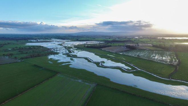
Images captured by Unmanned Ariel Vehicles (UAVs) offer a landscape-wide view of flooded river systems Images from an unmanned aerial vehicle suggest excessive management of floodplains limit their ability to hold water and slow the flow of floodwater. Drainage channels on floodplains meant water was returned to rivers too quickly, exacerbating flooding further downstream, researchers observed. They added a drone allowed them to gather a unique view of the impact of the floods that hit northern England. The University of Salford team were able to survey 60km in one day. “Because we have the UAV we can access areas really quickly and the height we can fly at, you don’t have to get very close to the river because you can fly it 500 metres away from you where you can get the images,” explained Neil Entwistle from the university’s School of Environment and Life Sciences. “What we basically did in Storm Desmond was to try and get to as much of the River Eden’s catchment (area) that we could in order to see where the flood extent was, and capture evidence of it and get data on floodplain inundation.” Before researchers were able to use UAVs, […]