For the first time, a team from Florida Atlantic University’s Geosciences Department is using an unmanned aircraft system to monitor ongoing beach restoration efforts.
Typically, scientists use traditional surveying methods such as an electronic total station and a RTK GPS receiver to study the impact of these types of projects, Assistant Professor Tiffany Briggs said, but this time she wanted to see how UAS could augment that approach. She’s working with James Gammack-Clark, an instructor and Ph.D. candidate at FAU, who is heading up the UAS aspect of the project.
The team is monitoring how a beach in Boca Raton, Fla. equilibrates and evolves following re-nourishment, Gammack-Clark said. FAU, the City of Boca Raton and Gumbo Limbo Nature Center are all supporting the effort.
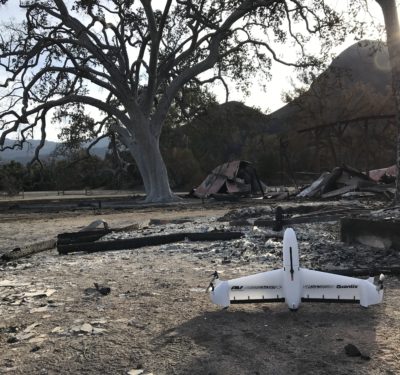
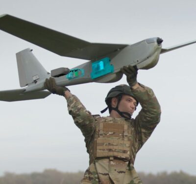
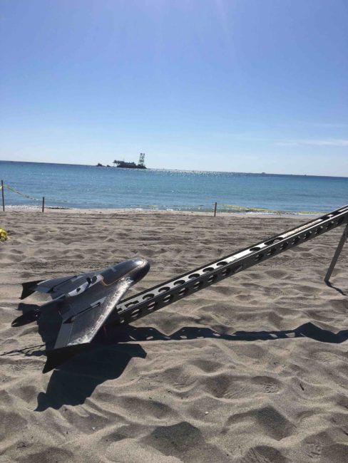
The team opted to deploy Trimble’s UX5 for this project, which started with a baseline flight on March 16, a few days before the restoration work began. They’re also using Trimble’s GIS handhelds, Trimble Access field software and the company’s photogrammetry software, Inpho UASMaster. Before each mission, non-intrusive Ground Control Points are laid on the ground throughout the study area and measured with RTK GPS for both horizontal and vertical control of the output.
While bad weather and mechanical delays slowed down both the dredging and the project, the team flew the UX5 several times in April before stopping for turtle nesting season on April 30.
What they’ve learned so far
During the April flights, the team collected high spatial resolution and high temporal resolution aerial photography, as well as generated Digital Elevation Models (DEMs) of the rapidly changing surface, Gammack-Clark said. Outputs also included OrthophotographyTime-Series Beach Profiles measured along various transects.
Traditional topographic surveys were conducted along various transects across the length and breadth of the restoration area, Gammack-Clark said, as well as adjacent areas to monitor lateral spreading, using both RTK GPS and Total Station Equipment.
“The DEMs and the Topographic Surveys will provide a mechanism for monitoring both the beach morphology change and for quantifying the volumetric changes upon it between the various surveys,” Gammack-Clark said. “This dual technique of change detection will serve to supplement one another and provide a unique opportunity for comparing the two methodologies.”
Why the UX5
Before beginning this project, Briggs and Gammack-Clark knew they needed a UAS that could cover a wide stretch of the shoreline. Each mission consists of two flights that last about 25 minutes and cover a square kilometer, which the UX5 easily handles. The data the drone collects enables Briggs to regularly monitor the change at various time intervals and see how the morphology of the beach is evolving.
“The UX5 is different than traditional drones. It’s a fixed wing product that allows us to cover a much greater area at a much higher speed than we could with a quadcopter based design,” Gammack-Clark said. “We can cover our study area in a practical timeframe in a practical number of missions.”
The challenges and advantages
Weather isn’t the only challenge this project has presented, Gammack-Clark said. Beach goers and high rises represent hazards that wouldn’t exist if the drone were operating in a rural area. To keep beach goers safe, the team only launches the UX5 within the proposed restoration area, which is roped off with caution tape to ensure no one accidently waders into the runway when the drone is launching or landing.
Flying UAS for this type of application also offers many advantages, with the aerial photography providing an invaluable database for tracking how the beach evolves during and after the restoration, Gammack-Clark said.
While it might not be faster than traditional methods, Briggs said, it does provide better images that give a more detailed view of the change that’s taking place. It also provides better coverage of the area.
“There’s a tradeoff between the time allocated and the spatial resolution,” Briggs said.
UAS can, however, save time after a storm. If a significant storm hits the study area or a rip current brings in large waves, the UAS can remotely monitor those coastal changes. With traditional surveying methods, scientists would have to wait a few days before they could get out in the field to monitor the storm’s impact.
Next steps
Flights resume weekly in November. Once the restoration is complete, the surveys will be conducted once per month for 12 months, Gammack-Clark said, giving the team a wealth of data to study and compare.
“UAS allows us to map literally every square foot of the beach,” Gammack-Clark said. “What we’re hoping to do is compare the results so we can provide a check on the accuracy of the UAS product with the more traditional, more established survey methods.”