Riegl exhibited its miniVUX-1UAV, first rolled out in October 2016 at the InterGEO conference in Germany, for remotely piloted helicopters…
Air
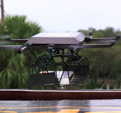
UPS Tests Drone Package Delivery
The Workhorse HorseFly UAV delivery system successfully delivered a package after being launched from the top of a UPS vehicle.

Expert Commentary: It’s the Data Link, Stupid
If the Air Force had let me order custom t-shirts for everyone back when I was helping manage our unmanned…
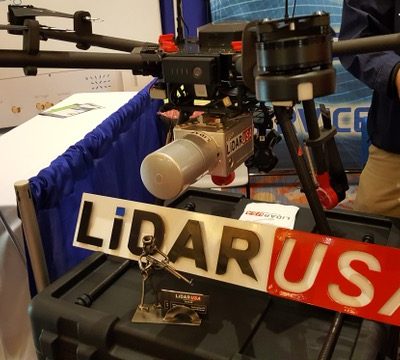
VectorNav and LiDAR USA Offer Aerial Mapping Product
To take advantage of smaller UAVs for aerial surveys, LiDAR USA is integrating VectorNav’s VN-300 Dual-Antenna Inertial System into its…
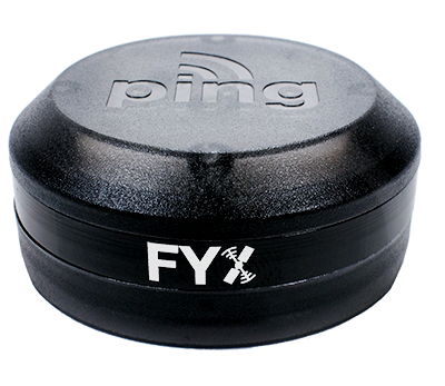
uAvionix Announces TSO for FYXNAV GNSS Position Source for Drone Autopilot and ADS-B Solutions
uAvionix Corporation, the leading Unmanned Aircraft System (UAS) ADS-B avionics solution provider, announced FAA TSO C-199 approval of its FYXNAV…
Verizon acquires drone operations management company Skyward
Verizon recently purchased Skyward, a Portland-based drone operations management company. This acquisition will enable Verizon to provide businesses with…

DroneDeploy Selected by CNH Industrial for Intuitive New Drone System Targeting Ag Customers
SAN FRANCISCO, CA and BURR RIDGE, IL–(Marketwired – Feb 16, 2017) – DroneDeploy today announced that its cloud-based platform has…

Aeryon Labs and DroneDeploy Form Partnership
Aeryon Labs and DroneDeploy recently announced a partnership that will deliver integrated unmanned aircraft system (UAS) solutions to commercial end-users and service providers.
New Leica SPL100 brings up to 10x more efficiency to airborne LiDAR mapping
(Heerbrugg, Switzerland, 13 February 2017) – Leica Geosystems, industry leader of reality capture and measurement technology, announced today the release…
senseFly Receives First Swiss Approval for Anytime BVLOS Operations
Cheseaux-Lausanne, Switzerland-based senseFly announced on February 9, 2017 that it has become the first drone operator to be granted anytime Beyond Visual Line of Sight (BVLOS) authorization in Switzerland.

Spirent Security Experts Predict Greater Risks to GPS, Including Connected Vehicles
Spirent Communications’ security forecast warns of the increased likelihood of disruptions to a wide variety of civil and military applications relying on global navigation satellite systems.
Measure Partners with AES to Inspect Energy Infrastructure
Measure, a drone as a service provider, will fly unmanned aerial systems (UAS) to inspect The AES Corporation’s energy infrastructure in 17 countries.
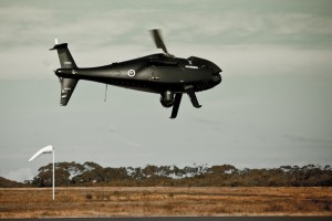
Schiebel Camcopter UAS Adopted by Australian Navy
[Australian] Defence awarded Austrian company Schiebel a contract for the supply of its Camcopter S-100 System and three years of…
Caterpillar Ventures Invests in Airware to Advance Work Site Intelligence through Aerial Data at Scale
Airware Products to be Sold Through Caterpillar Dealers; Bergerat Monnoyeur to be Among First Dealers
AUVSI, King Schools Launch Online Drone Pilot Ground School and Test Prep Course
ARLINGTON, Va. — The Association for Unmanned Vehicle Systems International (AUVSI) today announced a new partnership with the King Schools…

Swarms of Disposable Drones Will Make Critical Deliveries and Then Vanish
Delivery drones still face an uncertain future, but there’s at least one scenario where they make a lot of sense:…
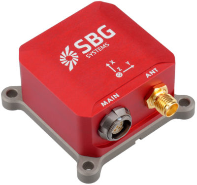
Major Improvements on the Ellipse Series
SBG Systems releases a new version of the Ellipse Series, its popular product line of miniature inertial sensors. The Ellipse…
