Geospatial data is transforming the fight against climate change. Unlocking precise data on ecosystem health, climate risks and infrastructure resilience, this technology paves the way for smarter, more sustainable decisions across industries.
Beautiful, interconnected…and fragile: three words that describe planet Earth. Human activities have created unprecedented environmental challenges for her. As our collective future hangs in the balance, geospatial data and technologies have emerged as powerful tools in the fight against climate change and the pursuit of sustainability. Maps provide content, context and tell meaningful—and objective—stories about how Earth continues to change and the way we must address these critical issues. From assessing climate risk, protecting infrastructure, formulating conservation plans to informing the global public about climate change, the vast applications of this contextual data remain only as limited as one’s imagination.
CONSERVING OUR WILDLIFE
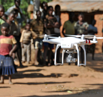
Geospatial technologies play a crucial role in protecting and preserving wildlife and habitats worldwide. By providing global perspectives that enable rapid response to environmental changes, they bring immense value to wildlife conservation. Use cases range from facilitating detailed ecosystem monitoring to enhancing data analysis capabilities and empowering local communities.
One illustrative example, The Nature Conservancy (TNC), a global organization that helps to protect the Earth and nature, leverages geospatial data and technologies to accelerate and scale their conservation efforts.
TNC’s ambitious 2030 goals include curbing climate change and biodiversity loss by conserving 30% of lands and waters, inspiring 1 billion climate action takers and investing in 100 community-led conservation projects. Teal Wyckoff, associate director of TNC’s Geospatial Services, said Earth observation technologies, including satellite imagery and drones, play a significant role in these efforts.
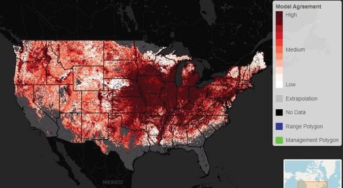
“Geospatial technologies allow for the identification and monitoring of critical ecosystems, such as mangrove forests, to not only map their locations,” Wyckoff explained, “but also assess their health and carbon storage capacity.” She continued, “Similarly, these tools aid in detecting invasive species and tracking native wildlife populations. All of these applications provide invaluable data for conservation planning and management.”
One of the key advantages of geospatial technologies in wildlife conservation is their ability to provide this data from a worldwide perspective. This global approach allows for more comprehensive and coordinated conservation efforts across diverse ecosystems and regions.
For TNC, which has a presence in all 50 U.S. states and 78 countries, having systems that can communicate and share data on a global scale remains crucial to its operations.
The technology, and the ease of use of the data on a global scale, translates into additional and stronger global collaborations. By leveraging user-friendly tools and software-as-a-service (SaaS) products, TNC seeks to empower its staff and partners to leverage these technologies effectively, regardless of their level of technical expertise. This democratization of geospatial tools is essential to scale up conservation efforts and assist in incorporating local knowledge into key decision-making processes.
As for what lies ahead, TNC has already begun to integrate artificial intelligence and machine learning (AIML) into its geospatial workflows. Wycoff said this will enhance its ability to process and analyze large volumes of data for more efficient and accurate identification of environmental patterns and trends. This will, in turn, lead to making even more informed conservation decisions.
Wyckoff underscored the urgency of leveraging technology to address rapidly changing environmental conditions. “With climate change impacts becoming increasingly evident, conservation organizations need to innovate and accelerate their work,” she said. “Geospatial technologies enable us to quickly identify, analyze and respond to environmental changes and threats to wildlife habitats.”
MODELING CLIMATE RISK
In 2023, according to Aon’s 2024 Climate Catastrophe and Insight report, natural disasters caused over $380 billion dollars in global economic costs. These same disasters, including earthquakes and heat waves, caused over 95,000 deaths. Those numbers don’t account for the fact that heat-related deaths are widely believed to be under-reported.
And natural catastrophes continue to rise. Yet, today only about 31% of climate-related economic losses are covered by insurance. On top of this, those U.S. homeowners who do have such insurance now pay an average of 2.6% of their income on it, a 30% increase over the past decade. The protection gap and rising insurance costs both highlight the need for more accurate risk assessment and pricing models. As the insurance industry grapples with the fallout from climate change, geospatial data and analysis plays an ever-increasing role in assessing risk, setting prices and overall sustaining our way of life.
With regard to physical climate risk modeling, geospatial data and technologies enable insurance companies to identify high-risk areas with greater accuracy, assess potential impacts of various climate-related events, develop more models that inform underwriting decisions and guide disaster response and claims management.
Aon Senior Managing Director Andy Neal stressed the importance of using multiple models and data sets in geospatial analysis to navigate uncertainty and make more informed decisions. “I advocate for using multiple models and data sets to get multiple answers and look at them together,” Neal explained. “This approach allows us to better understand the range of potential outcomes and make better decisions in the face of uncertainty.”
As for the future, similar to in the conservation arena, Neal said, the integration of AIML into advanced geospatial technologies will likely further enhance the insurance industry’s ability to navigate the complex landscape of climate-related risks.
POWERING UP UTILITY MANAGEMENT
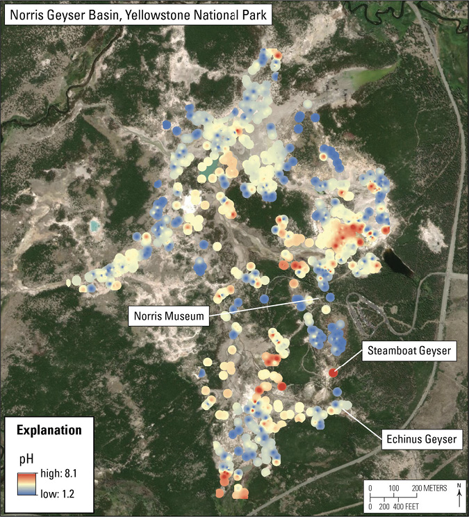
Climate change and natural disasters have also significantly impacted our nation’s critical infrastructure. As such, geospatial data has become crucial for modern utility management and resilience. Applications of geospatial data across the utility sector include asset management, storm response, vegetation management and safety considerations, among others. Utilities like Duke Energy stand at the forefront of using this technology to address these challenges.
For the utility sector, asset management forms a cornerstone of geospatial applications. This data, and the actionable intelligence that flows from it, allows utilities to efficiently track and maintain their extensive network of circuits and pipelines.
During climate-related weather events, pre-collected geospatial data about utility assets and related models, when integrated with real-time incident information, assist responders in assessing potential impacts on infrastructure and coordinating response efforts.
Take, for instance, Duke Energy’s use of geospatial data during Hurricane Ian in 2022. This hurricane, the third most costly on record in U.S. history, caused widespread power outages across Florida. Its consequences included approximately $180 billion to $210 billion in economic damages and at least 152 fatalities. Duke Energy Power Grid Operations Manager Amy Barron noted her company used geospatial data to identify critical substations and customers and to prioritize protection and response measures amidst Ian’s devastation. With the help of geospatial data, she said, Duke Energy restored power to more than 1 million customers within just days.
Additionally, Barron explained, Duke Energy proactively employs geospatial technologies to identify threats to its assets. For example, climate change-induced droughts and heat waves have made vegetation management a crucial aspect to safely maintain power line corridors. Duke Energy and other power companies heavily rely on geospatial analysis to identify areas requiring attention. This helps to prevent outages and reduce wildfires that vegetation encroachment on power lines could cause.
In all such operations, safety remains job number one. To bolster worker safety, the utility sector also uses geospatial data in the form of vehicle telemetry systems with geofencing capabilities to alert employees when they enter high-risk areas.
“The power of geospatial data in utility management lies not just in its ability to map assets,” Barron said, “but in its capacity to inform decision-making across various operational aspects. From infrastructure planning to emergency response and worker safety, geospatial data has become an indispensable tool in our sector’s toolkit.”
DEMOCRATIZING CHANGE
While geospatial information supports the use cases described, and a wide range of other applications across various commercial sectors, Geographic Information Systems (GIS) perhaps play an even more important role in the form of visual storytelling about the complex environmental issues we face. Because this data objectively reveals our planet’s vulnerability and is available to both the public and governments, it can help to spur much needed environmental change.
Bobby Shackelton, chief operating officer of Riskthinking.AI, elaborated. “Geo data gives us the ability to understand not just what’s happening, but where and why it’s happening,” he said. This contextual information allows us all to comprehend the complex relationships between individual actions, events and broader systemic changes.
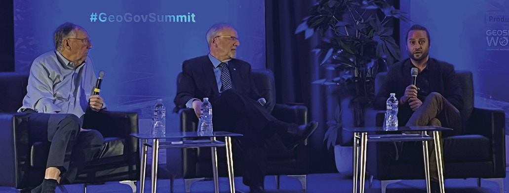
The scope and scale of this information is staggering. Esri President Jack Dangermond said people make between 4 and 5 billion maps daily with his company’s software. This exponential growth in map creation, increasing by 30% to 40% annually, has transformed Geographic Information Systems (GIS) into what he described as a “ubiquitous language of understanding.” Dangermond explained, “GIS is evolving into a common platform for understanding our world. It’s not just about making maps. It’s about creating a shared language for everyone to address global challenges.”
Dangermond elaborated that Esri’s knowledge architecture has become increasingly distributed, server-oriented and integrated with data from various sources. “We have distributed nodes of knowledge that serve information into portals which can bring data together. This enables organizations to share their knowledge and work as part of a larger, interconnected effort.”
Shackelton agrees that data accessibility remains crucial to a sustainable future. He recently announced his company’s launch of askRiskthinking, which he described as “the first openly available AI platform for climate data and analytics.” This free platform provides users worldwide with access to global insights for decision-making. He hopes to down barriers that often prevent smaller organizations or developing countries from taking meaningful action on climate change.
Shackelton explained why he and his team created this open platform. “it’s not just about having the data,” he said, “It’s about ensuring that decision-makers and the public can understand and act on it. We need to bridge the gap between complex geospatial information and practical, actionable insights. That’s what our platform does.”
WHAT LIES AHEAD
As the world continues to grapple with the challenges of climate change and sustainability, geospatial data and technologies offer powerful tools for understanding, predicting and mitigating environmental impacts.
Geography and geospatial data can serve as a bridge between information and action—and between GIS professionals, decision-makers and the public. On this point, Shackleton said it best: “Collaborative geospatial thinking allows us to see connections and patterns that might otherwise be missed. It’s about creating a holistic view of our environmental challenges and working together to develop innovative solutions to complex environmental challenges.”
The future of geospatial technologies in addressing climate change and sustainability remains bright. It also requires continued innovation, collaboration and responsible use. By continuing to couple the power of GIS, along with collaborative strategies, AIML and open platforms, geospatial data will undoubtedly help us build a more sustainable and resilient world.


