LAS VEGAS—Hexagon is aiming its ARTEMIS small unmanned aircraft kit, originally developed for the military, at new markets, including public safety, disaster response, agriculture, land management, utility management, field research and others.
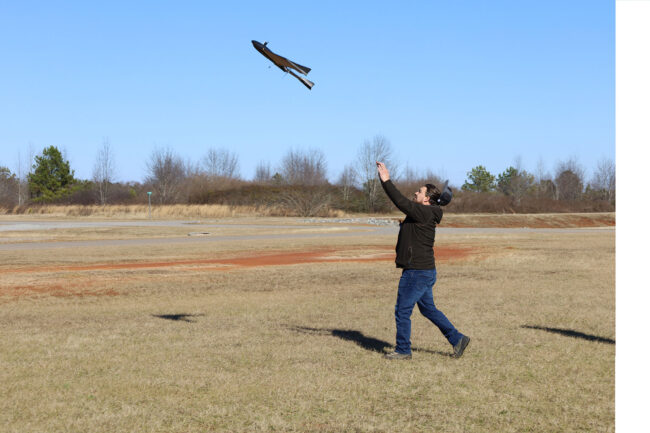
Ebee TAC, the tactical UAS at the heart of the ARTEMIS package, is manufactured by senseFly. It weighs 3.5 pounds, fits in a backpack, has few moving parts, is simple to repair, is certified for flights over people and can cover up to 1,200 acres in a single flight, making it a great tactical kit, Hexagon U.S. Federal’s Rod Erickson, federal business development/capture, said last week at the HxGN Live conference here.
ARTEMIS stands for aerial reconnaissance tactical edge mapping and imagery system and was developed by Hexagon U.S. Federal. It’s “blue UAS” approved and available under the federal GSA schedule for government agencies to purchase and use.
It also comes with more than just hardware, Erickson said, as it includes four days of training for up to eight people in Southern Pines, North Carolina, conducted by Hexagon partner Tough Stump Technologies.
“Equip, train, fly, deliver. It’s a complete kit, it’s not just a drone,” Erickson said. “It’s really cool because they really maximize your time the field. …You didn’t just buy a drone, and ‘now what?’ You’re going to wish you had this training.”
The eBee TAC can carry a variety of sensor payloads, including packages for specific markets, uses senseFly’s E-Motion flight planning software and Pix4D imagery.
Because it was originally designed for the military, it needed to be intuitive and simple to use, Erickson said. The system has a flight time of up to 90 minutes at 2,000 feet, and can get down to centimeter-level accuracy using control points, or one to five meters accuracy without.
The data says on the drone during flight, enabling it to “run silent” for military uses, but operators “can start visualizing the imagery right away” after landing, Erickson said. “Within hours of the flight, you can have orthomosaics, digital surface models, 3D point clouds, 3D textured mesh, multispectral imagery.”
The kit costs about $25,000 for the drone component, with sensor cost on top of that varying by sensor. Hexagon U.S. Federal is also considering drone as a service uses, Erickson said.