An image taken from the system using a standard high resolution Nikon D7100 camera.
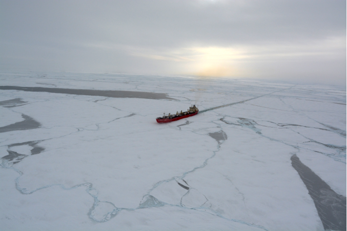
Navigating ice-covered waters isn’t an easy task. Even ice-breaking cargo ships like Fednav’s MV Arctic can end up stuck for days at a time as the captain tries to find a way around the built-up ice blocking the ship’s path.
The trick is finding open spaces in the ice, either through satellite-based solutions or spotlights that help these captains see their way through the ice at night. Companies like Enfotec provide ice prediction and ice plotting to help these cargo ships navigate through the Arctic, but imagine how much easier that job would be if they could provide a view from the sky.
ING Robotic Aviation partnered with Enfotec to see if they could make that happen. They set out on a two-week Research and Development mission last month aboard the MV Arctic that took them from Montréal north to Deception Bay. The mission, led by Enfotec, was designed to assess various operational and technical aspects of ship-based UAV ice monitoring.
The mission brought about many challenges, but gave ING valuable insights into what it would take to incorporate UAVs into this type of application, CEO Ian Glenn said.
“Just getting the Responder into the sky was pretty challenging,” Glenn said. “You’re flying off a deck on a moving ice breaker in the Arctic in the dead of winter. It’s cold and windy and the ship is moving. You have to overcome all these factors to have any kind of success.”
The Mission
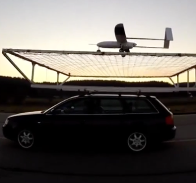
During the mission, the team faced harsh conditions, yet successfully flew the Responder rotary wing UAV from onboard the ship, Glenn said.
A two-person team managed the flights, with an external pilot launching the aircraft off the bow and then handing over operations to the control station operator, who was 240 meters back and 5 meters up on the bridge of the bulk carrier. ING developed a digital data link to make this hand off possible. At the end of the mission the external pilot took back control and returned the Responder to the deck.
“We got real-time footage to both the station doing the ice route planning and the captain of the vessel, and we were also able to download real time high-res still pictures from the sensor on board for an enhanced view,” Glenn said. “The live feed helped give the captain situational awareness and a better understanding of where he should go.”
ING also developed new technologies to keep the Responder’s battery in top condition while it worked in the harsh Arctic environment, Glenn said, which they achieved before the mission began. Missions typically lasted about 20 minutes.
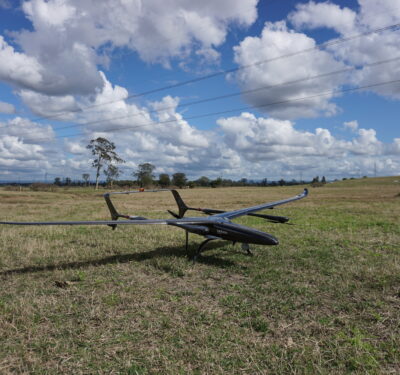
The Responder
For this mission, the team needed a UAV with a lot of power and stability—both features The Responder has. They also needed a UAV with payload flexibility and capacity, and the ability to develop innovative ways to keep the batteries warm and maximize battery power during flight.
“We needed a powerful, stable UAV to handle the weather,” Glenn said. “We designed the Responder specifically to handle the harsh conditions of Canada.”
The Benefits
The Arctic can be a dangerous place, so finding ways to gather more data to help ship captains navigate the icy waters, while taking humans out of the equation, offers a variety of benefits from increased safety to reduced costs, Glenn said.
“Without putting people at risk we were able to provide useful data that can improve the efficiency of that vessel delivering supplies back and forth in the Arctic,” he said. “That has a huge cost benefit to the operators and the companies doing this work. This gives them a tactically useful view of which way to go, which can save them days and sometimes weeks. It reduces the risk, reduces the cost and provides a much better data set than what was previously available.”
What’s Next
The team at ING learned a lot during this R&D mission—a mission that Glenn describes as the company’s most challenging to date—and will use these insights to further improve the Responder’s capabilities. They still need to do more testing before UAV technology can be applied to ice-monitoring, but Glenn is very happy with the results of the mission and is “committed to developing an even more robust solution in this space.”
“When you’re onboard a ship for two weeks you have a lot of interactions, and we were working with people who do this every day. We learned a lot and we had success on the days the weather permitted it,” Glenn said. “We certainly proved the utility and clearly demonstrated how this can be a useful solution for Arctic shipping.”