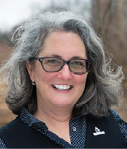
Lori Scott is chief information officer and vice president for technology and partnerships at NatureServe, which, for nearly 50 years, has been the authoritative source for biodiversity data throughout North America. Scott oversees NatureServe’s technology team, with a portfolio that includes software product development, user support, and IT infrastructure for mission-critical enterprise information management and delivery systems.
Q: What is NatureServe and how does it work
to enhance biodiversity?
A: We’re a nonprofit that is the hub of a network of programs, and we work with partners in every state in the U.S. and every province in Canada. This is called the NatureServe Network. That network was initiated by the Nature Conservancy in the 1970s, and then in 2000, NatureServe was spun off as an independent non-profit. They [the Nature Conservancy] have a land protection mission, and there just wasn’t good data on which to base those decisions. So, to be less opportunistic and more strategic, a system was designed for tracking what exists where and how it’s doing.
Q: How are things going on the biodiversity front, and what is the importance of maintaining as much of it as possible?
A: Well, it’s not great. There are a lot of headlines you could pick from in terms of the number of species facing extinction or that have gone extinct. In terms of why it matters, it’s sort of the basis of all life. So, biodiversity can be genetic, diversity of species, diversity of ecosystems. We’re all connected. And so everything we really rely on comes from that diversity. Seventy-five percent of our crops depend on pollination. About half of the medicinal drugs we use…that have been approved in the last 30 years have been derived from natural products. And then climate regulation, flood control, all the things we’re seeing in the headlines about climate. They’re very integrated and interrelated with biodiversity and the health of the environment.
Q: How have the types of data you use changed over the years?
A: Some aspects of our data model are very similar in terms of the kind of core data we need to know about each species. That’s fairly consistent, but how we map it has changed dramatically. It used to be biologists would go into the field to survey for species, and they would map things on paper, on quad sheets or topo maps. But we got to using GIS really as soon as it started. Esri’s history is about the same as our network’s history. It’s about 50 years old as well. So, we were using the very earliest forms of GIS once it became available, and transitioning from paper-based mapping to GIS mapping. And, of course, our database went from index cards to actual computer databases, once that became available to fit in less than an entire room. Drones and satellites added another dimension in terms of doing more remote monitoring.
Q: What new technologies are coming to the fore, beyond satellites and drones?
A: I’d say one of the newer ones, it’s not that new, but call it citizen science…I mean, everyone has a sensor in their pocket these days. And so, there’s a flood of new data coming in from people out observing and posting those observations. Harnessing that huge volume of citizen science data and parsing it, kind of looking for the needle in the haystack, that’s something we’ve been doing.
Q: What is NatureServe’s Map of Biodiversity Importance?
A: Increasingly, the technological advancement we’ve been using is predictive modeling of the habitats that are suitable for a species. We can do this quite accurately with all this great species occurrence data we have to train the models and combine this with really high-resolution predictor layers to predict species habitats. We’ve modeled over 2,200 of the most imperiled species. We did a massive scaling up of our modeling in the last few years. That was the Map of Biodiversity Importance project that is the next frontier in filling in the gaps on the map.