GeoCue, a provider of geospatial technology, has announced the release of LP360 Land, a new addition to the LP360 software ecosystem designed to elevate handheld LiDAR scanning with the TrueView GO.
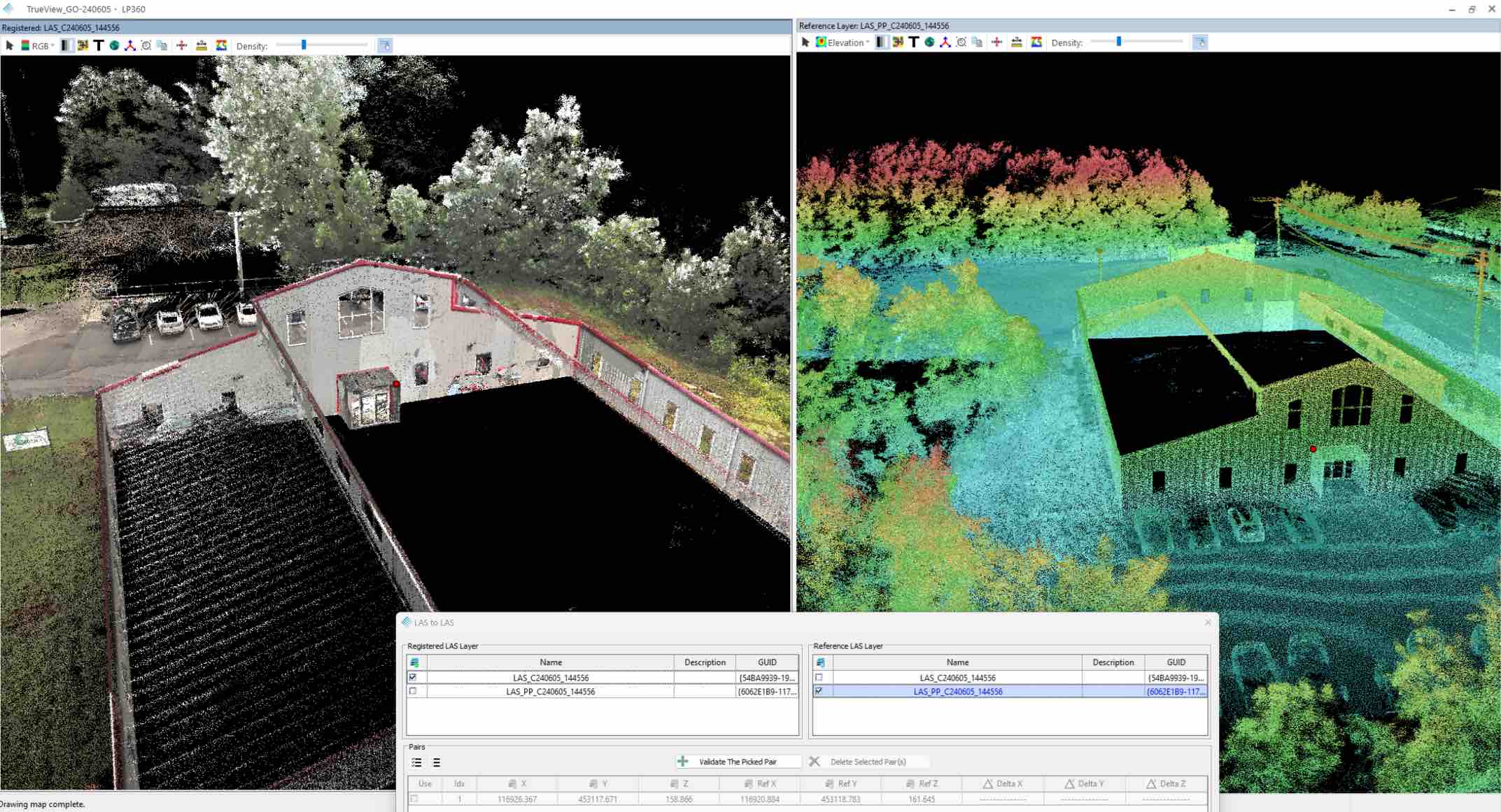
“The integration of LP360 Land with the TrueView GO is a game-changer for professionals seeking efficient and accurate data processing,” said Frank Darmayan, CEO of GeoCue. “This powerful combination enables users to seamlessly process, visualize, and analyze their handheld LiDAR data, enhancing their overall workflow.”
LP360 Land offers a workflow for the processing of LiDAR, GNSS, and SLAM handheld sensor data. “We are excited to see how LP360 Land will enhance the capabilities of TrueView GO users,” said Vivien Heriard-Dubreuil, CEO of mdGroup. “With LP360 Land, the user can combine LiDAR data coming from mobile, aerial and ground sensors to complete a job and work on a registered, colorized and georeferenced point cloud. This software reflects our commitment to providing innovative solutions that meet the evolving needs of the geospatial community.”