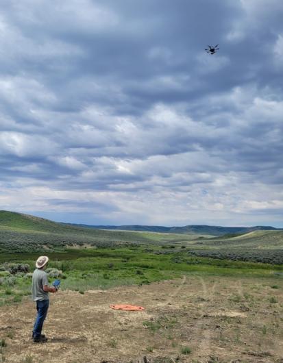
The Bureau of Land Management (BLM) is utilizing Uncrewed Aircraft Systems (UAS) to collect resource information on public lands in Wyoming’s two Restoration Landscapes, LaBarge and Muddy Creek.
The BLM manages more than 245 million acres of public land located primarily in 12 western states, including Alaska, on behalf of the American people. The BLM also administers 700 million acres of sub-surface mineral estate throughout the nation. The stated mission of the BLM is to sustain the health, diversity, and productivity of America’s public lands for the use and enjoyment of present and future generations.
The BLM will use imagery collected by UAS to document habitat and resource conditions. UAS are a valuable tool for resource management that allow for the collection of natural resource data while reducing risk and decreasing costs compared to crewed aircraft. UAS imagery is used to create high-quality, accurate digital images and surface models with spatial resolutions of about one inch.
UAS will be used to map streams and drainages where the BLM is conducting restoration activities with funding from the Inflation Reduction Act. The information from UAS will allow the BLM to determine and document the effectiveness of these efforts and show how the affected drainages and streams change over time.
The BLM will prioritize projects funded under the Bipartisan Infrastructure Law in the LaBarge and Muddy Creek landscapes to maximize return on investment and enhance durability.