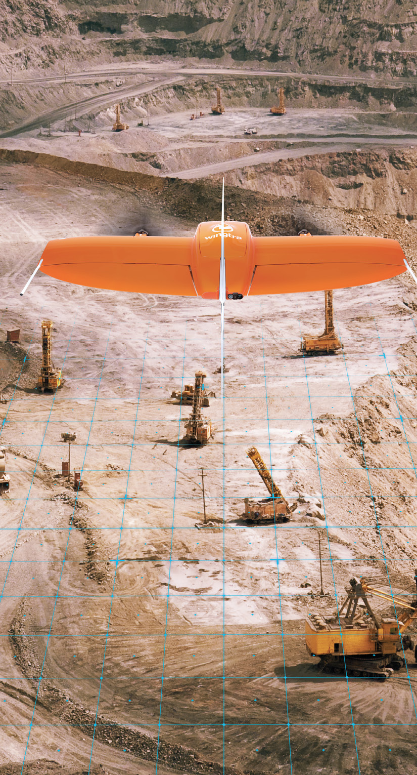
VTOL Wingtra drone flying above a quarry.
Drones are making their mark in mining, allowing for more efficient inspections, increased productivity, improved prospecting and enhanced safety.
For years, Anglo American has relied on drones for survey and inspection work across most of its world-wide mining sites. How the London-based company deploys UAS for extraction of multiple minerals adapts as systems and related technologies advance, with the goal being to eventually eliminate the need for surveyors, management and other technical staff to enter dangerous, hostile work environments.
Already, most of the traditional mine surveys Anglo American conducts are completed via drones. Data is used during pre-shift meetings to discuss safety and assignments, and to share site conditions.
Technical applications requiring orthomosiacs and volume calculations are driven through the company’s geomatics modernization program, which is part of its Modern Mine approach. Anglo isn’t just flying drones; the company is “developing a new generation of technologies that are delivering safety benefits and efficiencies in the mining operation,” a company spokesperson said.
The rest of the mining industry is also turning to drones and other advanced technologies to enhance safety and efficiency. Drones are deployed during exploration, to inspect dangerous pit areas and processing equipment, to measure stockpile volumes, to document sites before and after blasts, and for reclamation. They’re producing 2D models, 3D meshes, digital surface models (DSMs), point clouds, digital twins and other deliverables that are providing valuable insights.
As the technology continues to advance, mine personnel have started to embrace drones, and adoption is only expected to increase.
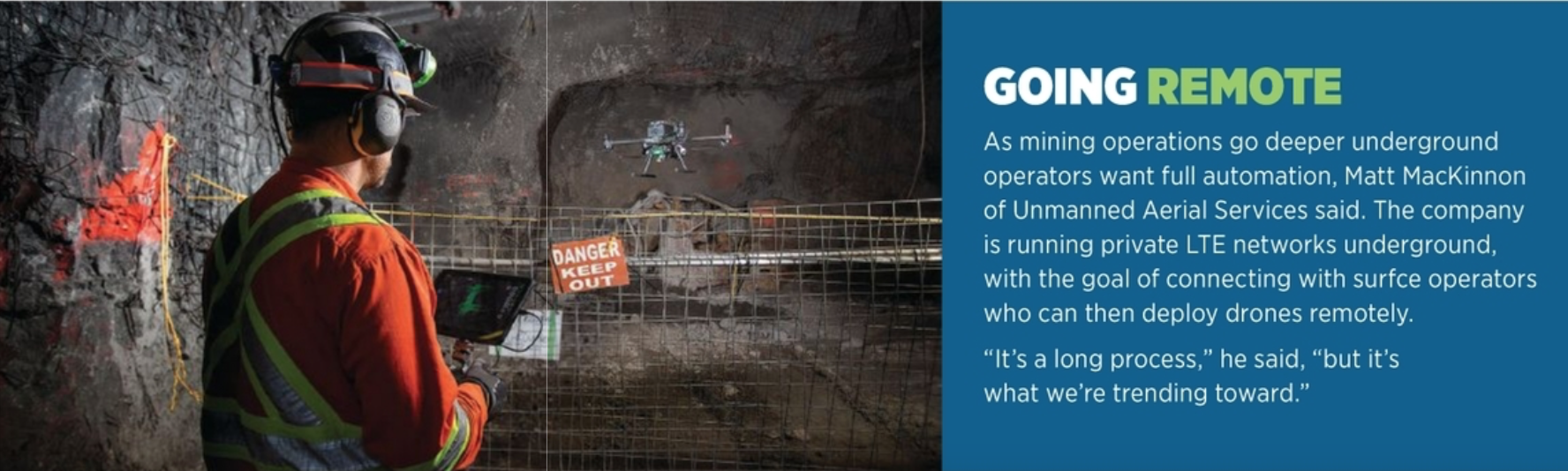
“Everything depends on mining. To create anything, you need minerals,” said Matt MacKinnon, founder of Sudbury, Ontario-based Unmanned Aerial Services. “You don’t realize how many mines there are and how crucial they are to the world economy. We’ve basically mined out a lot of the low-hanging fruit, and now everything is getting deeper and harder to access. That’s where this drone technology will shine over the next few years.”
EXPLORATION, EXPANSION AND RECLAMATION
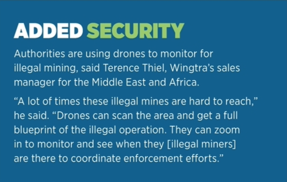
Exploration is one of the biggest growth areas for drones in mining, said Terence Thiel, Wingtra’s sales manager for the Middle East and Africa. Typically, manned aircraft fly magnetometers over prospects to locate iron ore deposits. Those are expensive missions, which is why the Zurich-based company receives daily requests from customers asking if a magnetometer can be fit on the WingtraOne vertical take-off and landing (VTOL) drone.
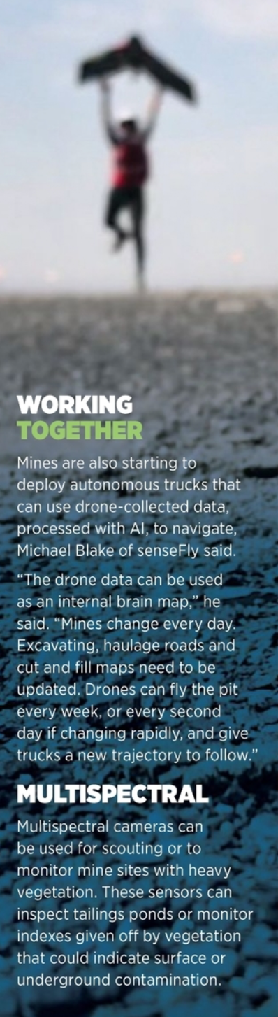
Before excavation, drone-collected data can help determine what materials are on the site, their consistency, if there are cracks or dampness in the rock, where to excavate and how deep, said Michael Blake, customer service engineer for senseFly. This is also useful when adding to an existing mine.
“LiDAR sensors come into play when there’s thick vegetation,” said Hanno Truter, Microdrones sales manager, Africa. “You need the natural ground level to see how deep you have to go down and to calculate how much soil and overburden needs to be taken off before you get to the ore. If you use a camera you only get the top of the vegetation, which gives a false reading of the ground level.”
Vegetation can be removed in software, but that takes time, Truter said. LiDAR penetrates all the way through the vegetation, which is a more efficient way to survey for a mine prospect or expansion.
Drones are also used to obtain baselines of new sites, Thiel said. This is critical because after mining is complete, regulations require the land be returned to its pre-work state. Mine operators must monitor and maintain the land for 10 to 15 years after shutting down to make sure there’s no lasting environmental damage: otherwise they face fines.
INSPECTING DANGEROUS AREAS
Mines are hazardous places. Rugged drones that can stand up to the environmental challenges reduce the risk to workers while also giving them access to areas that are difficult, even impossible, to reach with traditional methods, Flyability Training Manager Charles Rey said.
For example, it’s difficult to know how an ore pass, a tunnel used to transport materials, is holding up after a year or two of use, Rey said. Sending a camera down to get a look at how it’s changed isn’t easy, and, because these passes aren’t on supported ground, they can have failures. In minutes, a drone provides an overview that tells crews if the pass is suitable for use.
MacKinnon uses Flyability’s Elios 2 for visual inspections in confined spaces. This might include inspecting beam pockets to see if they’re the same size as in the design data. Drones are also deployed for vertical inspections, eliminating the need for manlifts and scaffolding.
Typically, mine equipment must be shut down and cooled pre-inspection and then restarted—a multiple-day process. A drone can complete an inspection in 15 to 30 minutes, MacKinnon said, significantly reducing downtime and lost production.
The second area MacKinnon focuses on is laser mapping. Traditionally, cavity monitoring scans (CMS) in stopes are completed via a laser scanner pushed on a cart, shooting out points from only one given location. Workers must physically push a pole into areas being scanned, which is not only difficult, it’s also dangerous. Mounting the scanner on a drone creates distance and removes the human element.
The primary area where CMS is completed is within a stope, MacKinnon said. Stopes are open spaces sliced out of large ore bodies (panels). Areas with stopes can be prone to collapse because they are unsupported and do not contain bolted ground or meshes, which means humans can’t work there. Inspections to reconcile stopes before and after blasting must be done remotely and at a distance. Drones simply make the process easier and faster.
“There’s a plan of what stopes are supposed to be shaped like when they’re blasted,” MacKinnon said. “Picture a row of dominos. When taking out stopes, if blasting goes wrong and the adjacent panels are compromised, the mine could potentially lose millions. With the Hovermap Scanner from Emesent we can easily scan those stopes and generate a model to make sure the blast went as expected as it progressed through the ore body. If the blast did not go as planned, the mine needs to understand what happened, and compare the actual size and shape of the captured scan against the pre-planned size and shape of the stope.”
Drones can be sent in after a blast to ensure everything is stable before workers enter. They also can be quickly deployed after an incident, giving operators an overview of areas impacted for quicker, safer responses.
In open cast mining, drones can also monitor haulage way gradients or bench heights and width, and the consistency of the narrow “benches”— long horizontal ore ledges or faces of ore—bound by the slopes above and below them, Blake said. RGB sensors identify different rock types, how they’re positioned and if they’re stable.
Haul roads are another critical inspection area. With a point cloud or 3D mesh, their length, gradient and slope can be calculated, while RGB imagery shows the consistency of the ground, and if there are any damp areas or water seepage that could cause large haul trucks to lose traction or lead to an incident.
Haul roads must meet certain requirements, including height, or mine owners face fines, Thiel said. A mine’s shape typically changes every three to six months, so crews must constantly build new ways into the pit and move stockpiles, meaning haul roads need to be adjusted, too.
“If haul roads are two, three or four percent off, trucks must slow down during their turns, which causes a bottleneck,” Thiel said. “Drones can create a visual model they can check against their mine planning software.”
Kespry’s software specifically monitors and assesses haul roads, President Krishnan Hariharan said. Using computer vision, the software determines the width of the road and the berms on either side, allowing crews to analyze and ensure safety standards are met, even as they identify bottlenecks.
Drone data also can create 2D and 3D models of the mine before and after blasting, Thiel said. Without a drone, there’s no way for surveyors to go onto the side of a pit’s walls for an accurate reading of their height and angle. Any shift on a wall indicates it’s more likely to fail than others, a huge safety risk.
Conveyor belts—some up to five or six miles long—need to be inspected almost daily, Blake said. Fixed-wing drones can complete long corridor mapping missions to capture images that show blockages along the belts, and discover if any rollers have come off or are loose.
Other inspections include looking for cracks or loose rocks in vertical rock faces, as well as flying equipment in processing plants to detect defects and monitor for heat using a thermographic inspection sensor payload. These provide an overview of the entire mine, or specific areas, for inspection and comparison to original designs.
“Our Duet T thermal sensor, combined with the eBee X, can assist thermographic inspection of electrical equipment by monitoring for thermal signature anomalies,” Blake said. “You also can combine data sets from professional survey personnel conducting terrestrial heat detection on the ground and the drone data to get a better overall picture.”
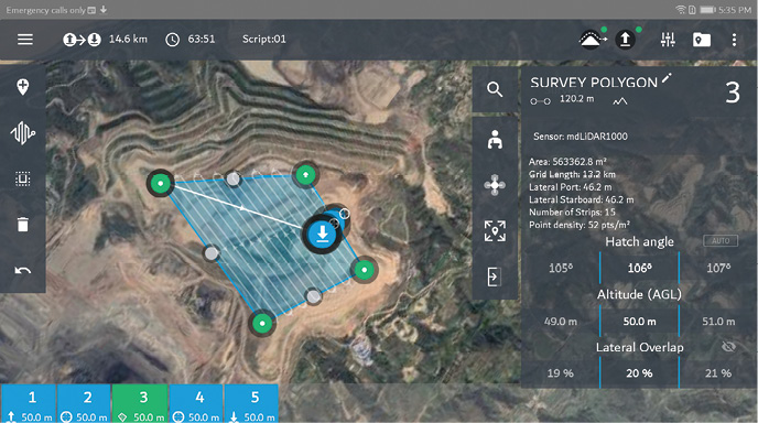
mdCOCKPIT lets users plan, monitor, adjust, analyze and control missions from a tablet.
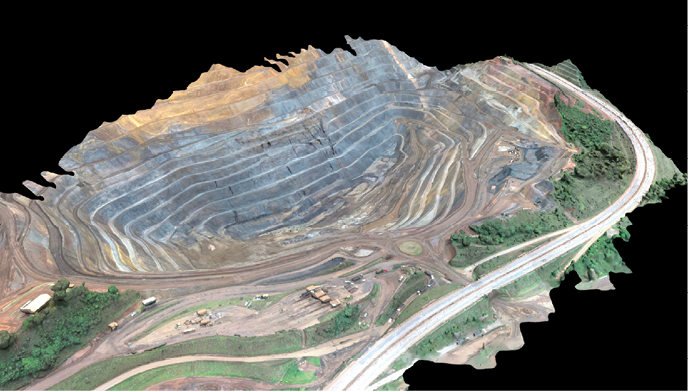
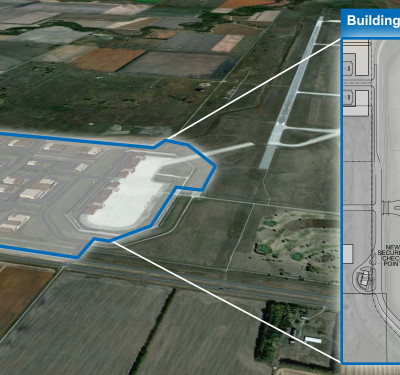
Esri’s Site Scan generates a high resolution 3D mesh of a mine.
TAILINGS AND STOCKPILES
Once mined, raw ore must be processed to extract valuable materials. Tailings are the biproduct of the initial processing, with most of this material ending up in tailings ponds or dry waste piles. These ponds can be the size of the actual pit.
“From drone data, we can scout new areas to create digital surface models of where we want to build a new tailings pond or monitor existing ponds,” Blake said. “As production increases, the tailings area will need to be extended or the height increased to accommodate the waste tailing material.”
Waste material that doesn’t make it to the ponds, known as spoil, can damage surrounding vegetation. The ponds can leak as well. senseFly’s Duet T, an RGB/thermal mapping camera, can detect discolored areas and heat differences in contaminated soil.
Kenmare Mine, a “moving mine” in Mozambique, surveys mining tailings weekly using the Microdrones mdMapper1000DG. As the team mines sand dunes to extract titanium and zircon, the sand is pumped back to the mine site and the mine then closed and the area rehabilitated.
“We have acquired a Microdrones system to help us carry surveys in wet tailings, high unstable faces of the mine, topographic surveys of very large areas and for volumetric measurements,” Senior Surveyor Naison Kambo said, noting they’ll be able to do even more once post processing times improve. “The wet tailings are very unstable sand material. It’s not suitable for one to move around with GNSS equipment or a prism pole. High unstable mine faces are also a danger to surveyors when capturing the mine’s weekly progress. The company has huge benefits in safety-related matters. There is also reduction in fatigue and overtime hours for survey members.”
Stockpile calculations are another area benefiting from drones. Traditionally, workers climb stockpiles using terrestrial hand-held GPS or total stations, Blake said, noting the danger of the job. A team of two or three can collect about 1,000 points each day. A drone can map the entire area in about 10 minutes and produce 3D models with one million points per pixel within the same or less time than terrestrial methods. Not only is this safer, it provides a more accurate calculation of stockpile volumes—a significant impact on revenues.
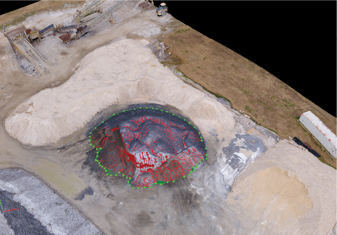
Stockpile volume calculation in Pix4Dmapper software.
EVOLVING SOFTWARE
As operators collect more data, they want deeper insights, Esri’s Director of Global Remote Sensing and Imagery Richard Cooke said. That means applying AI and machine learning.
“That’s one of the bigger trends we’re seeing,” Cooke said. “They want to maximize the data they’re collecting or to make predictions based on the data. AI and machine learning deliver more forward-looking insights into what’s happening in the mine.”
Kespry’s software uses AI to extract images from orthomosiacs, Hariharan said. Removing heavy equipment, for example, provides a better view of a mine’s topography. Users can collect data using the autonomous flight app, with images automatically sent to the cloud via an LTE connection. AI is then applied to the 2D and 3D models created. Users can log in to look at specific pits and mines for data collected over time. Customers process data in third-party software and via detailed PDF reports.
3D models can be shared online with colleagues, who can zoom in to inspect surfaces and plan for further excavations, said Gabriele Ruggiero, senior business development executive for Pix4D. The software also uses AI to automatically recognize ground control points (GCPs), improving the model’s accuracy. Models can be imported into CAD software for future planning.
“Once the complex algorithms are properly set up, they can be used to facilitate and quicken the terrain analysis,” Ruggiero said, “extracting useful information faster for better decision-making processes.”
Esri’s end-to-end solution, Site Scan, now being used by Newmont Corporation, offers site planning, terrain following and fleet management. Newmont has nine major mines globally; with Site Scan, all the drones talk to each other, streamlining workflows and enabling managers to see what’s going on with every system, no matter where it is located.
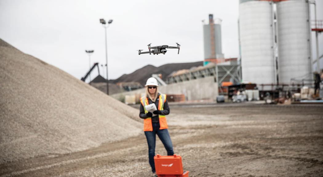
Kespry’s aerial intelligence solution makes mining operations safer and more efficient.
LOOKING AHEAD
As AI improves, drones are poised to become a more integral part of mine compliance workflows, Cooke said, and will continue to prove effective in safety monitoring, inspections, soil movement and volumetric analysis.
A continuing environmental push and consistent proof of drones’ value will increase adoption. That’s already happening in places like Africa, where regulations are laxer. Thiel estimates that 95 percent of sites there already have a drone; probably half have two.
On-site processing will increase, without uploading to the cloud. Platforms that can support multiple drone types will also be the norm.
“We’re all looking at what we call mines of the future, or connected mines,” Truter said. “All the data collected is sent to one room where it is processed, and everyone has live access to what’s happening at any time of day. That allows them to make decisions very accurately and very quickly. The connected mine is happening, and drones are definitely part of it.”