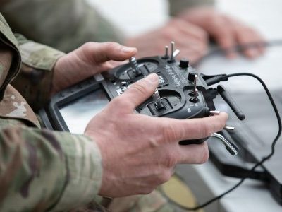
The Island Conservation team is deploying drones to eradicate invasive species, such as rats, that threaten island animals.
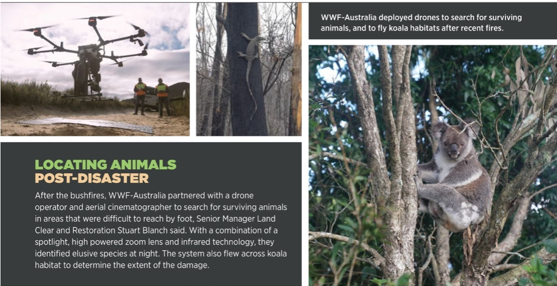
Before the massive wildfires that ravaged eastern Australia did their damage, the koalas who live there were already facing extinction, likely by 2050. The fires that raged in late 2019 and early 2020 destroyed 30 percent of the remaining habitat in New South Wales, accelerating that timeline unless drastic action is taken, and quickly.
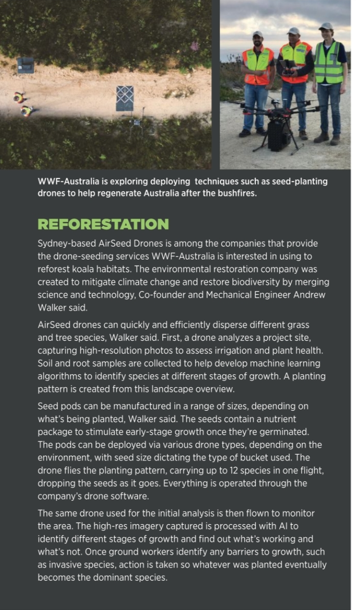
That action has come in the form of “Regenerate Australia,” described as the largest wildlife and nature revival program in that nation’s history. Launched by the World Wide Fund for Nature-Australia (WWF-Australia), the goal is to change course and double the number of koalas in eastern Australia by 2050. Leveraging drone technology is an element of this plan, with UAS set to play a crucial role in habitat re-establishment.
WWF-Australia is trialing specialized seed-dispersing drones to plant koala food trees and create wildlife corridors, said Stuart Blanch, senior manager land clear and restoration. Some drone models can disperse 40,000 seeds a day, a process that’s much more efficient than planting by hand.
“This is a staggering loss to nature that requires action at scale, and recognition that business as usual can no longer be the way forward,” Blanch said, noting that the wildfires destroyed or displaced an estimated 3 billion animals and up to 7 billion trees. “We need to dream big, prioritize innovative ideas and find new solutions that work for people and nature. Drone seeding is one of these new solutions.”
Drones are increasingly being deployed to aid in wildlife conservation, including monitoring endangered animals, eradicating invasive species and assessing habitats, to name a few, said Rick Spaulding, chair of The Wildlife Society’s drone working group. Researchers are flying drones with RGB, thermal, multispectral and hyperspectral payloads, and they are leveraging artificial intelligence (AI) to gain new insights into animal populations and habitats. Spaulding’s own drone working group is focused on developing best practices and guidelines to ethically conduct research on species and their habitats, which includes maintaining a certain distance to avoid disturbing the animals or impacting their behavior in any way. It’s important to be aware of how drone technology affects them.
WILDLIFE MONITORING
Monitoring endangered animal populations is critical work, but it isn’t easy. Surveying by foot takes time and counting from a manned helicopter can be costly and dangerous. With a drone, researchers get a much better view of an area, collecting high-resolution images to run through AI algorithms for accurate population counts or turning them into deliverables such as orthomosiacs and 3D models.
In Africa, the Kordofan giraffe is among the endangered species being monitored by drone, with the U.K.’s University of Bristol partnering with the Bristol Zoological Society to run trials at Bénoué National Park in Africa’s Cameroon.
Matt Watson, who is with the university’s earth sciences department, traveled to Cameroon last December to fly drones over the massive national park. It took days, but eventually the team captured images of the elusive giraffes, which tend to blend in with the trees around them. Thermal was a useful tracking tool, as giraffes register a different temperature than their surroundings late at night and early in the morning.
Learning from this trial, the team is creating a customized system to map the park using optical and thermal cameras, Watson said. The low-res camera will register when the drone locates a giraffe, then return to it at a lower altitude to capture imagery with a higher-res camera. AI and machine learning tools will be able to identify exactly which giraffe it is, eliminating the possibility of counting the same giraffe more than once.
“The splashes on a giraffe are how it controls its body temperature,” Watson said. “They’re like a fingerprint. AI can go through the images and identify that’s Giraffe Four with Giraffe Two and they may be a family. It allows us to map out the movement of the population.”
The team plans to study giraffes in areas where they’re in greater abundance or able to roam free to learn more about how they react to the technology while also collecting images for the AI dataset. Eventually, they’d like to return to Cameroon with a sophisticated system local park officials can be trained to fly.
WildTrack co-founders Zoë Jewell and Sky Alibhai use footprints to non-invasively monitor endangered species such as rhinos. The tech evolved slowly, Jewell said, but can now identify animals from footprint images, which are much easier to capture than those of the actual animals. It might take four days to spot a rhino, but a drone can collect footprint data daily. UAS also can identify rhino trails, and then follow them while taking images in autonomous mode.
The footprint identification technique (FIT) WildTrack developed sits on top of JMP statistical software, where the footprint is uploaded and measurements automatically taken to identify an animal’s species or class, Jewell said. The only limitation is the need for expert input for landmark points on the footprint, such as toes and heels.
WildTrack is developing AI to read and classify footprints to identify individual rhinos, Jewell said. “Footprints are a very rich source of data. Expert trackers can tell you amazing things about footprints,” Jewell said. “The bigger picture is making this accessible to people who don’t understand footprints, and that’s the power of our system. You have this impression in the ground that has the same color and substrate around it and same texture, so it’s difficult for a computer to pick that out. It’s a breakthrough with AI to identify a cryptic ground image or object.”
The team uses systems from senseFly and Skydio, Jewell said, and payloads ranging from high-res cameras to multispectral. Downloaded images are stitched into an orthomosiac of one big landscape or looked through individually for objects of interest. The team then ground truths the images to make sure what they’re seeing on the map is accurate, and if so they’re entered into a database to classify with AI, FIT or both.
Cape Town, South Africa-based Airborne Drones recently used thermal imaging and videos to monitor endangered orangutan nests in the Malaysian rainforest. Drones surveyed a large area in a few hours, a process that would have taken weeks or months on foot. As a result, researchers tracked changes in population size more efficiently, spokesperson Gideon Gerber said.
“Using waypoint GPS navigation, the drone is allowed to fly on its own to its destination and hover manually at ‘points of interest,’ which are pre-planned and configured into the drone’s autopilot software,” Gerber said. “Heat detection allows you to see equally well in highly lit and completely dark environments. Combining this with HD feed provides an innovative platform for conservation of the endangered rainforest.”
PREVENTING POACHING
Poaching has become a huge problem in poor countries, where selling rhino horns, for example, can bring a payday larger than a yearly salary, Jewell said. Anti-poaching patrols sweep areas at night, but finding offenders is difficult, dangerous work.
Drones can provide night surveillance, Jewell said, eventually flying pre-programmed routes with little to no human intervention, alerting the appropriate personnel when a poacher is identified.
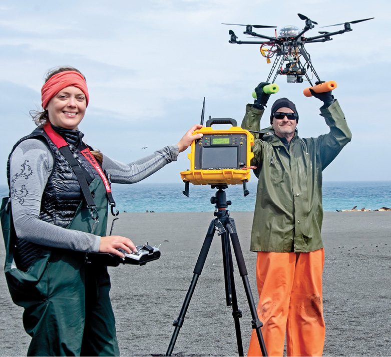
About three-and-a-half years ago, the team at Netherlands-based Avy began flying its fixed-wing UAS to search for poachers in South Africa, co-founder Patrique Zaman said. The threat wildlife faced led him to test the feasibility of deploying the long-endurance drone for anti-poaching missions. However, after restrictions prevented the team from flying a prototype, they have since improved its capabilities and developed a drone for firefighters and wildfire prevention in the EU. They hope to return to protecting wildlife in South Africa in the near future
The work is difficult, Zaman said, as the parks are vast. Poachers aren’t easy to find, making it critical to learn more about their behaviors, including when they’ll be in the park and how they get in. It’s a complex problem, so it took time to determine how drones could best help.
Spotting trees that have turned to charcoal is one example. These trees are cut down, covered with fuel and sand, then burned. This exposes the animals, but a lack of smoke leaves the fires undetected. A drone using thermal camera can locate these areas, and the lurking poachers.
Damaged fences are another sign of poachers, Zaman said—again, something regular surveillance flights can easily spot. Monitoring soil moisture also can indicate where animals, and ultimately poachers, are headed next.
REMOVING THREATS
Invasive species, such as rats that devour eggs, are a leading cause of animal extinction on islands, said David Will, GIS and data programs manager for non-profit Island Conservation. Removing them allows endangered populations to recover, another task drones are starting to take on.
Typically, eradicating rodents requires spreading a toxin across an island, Will said, either via helicopter or hand broadcast. Deploying drones instead reduces cost and enhances precision. UAS also detect species and confirm eradication sooner than other methods.
In 2019, Will traveled to Seymour Norte Island in the Galapagos, where once-eradicated rodents were rediscovered, posing a threat to the large populations of sea birds who live there. Island Conservation received emergency funding to respond to the threat, using custom-made drones carrying drop buckets with 360-degree directional spray to deliver the poison.
A boat-launched drone with a 15-minute endurance distributed 3,000 kilograms of bait over three days, Will said, before the pellet chunks began to burn out the motors. The remainder of the first application was finished with hand broadcasting, while the second was completed entirely via drone.
There are plans to fly drones for the same type of project on a much bigger island in 2022, Will said. Increasing the scale of drone applications will require a larger drone with higher payload capacity, longer endurance and the ability to autonomously follow complex coastlines and steep, rocky terrain.
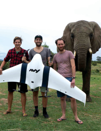
Avy team in South Africa performing test flights with an old Avy prototype drone.
Certain birds also pose a threat to endangered species. The desert tortoise population has declined steadily over the years, with raven predation among the contributing factors, said Tim Shields, founder and CEO of California-based HardShell Labs, making it critical to reduce that bird’s population.
How? Remote egg oiling is one accepted solution, Shields said. With this practice, a layer of oil is spread on unhatched eggs, killing the embryos. The eggs remain undamaged, so the parent continues to care for them. This has proven effective in controlling species like Canadian geese that nest on the ground, but ravens tend to nest in areas that are harder to reach, such as trees and utility towers.
Enter drones carrying a remote fluid application system (RFAS). A linked camera, oil nozzle and pressure system accurately delivers a stream of oil across the eggs from as far as 15 feet away. The team first tested the device in tree nests and has worked closely with a local utility to target nests in towers.
“It was a matter of demonstrating the technology was safe and wouldn’t damage or endanger their critical infrastructure,” Shields said. “This is going to become a normal component of raven control. Those utility corridors provide nesting sites to ravens that wouldn’t exist otherwise, and that’s important because during nesting season adult ravens turn into killing machines to feed their babies, who are ferocious eaters.”
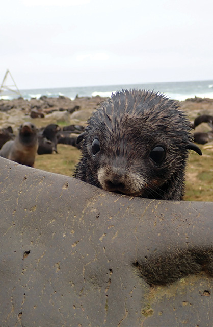
A fur seal pup.
Shields is also part of a project to semi- automate the egg-oiling process, using AI for nest detection and to autonomously position the drone relative to the nest. AI will eventually be used to identify if there are eggs in a nest and what species they represent, and then provide the operator with the choice to oil or not. This will eliminate the need for highly skilled pilots to operate the drone, making the technology more accessible.
Shields noted the collaboration required between engineers, biologists and agencies to develop these types of advanced systems. Sundance Biology and T3B are among the partners key to developing and advancing this technology.
NOAA Fisheries Alaska Fisheries Science Center biologists Brian Fadely and remote pilot Katie Sweeney conducted UAS surveys on Bogoslof Island, Alaska, to study northern fur seals.
MARINE/FISHERIES
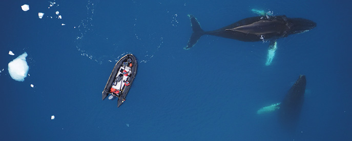
Drones are useful for projects in marine environments, with researchers from Duke University Marine Laboratory deploying the systems for everything from water quality measurements to counting oyster or sea bird populations to studying whales, said David Johnston, associate professor of the practice of marine conservation & ecology division of marine science and conservation, Nicholas School of the Environment.
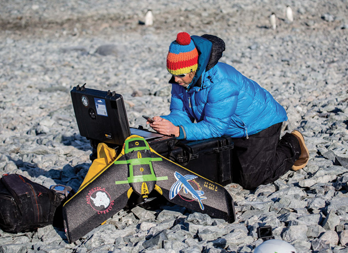
The team has deployed drones widely, for population assessments of sea bird colonies in remote Antarctica, sea turtles off Costa Rica and grey seals in eastern Canada.
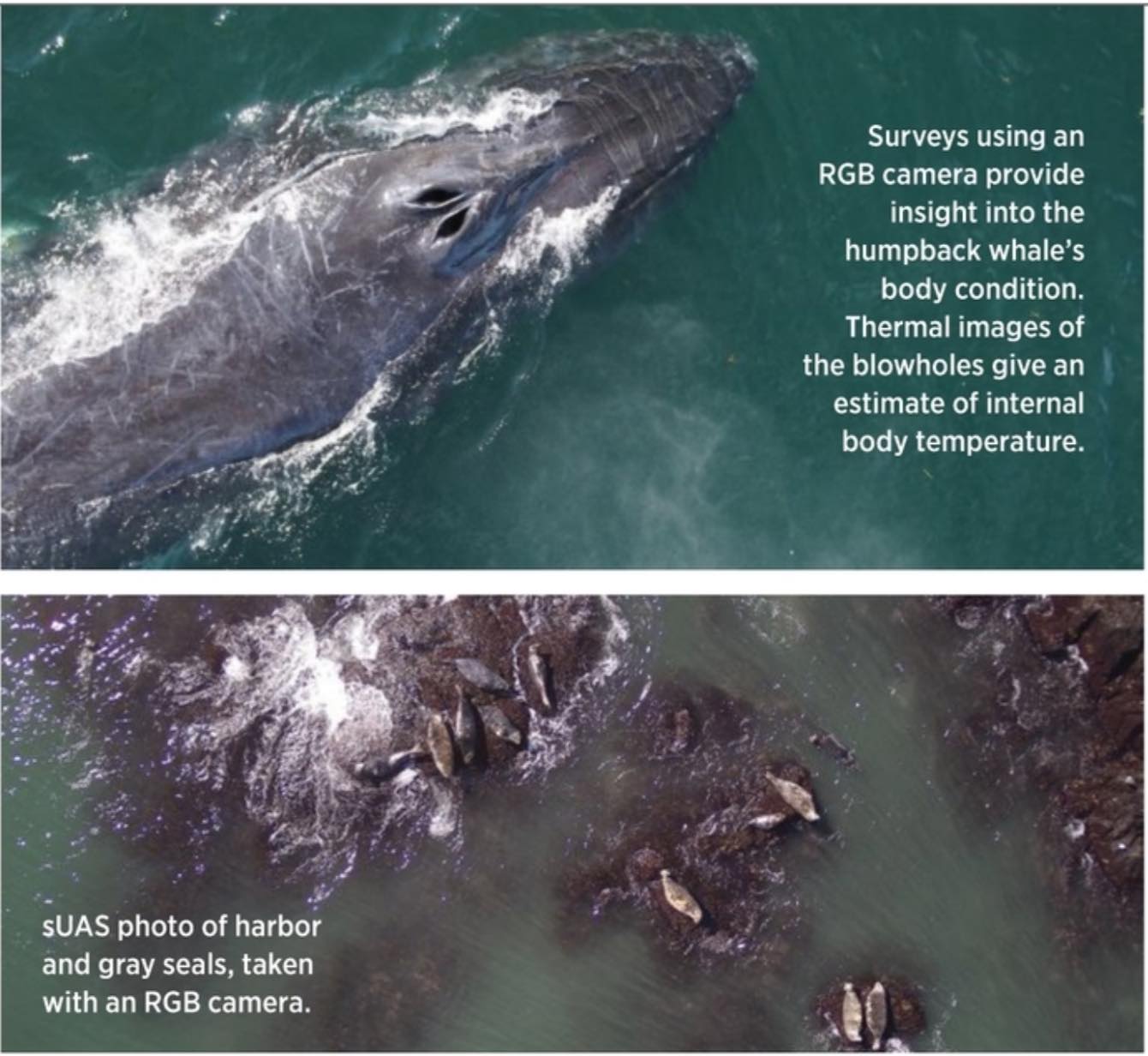
UAS can give scientists insights into individual animals, Johnston said, capturing behaviors with video and imagery. For example, using drones in a photogrammetric workflow makes it possible to estimate a humpback whale’s body size and changes in body condition over time.
Hovering above a whale, drones can collect and analyze the vapor when it blows. Taking thermal images of animals under trees or hiding in dense vegetation, as well as detecting nests, are among common uses.
Like others, Johnston is working with AI to manage the massive amounts of data captured, making it possible to identify habitats, automatically measure whales or enumerate individual animals in colonies. “If you’re trying to estimate the amount of sea bass in an area or oyster reef, you have to trench around with GPS in the muck,” Johnston said. “It’s so much easier and faster to use a drone. We also collect very high resolution centimeter-per-pixel images that surpass what we can get with satellites or occupied aircraft. You really can see the fine details.”
The National Oceanic and Atmospheric Administration’s (NOAA) Marine Mammal Lab has deployed drones to survey endangered steller sea lions since 2014, flying a simple VTOL with a camera, Uncrewed Aircraft System Lead Katie Sweeney said. Now they want to use an octocopter to survey northern fur seal pups in Alaska.
The system flown for sea lions won’t work for this application; fur seals blend in too well with the black volcanic rock around them to be seen in detail, Sweeney said, requiring more sophisticated imaging. In phase one of what is expected to be a three-phase project, the team assessed thermal imagery, and while it worked fairly well, its low resolution and impact from ambient temperature make it less than ideal.
They tried spectral signatures next, using a radiometer to measure reflectance values from the seals and their background to calculate at what wavelength they most pop out from wet rocks or matted vegetation. The plan is to use multispectral sensors with those customized bands and thermal capabilities in phase two, and hopefully try it out in Alaska in July.
For phase three, the team will work with AI experts to automate image processing and analysis, something they’ve already done with sea lions. The fur seal images will be more challenging, though, as they’re collecting visual, near infrared and thermal images, leading to more data sets.
Traditionally, a method called shearing is used to count fur seal pups, a time-consuming process that’s done once every two years. Deploying drones instead will reduce the number of people needed to travel to their remote habitat, making yearly surveys possible.
“There’s usually not a disturbance with UAS when it comes to fur seals so it’s an optimal strategy,” Sweeney said. “Females have just had pups and don’t want to leave, and males are holding their breeding territory so they’re not paying attention to the UAS in the air. This really could revolutionize how we survey fur seals.”
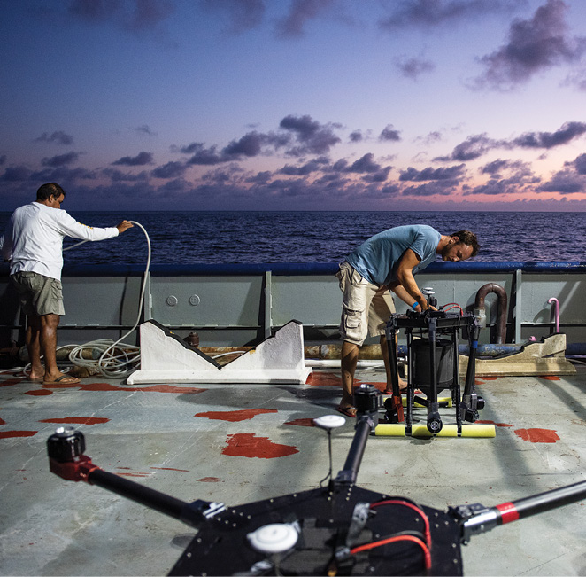
Duke Marine Robotics and Remote Sensing Lab deploys drones to monitor populations and individual animals.
CONSERVING THE FUTURE
Animal populations are declining all over the world, in what Shields describes as a broad-scale ecological catastrophe; drones can provide needed information about why that’s happening. Researchers and developers alike will access even more platforms and powerful, specialized sensors, Spaulding said. Battery life, a challenge now, should continue to improve, leading to increased efficiencies. As systems come down in cost, more conservationists will have access to them.
UAS developer Zaman hopes national parks worldwide can have one or multiple drone in box stations, with systems taking off automatically at specific times to provide situational awareness. Professor Johnston sees drones becoming more integrated with multi-scale assessment, with machine learning applied to validate data collected from satellites or occupied aircraft. Integrated into a system of systems, they’ll be used, for example, to detect changes in a coastline, with initial findings queuing up a higher resolution assessment, also done via drone.
“The beauty of drones is they can be non-intrusive and help conservationists think about how to get data without disturbing the animals,” Jewell said. “The technology is growing so quickly and is so much better now than it was just 5 years ago. If we can get AI capabilities to work on drones so we can get them to follow objects of interest and collect data remotely, it’s going to be truly transformational.”