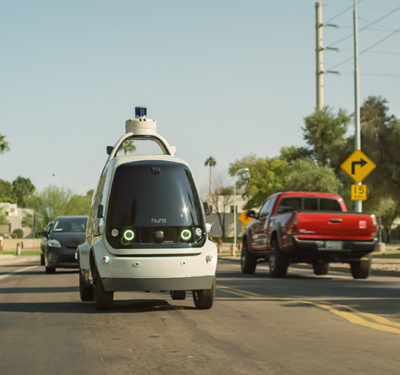
Auto makers, ride-service providers and system integrators all anticipate the day—perhaps sooner than some think—when fully autonomous vehicles take the road. Many rigorous technical navigation challenges must be surmounted to reach that day: safety and reliability come first, before convenience and cost-savings can be realized. Innovative engineers who have solved these challenges share their lessons learned in a free webinar, Wednesday, October 2: “Inertial + SLAM: Creating the Roadmap for Autonomous Vehicles.”
Their achievements are realized today in completely driverless shuttles operating in urban, GNSS-obstructed environments around the world. Inertial systems combine with simultaneous location and mapping (SLAM) technology in these pioneering ventures to provide accurate, reliable absolute positioning and navigational awareness during GNSS outages.
The hour-and-a-half webinar discusses real-time navigation, vision- and LiDAR-enabled SLAM and high-definition (HD) mapping in detail. Integration of these techniques produced the driverless shuttle, an on-demand mobility services optimized for user experience, viewable here. The product has successfully performed in more than 60 trials in seven countries, safely transporting over 120,000 passengers.
Demonstrations and key takeaways from the October 2 webinar include:
- How inertial navigation systems integrate with GNSS to provide reliable absolute positioning at all times, in harsh environments for autonomous vehicles, with proven reliability of data to address safety issues.
- How vision- and LiDAR-enabled SLAM algorithms create advance trajectory computations to augment this integration, yielding high-definition (HD) maps of complex 3D environments.
- How shuttles and robots employ the system to determine where they are on the map and then, where they next must go.
Several localization layers are investigated, compared and discussed by the expert panel, with test results and data showing reliability, repeatability and accuracy.
With no human operator to fall back on, these fully autonomous vehicles represent a special niche in today’s rapidly growing field, and yield important insights for the wider driverless future.
Proven customer use cases validate the concept in action. Coast Autonomous, the self-driving mobility company represented on the webinar speaker panel, integrates inertial and SLAM technologies aboard autonomous vehicles in low-speed environments such as campuses, downtown areas, theme parks and airports. The solution provides increased customer safety, faster response to user requests, and resolves logistics bottlenecks.
Speakers on the October 2 webinar, “Inertial + SLAM: Creating the Roadmap for Autonomous Vehicles” are:

Raphaël Siryani
Raphaël Siryani, chief software architect and co-founder of inertial manufacturer SBG, a supplier of miniature, high-performance motion-sensing solutions. He has an M.S. in embedded systems engineering from the Ecole Centrale d’Electronique. SBG Systems designs and manufactures attitude and heading reference systems (AHRS), inertial measurement units (IMU), inertial navigation systems with embedded GPS (INS/GPS), and more.

Jérôme Ninot
Jérôme Ninot, mapping chief and founder of Viametris. Ninot holds a Ph.D. in engineering from Telecom Bretagne. Viametris provides sub-centimeter localization for increased productivity, accuracy, and efficiency, using point cloud, localization, immersive images and mapping.

Pierre Lefevre
Pierre Lefevre, chief technical officer of Coast Autonomous, highly experienced in robotics, 3D mapping and autonomous vehicles, a consultant to governmental rule-making authorities, commercial vehicle manufacturers and technology companies. In 2017, he delivered the first autonomous shuttle to Hong Kong, and in 2018 demonstrated the first autonomous vehicle, the P-1, on Broadway in heart of New York’s Times Square.


