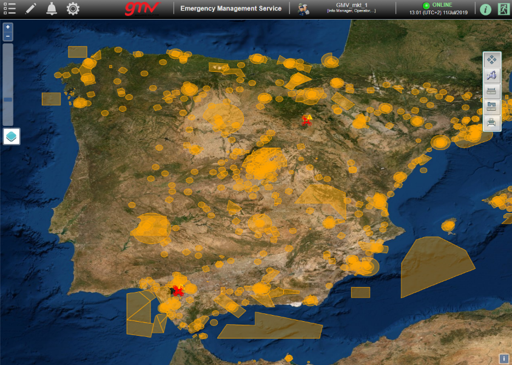
Growing from its participation in the European DOMUS project, and designed to come up with a response to the growing number of civil unmanned aircrafts likely to be sharing the airspace in the near future, the technology multinational GMV has developed the U-Space suite dronelocus®, which integrates a Tracking Service and an Emergency Management Service.
U-Space is the set of new services and procedures designed to guarantee safe and secure airspace access for unmanned aircrafts, taking in operational security, respect for public privacy and safety of persons and infrastructure.
GMV’s growing participation in programs oriented to the use and management of drones has prompted it to develop the dronelocus® family of products. In 2018 GMV was chosen by the air-navigation services provider of Spain, ENAIRE, to develop the tracking service, the emergency management service and the GNSS performance forecasting service for navigation and surveillance within the DOMUS project.
DOMUS is one of the six European projects selected by the Single European Sky ATM Research (SESAR) program for demonstration of U-Space services for Unmanned Traffic Management (UTM). To come up with an answer to the growing use of unmanned aerial systems of this type, GMV has developed the dronelocus® family of products.
“The number of civil unmanned aircrafts using the airspace is expected to soar in the mid- to long-term, making it necessary to set up a drone traffic management system”, argues Carlos Molina Delgado, dronelocus® Project Manager. “Especially”, he goes on, “if we take into account the forecasts of the Strategic Plan for development of the sector, with estimates a fleet of up to 51,400 drones for professional use in Spain by 2035, making the sector one more factor in the mobility and transport fields”.
How does dronelocus® work?
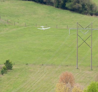
U-Space focuses on the management of low-level flights at an altitude of less than 150 m above ground level in both built-up and open-country environments. In this context, the Tracking Service from the dronelocus® suite processes data from positioning sensors installed on the drones and then records this information. It thus becomes a powerful support tool for investigating any type of accident or incident, by analyzing the flightpaths previously recorded in the system.
The Emergency Management Service from the dronelocus® suite, for its part, in combination with the Tracking Service, manages drone operation alerts sending automatic notifications to the authorities in certain hazardous circumstances. This service also allows setting up ad-hoc airspace drone restrictions around the emergency-affected areas (e.g. a road accident, fire, safety zones, etc.).
These features ensure that general drone operations are performed according to the airspace restrictions, and at the same time authorized drone operators can fly in the restricted zones.


