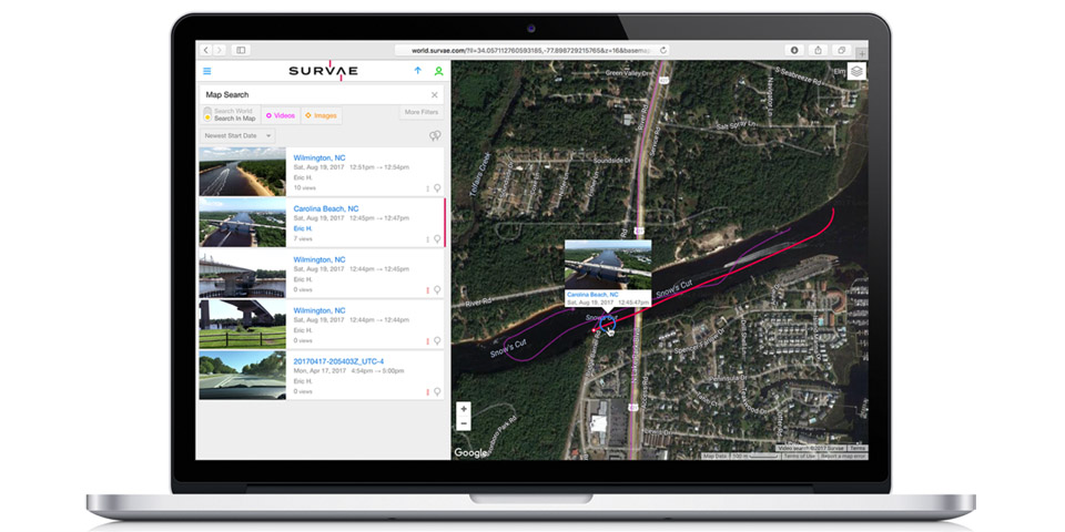
The Kongsberg Geospatial IRIS UAS Ground Control Station (GCS) will now be integrated with SURVAE’s digital asset management platform for geolocated video, imagery and data—giving drone operators access to multiple video streams from multiple simultaneous drones.This capability will enable single operators to manage real-time display and storage of multiple video streams from the drones being managed by the IRIS GCS, according to a news release. Videos will be meta-tagged and stored for near real-time analysis or for post-mission archival search of missions flown.
“It is clear that future operations will require a single operator to be able to manage the data collection from multiple aircraft,” said Eric Hesterman, CEO of SURVAE, according to the release. “The Kongsberg Geospatial IRIS GCS provides the ability to manage multiple aircraft and their sensors so Kongsberg is a very logical partner for us to provide an integrated solution for operators. Managing the data is the next challenge for the drone industry.”
The platform provides real-time services to enable beyond visual line of sight operations (BVLOS), including real-time calculation of aircraft separation and line-of-sight for data communications. The expanded post-mission retrieval and analysis capability will significantly reduce the workload for drone operators.
“Our clients are telling us that real-time video management and storage is a great problem for them, and SURVAE provides a best-in-class solution to this growing need,” said Ranald McGillis, President of Kongsberg Geospatial, according to the release. “Integrating our capabilities creates a seamless workflow from data collection to post-mission retrieval.”