LAKELAND, Florida—The National Oceanic and Atmospheric Administration (NOAA) plans a three-layered investigation of hurricanes this year. In addition to its head-line grabbing use of unmanned aircraft, NOAA will be studying hurricanes on the surface of the water and below.
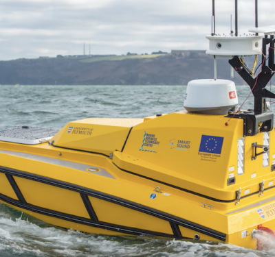
Ten Saildrone vehicles from the company of the same name will patrol the surface, while as many as 40 gliders will be underneath.
It’s a relatively quick process to place an ALTIUS 600 unmanned aircraft into the eye of a hurricane—it’s pushed through a release tube in the belly of a P-3 Orion aircraft. Getting Saildrones and gliders into position is a little tricker, and much slower.
“These are not fast-moving systems,” Kathleen Bailey, glider program manager for NOAA’s Integrated Ocean Observing System, said of gliders at a recent press briefing at the NOAA Aircraft Operations Center here. “They move at a slow crawl, collecting temperature and salinity [data] throughout the water column.”
Gliders move in a see-saw pattern by taking in water to dive and releasing it to go up, moving around for up to three months and diving as deep as 3,000 meters. They can collect data on such underwater features as pockets of cold water, which can sap a hurricane’s strength as it passes overhead.
“We’re measuring these features in particular, we’re steering the gliders toward these features, like eddies, the loop current” and cold-water pools, Bailey said. The gliders send their data via satellite upon surfacing, and “that data goes straight to the model” and to the National Hurricane Center.
NOAA targets the gliders for peak hurricane season, so will ramp up the fleet beginning in August. “I estimated about 40 are going in the water throughout the entire hurricane season this year,” she said.
“We have other gliders in the water for other purposes,” Bailey said. “The beauty of that is we have a data management system that takes in all the information and sends all of that data to the model, so we’re able to leverage those other gliders for this project.”
New Saildrone CONOPs
This is the third year Saildrone has collaborated with NOAA, said Matt Womble, the company’s director of ocean data programs. It had five vehicles deployed in 2021, seven in 2022 and will have 10 in the water this year, nine in the Atlantic and Caribbean basin and one in the Gulf of Mexico.
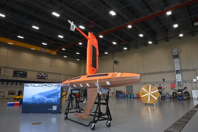
“This of this as very similar to a meteorological and oceanographic buoy that would otherwise be deployed, [have the] same or very similar sensors, things like air temperature, relative humidity, wind speed, wind direction, wave height, wave period, all those critical variables that forecasters and researchers like Greg need to understand the dynamics feeding and fueling hurricanes,” Womble said, referencing Greg Foltz, an oceanographer at the NOAA Atlantic Oceanographic & Meteorological Laboratory who works with the Saildrone data. “The difference being that this is obviously not tethered to the ocean floor. It’s not static, it can move around, it’s not spatially bound.”
“We can steer these, we can direct these into hurricanes and we can do it continuously through the strongest parts of the hurricane, where the waves are up to 90 feet and the winds are up to 125 miles per hour,” Foltz said. “So, that’s something that’s unique.”
Saildrone managed to get direct intercepts of hurricanes Fiona and Ian last year. There was the possibility of getting two Saildrones into Ian, but one of them wasn’t quite in the right location—like the gliders, the Saildrones aren’t fast, moving at the equivalent of a walking pace.
To try to make sure the Saildrones are as well positioned as possible, NOAA and the company are doing two new things: pairing vehicles together and having one on shore in case it needs to be rapidly deployed.
“This year we’re going to pair some Saildrones together, so maybe within 100 miles of each other. The idea is to try to get them both, at least two Saildrones into the same hurricane, in different areas of the hurricane” because conditions can be quite different in different parts of the eye wall, Womble said. “If we can do that, I think we can learn a lot about how the ocean and atmosphere interact in different parts of the hurricane.”
As for the rapid deployment unit, that will be kept in St. Petersburg, Florida, in case a hurricane is projected to head into the Gulf of Mexico, where the Saildrone could augment the vehicle already there.
“The idea is, if we see a hurricane that’s predicted to go into the Gulf of Mexico…then we’ll give Saildrone a call, about a week in advance, and say, let’s rapidly deploy this and put it in the water get it in ahead of the hurricane, and hopefully have enough time to steer it into the strongest part of the storm. We call it rapid deployment, and it’s a new thing we’re trying out this year.”