Riegl is making the remapping of the world happen faster by bringing its gold-standard UAS LiDAR technology to lower price points and more user communities.
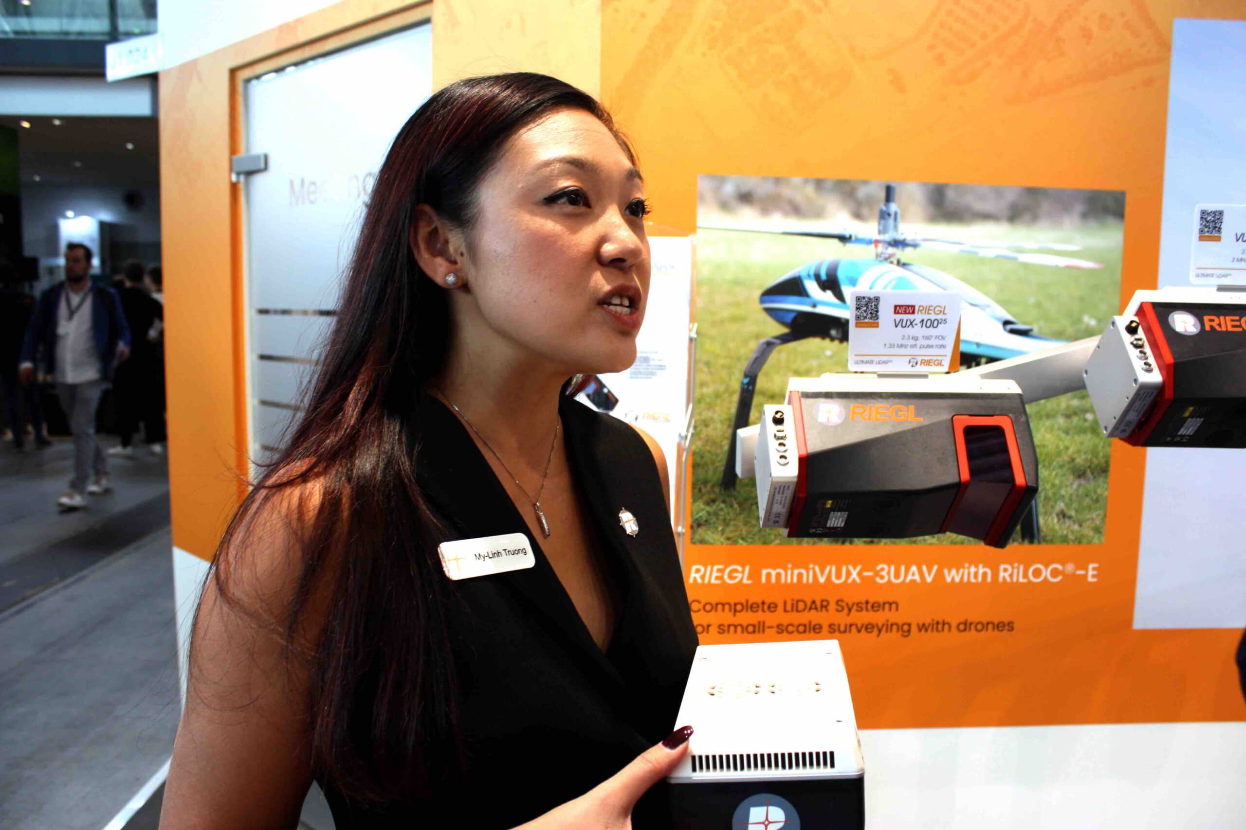
Speaking in Stuttgart at InterGEO 2024, My-Linh Truong, Riegl Division Manager Unmanned Laser Scanning, said, “This year, we are really excited to expand our fleet of UAS [unmanned aerial system] payloads, with the addition of the VUX-100.”
The new model features the same form factor as the well-established VUX-120; same mounting patterns and weight. “The key difference between the models is that the VUX-100 has an increased field of view, at 160 degrees,” said Truong, “where the VUX-120 and the VUX-160, which is the larger sister in the series, have 100-degree fields of view. The VUX-100 scans nadir-only, and it’s being offered at a lower price point.”
A wider field of view enables users to map with fewer passes, requiring less time in the air for the same project. “The key benefit is the improved efficiency,” Truong said. “With the wider field of view, you have less overlap. Data is captured at a lower density. The VUX-120 scans at a maximum of 2.4 MHz, while the VUX-100 scans at 1.5 MHz. We know that for a lot of projects that level of data density is absolutely sufficient. This unit is really optimized for a small UAS working on many kinds of tasks.”
Growing a successful line
The new addition comes hot on the heels of last year’s RiLOC (Riegl localization and orientation component). “RiLOC is our first foray into our own IMU GNSS solution,” said Thuong. “It’s designed to integrate with our small-form-factor miniVUX series.” Riegl took the solution further this year with the introduction of the RiLOC-F, a new version featuring improved performance that is fully compatible with the larger VUX series, making possible a lighter-weight system integration for the VUX-100 and VUX-120. “It also makes for a lower-cost, overall solution for the end customer, regardless of which VUX model they are using,” Thuong said.
All of this is likely to expand the company’s range of customers. “We’re definitely targeting those clients that have been interested in Riegl but have not been able to make that transition to the highest quality and performance that we can provide,” said Thuong. “This will bring them into the Riegl fold, into our processing work flow.”
Potential new clients include smaller, low-end ‘mom-and-pop’ surveying firms, as well as established geospatial industry players, big surveyors and engineering and mapping companies. “Some of these may have been more active on the terrestrial LiDAR side, and are ready to make that transition to UAS operation,” Thuong said, “and we also have clients that already fully invested in the large-format, aerial systems and may be ready to work with a smaller UAS payload and go after those smaller projects.”
Thuong said she believes that with the introduction of the VUX-100 and new integration possibilities such as the VUX-120 with the RiLOC-F, her company can bring more solutions to meet more needs among a more diverse customer base. If she’s right, Riegl will have taken us all a step closer to the remapping of the world, a goal that, among the InterGEO 2024 crowd, appears to have become a real and pressing target.