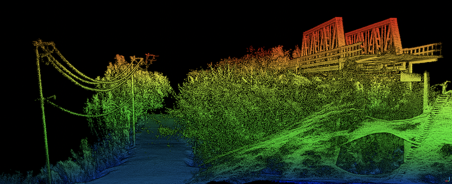
Pointcloud taken of bridge looking for structural weaknesses. Data collected using and OxTS xNAV650 INS and Velodyne VLP-16 LiDAR. Data processed using OxTS Georeferencer.
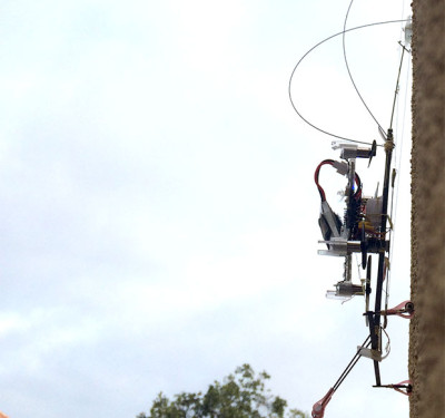
Oxford Technical Solutions has released the xNAV650 inertial navigation system (INS), the company’s smallest and lightest INS to date. It measures 77 x 63 x 24 mm and weighs 130 g and is designed to help surveyors to take advantage of highly accurate inertial measurements when low payload size and weight are key requirements.
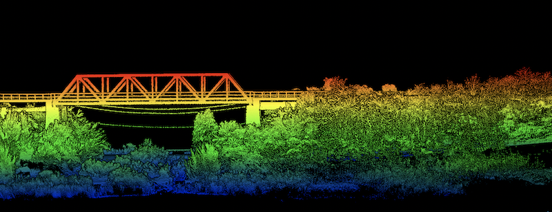
Pointcloud of Bridge Survey used to help identify overgrown foliage. Data collected using and OxTS xNAV650 INS and Velodyne VLP-16 LiDAR. Data processed using OxTS Georeferencer.
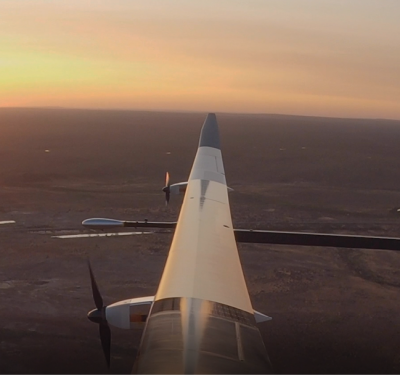
The xNAV650 INS is suitable for a wide range of applications where using a UAV is the preferred data collection method. These include bridge, building, forestry and rail surveys, coastal monitoring, pipeline exploration, map creation and more.
In one example, Dronezone used the xNAV650 INS and a Velodyne VLP-16 LiDAR on a drone to conduct a scan of an aging bridge to look for structural and potential hazards from overgrown foliage. By fusing the timing, position and inertial data from the INS with the raw data of the Velodyne VLP-16 (using OxTS’ LiDAR georeferencing software OxTS Georeferencer), the surveyor was able to produce a highly accurate 3D pointcloud of the bridge. The resultant pointcloud enabled engineers to easily and accurately pinpoint areas of the bridge that need closer attention.
The OxTS Georeferencer enables georeferencing pointclouds from Velodyne, Hesai and Ouster LiDAR sensors. The company is working to integrate new LiDAR sensors from a wider range of manufacturers into OxTS Georeferencer.
OxTS NAVsuite software is included with all OxTS INS. This full range of software tools allows users of OxTS’ devices to configure and post-process data with ease. Other optional software features are also available including Precision Time Protocol (PTP) and gx/ix tight-coupling technology.
- PTP allows for a much simpler LiDAR survey set-up over ethernet whilst simultaneously stamping out time-drift by utilising the high-quality INS clock source – GNSS.
- GX/IX tight-coupling technology, OxTS’ own proprietary navigation engine, ensures that users of OxTS Inertial Navigation Systems receive the most accurate measurements possible even in tough GNSS conditions.
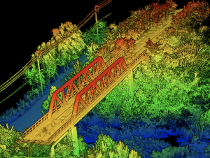
Side view pointcloud of bridge. Data collected using and OxTS xNAV650 INS and Velodyne VLP-16 LiDAR. Data processed using OxTS Georeferencer.