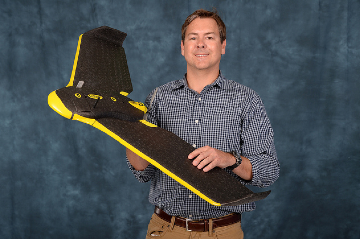
Dr. Michael Starek holds the eBee from senseFly.
When it comes to using drones to improve farming capabilities, the possibilities are endless.
Small unmanned aerial vehicles have the potential to detect disease early, to pinpoint crops infected with insects and to identify which areas need more water or fertilizer—all making farmers more efficient, saving them money and ultimately improving their crop yields.
Texas A&M University-Corpus Christi and Texas A&M AgriLife Research formed a partnership last summer to test these various precision agriculture applications and to determine how they can best be implemented in farm fields. They received their first Certificate of Authorization from the FAA in January, and are ready to begin testing this spring.
“The idea is to develop advanced remote sensing technology for the precision management of natural resources,” said Dr. Juan Landivar, AgriLife Research’s Corpus Christi Center Director. “This remote sensing technology has the potential to bring a multi-million dollar business to Texas.”
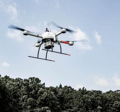
Researchers will use the eBee from senseFly for these tests, which will include baseline surveys of crop fields at the AgriLife Research and Extension Center in Corpus Christi.
“When growing season comes they’ll start planting different types of cotton strains and performing controlled stressors on them. We’ll fly over them and see what we can do with the data and imagery we collect,” said Dr. Michael Starek, Assistant Professor of Geographic Information Science and Geospatial Surveying Engineering at Texas A&M-Corpus Christi. “We’re combining our strengths. We’re using their expertise as a guide for the information they hope to get from these systems. Ultimately we want to improve the technology for precision agriculture to benefit the end user.”
The team has already completed test flights to make sure the eBee and its onboard sensors and cameras are ready for the real thing, Landivar said. They’ve used the initial tests to determine the effects of wind and how high the UAV needs to fly for these experiments, as well as to make sure the sensors are calibrated and collecting data at the right speed.
Landivar expects the cotton crops to be planted sometime in April, and for test flights over the fields to ramp up in May and June.
The Goal
Through this testing, researches want to develop tools that will help producers with prescription management of their fields, Landivar said. The systems will be equipped with specialized cameras and sensors to precisely map where crops are stressed, assess moisture conditions, identify pest infiltration, determine where crops are diseased and even help determine yields before harvest.
“We can develop a geo reference map showing their field and spots where they might need more fertilizer or better disease management,” Landivar said. “Based on that information, they can come up with a prescription to better treat the areas of the field that are affected by the problem, and do something while the crop is still responsive to treatment. This precision farming reduces costs and makes farmers more efficient in the field.”
Drones will give farmers the ability to collect this information as often as they want, Starek said, whether that’s once a week or once a day, without the added cost of hiring a manned aircraft to survey the field. It will also provide more accurate information than any method they use today.
These drones also have the ability to help farmers with phenotyping, Landivar said. Breeders often have plants with 1,000 or more genotypes, and must look at them one by one to determine which will perform best. The sensors can tell them which ones look best, so they can focus on the most promising plants. This will make plant breeders more efficient and save them a lot of time.
The Drones
SenseFly’s eBee is a fixed-wing UAV that weighs about 1.5 lbs. and features a 3 feet wing span, Starek said.
Fixed-wing small scale UAVs are great for this type of research because they can efficiently cover and map large areas, Starek said. The eBee can fly for about 45 minutes before it needs a new battery, and the team plans to use four of them so they can swap them in and out. Finding a way to extend battery life is one area where this technology still needs improvement, Starek said, but is an advancement he expects to see relatively soon.
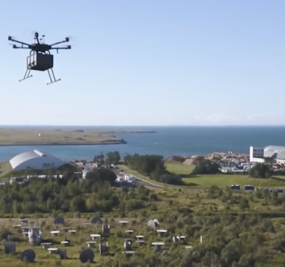
The researchers are also applying for another permit that would allow them to use a roto-copter, Starek said. The roto-copter, which they developed at the university, will enable them to hover and focus in on a particular problem in a field. This platform will be designed to complement the fixed-wing aircraft, and will feature a thermal camera and LIDAR to measure 3D structures.
Both drones will provide the up-to-date, real time information farmers need to efficiently manage their crops, as well as high-resolution images that will help them get a much better picture of what’s happening in the field, and what areas need special attention.
Delivering the Information
Drones have the ability to collect a lot of important information that farmers can use to increase efficiencies and improve yields, but one of the biggest challenges is determining how to process and deliver useful, actionable data to the end user, Starek said.
Finding an effective way to process all the information these drones gather is one of the university’s main objectives, and working closely with the biologists at AgriLife is key to helping them meet that goal. The team at AgriLife plans to set up advisory boards consisting of farmers, scientists and consultants to make sure the drones provide useful information that will lead them to better decisions and improved crop yields.
This feedback from the advisory board will let researchers know what they’re doing right and what they’re doing wrong, and will help the engineers determine the best way to deliver data to the farmers. They’ll have more insight into the type of problems farmers face, and how they can use drone technology to solve those problems.
“This has to be multidisciplinary as far as the technology development,” Landivar said. “The engineering and sensor technology is way ahead of the applications as far as what to do with the data. This is what I see as an opportunity for Texas A&M. We can come up with an interpretation of the data and ways to visualize it. We’re working with growers to configure the data in a way that makes sense for them and that is practical for them to use.”
The Future
Both Starek and Landivar are excited about the testing planned for this spring, and are confident drones can provide huge benefits to farmers, benefits that will ultimately help them increase their yields and reduce their costs. But the researchers also see the potential for using drones beyond crop scouting, including spraying pesticides and managing livestock.
“Crop scouting is just the beginning,” Starek said. “There’s no telling where we can go in terms of what UAVs will provide for precision agriculture. It won’t just be collecting imagery, I can tell you that.”