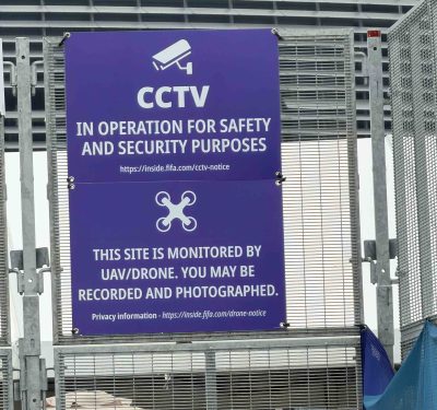
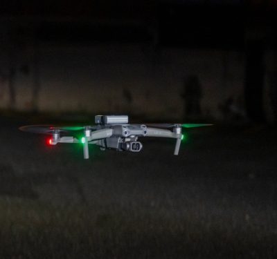
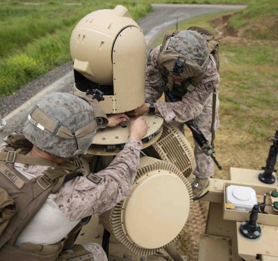
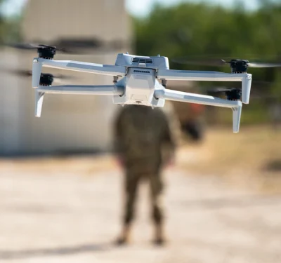
The C-UAS deployment at the 2026 FIFA World Cup was visible, acknowledged—and only part of the picture. The hex-rotor was…
FAA

The FIFA World Cup: A Catalyst for C-UAS Investment, But ‘Not the Whole Story’
Government funding, new legislation and the drone threat moving from the battlefield into our communities are all accelerating growth in…

Motorola Solutions to Acquire D-Fend Solutions for $1.5 Billion
Motorola Solutions announced today it has entered into a definitive agreement to acquire D-Fend Solutions, an Israeli counter-drone technology company,…

North Dakota’s Vantis Cuts BVLOS Waiver Timeline from Years to Weeks as Statewide Network Expands
The Northern Plains UAS Test Site hosted Vantis Fly Day on May 28 at the Gorman Field UAS Test Range…
FAA Releases Section 2209 NPRM, Two-Tier Framework for Drone Restrictions Around Critical Infrastructure
The Federal Aviation Administration on May 6 published a Notice of Proposed Rulemaking that would, nearly a decade after Congress…
Commercial Drone Alliance Calls for Interagency Coordination on Domestic Supply Chain
The Commercial Drone Alliance released a white paper this week urging the Administration and Congress to pair the Federal Communications…
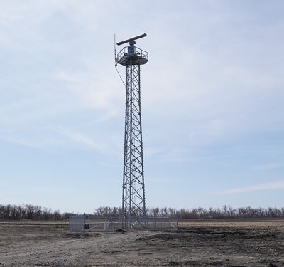
Thales Launches FAA Radar Data Hub to Support UAS Integration in North Dakota
Thales has announced the launch of a new FAA radar data hub in North Dakota, creating a secure pathway for unfiltered…
El Paso Airspace Restriction Lifted Amid Counter-UAS Testing Concerns
The FAA briefly imposed an unusually broad flight restriction affecting operations at El Paso International Airport, initially described as being…

FAA Reopens Part 108 BVLOS Comment Period
After more than 3,000 comments, many around its right-of-way proposals, the FAA has reopened the BVLOS rulemaking for a short,…

FAA Reorg Puts AAM, Drones and BVLOS Under “Advanced Aviation Technologies” Office
The FAA’s largest-ever organizational overhaul creates a dedicated office for advanced aviation technologies, a centralized safety management organization, and an…
Athena C-UAS Integration Bolsters Air Defense over Washington, DC
After seven years of development, the government-owned Athena integration kit has reached initial operating capability for the National Capital Region,…
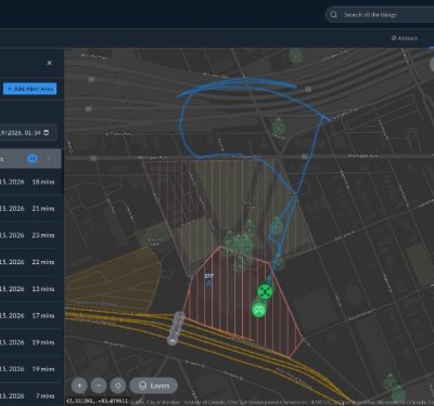
Airspace Link Adds Real-Time Drone Alert Tool in AirHub Portal Ahead of 2026 World Cup
The new Alert Areas feature in Airspace Link’s AirHub Portal gives public safety agencies and critical infrastructure operators real-time notifications…
Shielding Airports from UAS Intrusion
DroneShield and SRI Group offer a model for airport counter-drone protection. Brussels. Copenhagen. Munich. Oslo. Warsaw. All these cities’ major…
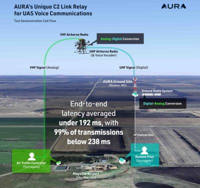
FAA-Sponsored Report Backs AURA, NPUASTS BVLOS Voice Relay Performance
A new FAA-sponsored report has documented how AURA Network Systems’ aviation-grade voice-relay architecture performed in beyond visual line of sight…
FAA Designates Two New UAS Test Sites in Oklahoma and Indiana
The Federal Aviation Administration has approved two new designated test sites for unmanned aircraft systems (UAS), expanding its national network…

DOT’s AAM National Strategy Sets 10-Year Policy Course for Air Taxis and Autonomy
The U.S. Department of Transportation has released its Advanced Air Mobility National Strategy: A Bold Policy Vision for 2026–2036, outlining…

FAA, States Pressed on AAM Readiness
At a December 3 hearing, lawmakers, OEMs and state aviation officials warned that U.S. leadership in advanced air mobility now…
