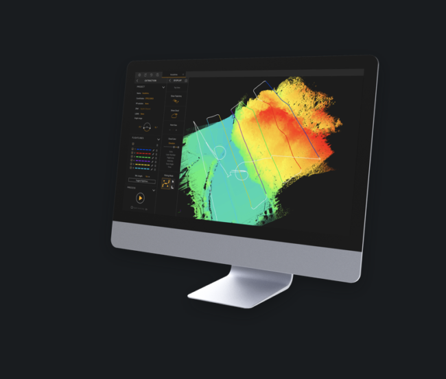
YellowScan, a UAV LiDAR Solutions leader, recently announced the release of its new software, CloudStation, which is designed to provide a complete solution to create and manipulate point-cloud data.
It allows users to extract, process and display data immediately after flight acquisition. The auto-generation of flight lines and the production of LAS files are now done in a few clicks.
“This launch is an exciting move for YellowScan. It allows a better and simplified experience for the customers,” said Tristan Allouis, chief technical officer of YellowScan. “Better user experience leads to more efficiency for our demanding client’s projects.”
Key business benefits that can be achieved from using CloudStation include:
– Checking the integrity of your data in the field
– Verifying your area coverage
– Making sure all objects you are mapping are identified
– Extracting your LAS files with only a few clicks, within a few minutes
CloudStation is immediately available with the acquisition of a YellowScan LiDAR solution.
For more information on YellowScan, please visit yellowscan-lidar.com. Also, if you want to learn more about the CloudStation’s workflow, request a personalized 1-on-1 demo via the company’s webpage.
YellowScan designs, develops and produces UAV Mapping solutions for professional applications. Fully integrated, ultra-light and easy to use, these highly automated data collection tools are used by customers around the world in fields such as surveying, civil engineering, mining, corridor mapping, forestry, environmental research and archeology.