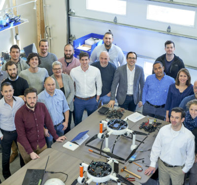
Marine researchers and operators are combining, stretching and repurposing unmanned air and marine systems to conduct searches, protect marine life and support commercial operations.
Helping lead the way is the National Oceanic and Atmospheric Administration (NOAA), an agency with a wide-ranging mandate to monitor the coasts, oceans and waterways as well as provide data for weather forecasts and track climate change.
To be sure it was using the most advanced technology, NOAA established in 2008 the Unmanned Aircraft Systems (UAS) Program, which helps NOAA’s scientists assess and implement UAS where appropriate.
“We’re basically evaluating UAS (technology) to see how it would fit in with all the other observations that we have at NOAA,” Program Director Robbie Hood said. “Observations are so incredibly important to us—from satellites to ocean buoys to aircraft, ships, weather radar—the whole nine yards.”
Hood said her office is particularly interested in technology that can be deployed quickly to assess the impact of events like storms (for both pre-storm surveys and post-storm damage assessments), oil spills, chemical spills and fast-paced changes in coastal systems. New systems that team UAS with autonomous marine vehicles may give NOAA more options to meet that requirement.
Aircraft Carriers for Drones
Entrepreneurs and researchers are modifying autonomous surface vehicles to carry and recharge unmanned aircraft. These blended systems will extend the range of the rotorcraft potentially making it easier to conduct long-distance and longer-duration missions.
Drone ‘aircraft carriers’ are going to be the “hot ticket,” said Philip McGillivary, science liaison for the U.S. Coast Guard Pacific Area/ Dept. Homeland Security.
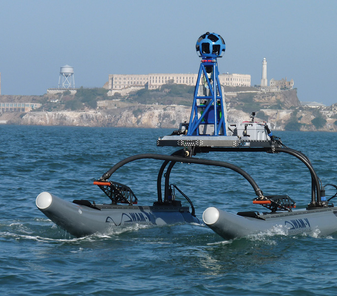
McGillivary was involved earlier this year in demonstrating one such system based on the Wave Adaptive Modular Vessel (WAM-V) by Marine Advanced Research. Looking a bit like a water strider, the WAM-V comprises two catamarans that support a platform between them, well above the water. The catamarans move independently from each other and the platform—with springs, shock absorbers and ball joints articulating the vessel and limiting stresses to the structure and payload.
“It’s like taking an off-road suspension and putting it on a boat,” said Mark Gundersen, Marine Advanced Research’s president and CEO. “Instead of plowing your way through waves you kind of ride them, like you’re riding over bumps.”
“The platform is independently geniculated,” said McGillivary. “Each hull moves independently and the platform in the middle—which is up off the water, which is what you want—doesn’t move at all, even in very high seas.”
WAM-Vs come in a variety of sizes and work is underway to develop a power source that could enable a drone to fly out to, say, find a toxic algae bloom or oil spill, map the area then return to the WAM-V to recharge before heading out again. Also under discussion are ways to enable underwater autonomous vessels to recharge at a WAM-V, or another similar platform, in much the same way.
“You can imagine a WAM-V that can deploy both the aerial and underwater assets—bring them back, recharge them and then send them out again,” Gundersen said.
At the Front
Some of the advantages of combining all three types of platforms became clearer during a California study of upwelling fronts. These fronts occur when the wind blows offshore, pushing the surface water before it. Colder water from the depths then wells up to replace it.
That water is full of nutrients, McGillivary said, and within a couple of days the area of a front will turn green with phytoplankton and become host to a range of marine life.
“You always find the fish, the sharks, the whales and everything else right at the front,” McGillivary said. “So for biology it’s a big deal. It’s also a big deal for chemistry because, as the water warms up, like when you boil water, the gases come out of a solution. The fronts are where your air-sea flux is happening.”
The Monterey Bay Aquarium Research Institute wanted to study these fronts and was searching for them using underwater vessels.
“By the time they found (the fronts), their batteries were just about out of power,” McGillivary said—so he and a colleague who had a drone offered to help. “We said, ‘Look we can fly and find the fronts, and transmit the information on where the fronts are down to the autonomous surface vehicle, which can then transmit it to the autonomous underwater vehicle. And then, instead of searching all over creation, it can go directly to the front and begin mapping of the frontal feature without wasting any energy—in fact is what has been done.”
The fronts are relatively easy to spot from the air. The upwelling water is cold enough it can be detected with an infrared sensor, the color of the water is different because of the phytoplankton and the waves, more specifically the lack of waves, sets a front apart.
“If you put a hose in the bottom of a sink and it jets up, there are no waves where the jet hits the surface because the water is flowing out away from it, right? So the sea surface’s normal wave field is not there,” McGillivary explained. “Then some distance away, at the edge of the front, all the waves pile up. So you have an area of piled up waves on one side and no waves on the other side—so you see a big difference in the surface wave field— at the centimeter scale to even bigger waves—and you can really see that.”
Using the High Ground
The capabilities of multi-domain systems could be used to search out naval mines floating on, or hiding beneath, the ocean’s surface. Potential commercial applications include the inspection of ship hulls and of infrastructure anchored in the water. Those responsible for maintaining bridges, oil and gas platforms and wind farms should find it more efficient to be able to operate simultaneously above and below the waves.
“You’ll need aerial robots to inspect above the water, Gundersen said, “and then you’ll need the surface and underwater vehicles to inspect from the waterline down to wherever the base is, if it’s anchored to the bottom or built into the seabed.”
Research is underway on automated recovery and recharging, he said, adding that the real challenge is landing either the drone or the autonomous underwater vehicles (AUV) on a vessel as it is moving in the water. “Launching them is the easy part,” Gundersen said.
There are automated drone docking systems, he said, but they are for a UAS returning to a set ground station “so it knows exactly where it is.”
“It’s different with a boat because obviously it’s moving,” he said. “It’s also not just moving in a 2-D space, it’s heaving right? It’s also moving vertically. So the challenge is with UAVs, in general, landing them on a moving object.”
The same is true for underwater vehicles returning to a WAM-V, he added, unless they are using a tether. Tethers supply power continuously so docking to a charger is unnecessary.
Remotely operated vehciles are an “obvious first step before AUVs,” Gundersen said.
Protecting Porpoises, Fisheries
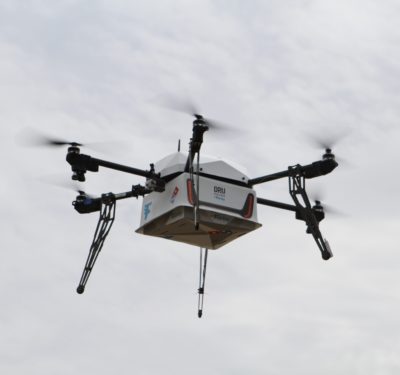
The ability of UAS to survey wide areas and report back is playing a key role in saving the last of the Vaquita, a petite porpoise being decimated by the gill nets of poachers trying to catch another endangered creature, the totoaba. Both type of fish have been driven to near extinction because the totoaba’s swim bladder is valued as a delicacy in China.
The nonprofit Sea Shepherd Conservation Society has been doing night patrols in the northern waters of the Gulf of California, the only place on Earth the Vaquita live. They are using a Predator quadcopter drone equipped with a FLIR thermal night vision camera to locate the poachers’ small boats.
“They detect them,” McGillivary said, “and they send the coordinates to the Mexican Navy and the Mexican Navy is busting them.”
Though the Shepherds are not necessarily using a drone/automated surface vessel (ASV) combination, the monitoring power of a UAS, especially one with its range boosted by an ASV, could also be useful for protecting fisheries.
In a paper before the Oceans ’16 conference in September presenting author Trent Lukaczyk of FlightWave Aerospace Systems, examined a variety of marine-focused applications for unmanned aircraft including dynamic fisheries management.
The problem with the current approach to restricted fishing areas, he pointed out, is that the fish don’t respect the borders.
“Today, MPAs (Marine Protected Areas) are established using static boundaries,” wrote Lukaczyk and four other authors including McGillivary. “A significant amount of effort goes into designing these boundaries because there are many stakeholders. For example, it is common for fishermen to argue that the boundaries are not appropriate because the fish population can migrate to a new area.”
By tagging fish and then using drones to monitor their movements, resource managers could match no-catch boundaries to the actual location of the fish in near real time, he suggested.
NOAA already tags and tracks marine mammals, Hood said, an activity it is looking to improve with UAS.
“We have marine biologists who want to be able to count seals on a shoreline,” she said. “The way they do it now is to walk among the seals and count them—but it spooks the animals and they go back into the water.”
The scientists want to be able to fly a small drone over the seals they can see in the distance. They want a small rotary craft because they want to maintain control and know exactly where it is and over which animal they’re placing it.
The researchers hope to use UAS like extended cameras, Hood said, cameras with some top-of-the-line capabilities
“They are interested in (resolutions at) the centimeter level—1 to 2 cm,” Hood said. “There are certain tags on wildlife, they want to be able to read the tags. They want to be able to have crisp enough imagery so that they can actually tell the difference between say one seal versus another seal and actually start collecting enough information so they can monitor the health and the lifecycle of that particular animal.”
NOAA Priorities
Finding better ways to protect fish and marine mammals falls under marine observation—the first of three key research realms for which Hood’s team is assessing UAS.
“When we were first building up the program we looked at the different categories of UAS to see how they would fit and then we looked at the requirements,” she said. “We came up with three main science focus areas that we try to bundle all of our in work within.”
The second is polar research.
“Whether it’s climate studies in the polar regions or weather observations or sea ice mapping, because we just feel that—because of the harshness of the polar regions, it’s just really hard to collect good observations there,” said Hood. UAS might be able to help, she told Inside Unmanned Systems, especially when it comes to filling data gaps. There may be observations in the Arctic that either our ships or our aircraft can’t get, she said.
The third, Hood said, is high impact weather.
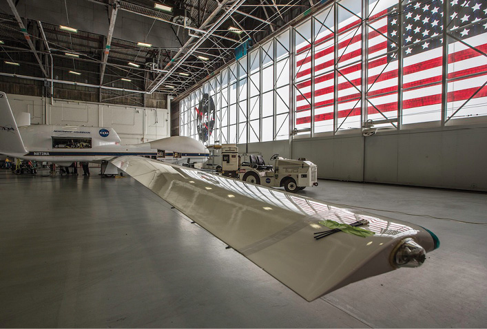
NOAA has been researching ways to use unmanned systems to improve the forecasts made possible by its constellation of weather satellites. It has been working with NASA to study the atmosphere with dropsondes launched from a Global Hawk unmanned aircraft. The system was developed by the National Center for Atmospheric Research (NCAR) with funding from Hood’s office. NASA’s Global Hawk can carry up to 90 dropsondes, deploying them from altitudes of up to 65,000 feet. As they fall they collect high vertical resolution measurements of the temperature, pressure, relative humidity and wind speed and direction in the atmosphere.
This year the Global Hawk was used to look at storms that were further, so far offshore, it was the only plane out there, said Gary Wick, NOAA’s chief scientist on the program.
“Our data helped the Hurricane Center say ‘Hey, this is a hurricane now, it’s no longer a tropical storm.’,” Wick said.
SHOUT
More recently Wick has been researching how the Global Hawk might be used to replace the data lost if something happened to any the weather satellites.
“We have new weather satellites that we’re going to be launching in the next year or so,” said Hood, including an improved GOES geostationary satellite and new polar-orbiting spacecraft. “So these are building upon previous capabilities but also bringing improved technologies.”
Should anything happen to those satellites, however, there needs to be a plan to deal with the data loss, Hood suggested.
“Once people get used to using the new satellite—or they’re looking forward to using the new satellite, and then it’s not available—then how are you going to fill that gap?” she said.
Satellite problems are not that unusual. There are rocket mishaps and technical problems that push back launch schedules as well as malfunctions that can put a spacecraft into the wrong orbit. The U.S. government is also increasingly concerned that international tensions could trigger conflicts in space that might directly or indirectly lead to the loss of space infrastructure.
NOAA began its three-year Sensing Hazards with Operational Unmanned Technology or SHOUT program in 2015 looking at using a high-altitude, long endurance UAS to help maintain weather forecasting for specific types of serious weather events.
“The overall goal of SHOUT…is to evaluate the utility of unmanned aircraft like the Global Hawk to either improve forecasts of high-impact weather events or, more particularly, look at what impact it could have on the forecast if there should be a gap in our satellite coverage,” Wick said.
The NOAA team is collecting data to support denial studies and running computer simulations trying out new observing systems to see their potential value.
“That (approach) is really important for satellite missions given the cost of deploying a satellite,” Wick said. “You know you like to be able to evaluate in advance what the potential impact of the observations would be. So we’ve got an element of that as well.”
NASA and NOAA are also looking at platforms other than the Global Hawk and weighing the costs and operational effectiveness of this approach to see if it makes economic sense
“Is it something that NOAA can potentially afford,” Wick said, “and is it worth deploying as part of their observation suite. So it’s not just pure science, it’s really the nuts and bolts of it as well.”
One of the issues they need to understand, Wick said, is whether it matters if the forecasts are degraded.
“It may be only when we have these real high-impact storms and hurricanes,” Wick said, “…where now, all of a sudden, every little bit of guidance that you can get from the models is critical. That’s then a time when we would say ‘Now it’s worth pulling out this other platform to fill in what the satellite would have been giving us.”
SHOUT researchers are also comparing the Global Hawk data to information from other types of sources like manned aircraft. For example, Wick said, a Global Hawk has some advantages because it can fly higher and longer.
“We can be out there for 24 hours so we get more time over the storm, and we fly at a higher altitude—we’re up around 60,000 feet where the (Gulfstream) G4s are down to maybe 42,000 to 45,000 feet. So we’ve got a little bit more of the atmosphere that we’re looking down through. So we’re evaluating if observations from that upper-level really make a difference or not.”
Operating at a higher altitude enables NOAA to trace out a pretty broad cross-section of the storm, he noted. “So it’s giving kind of a satellite-type sampling. We’re sampling a broader scale of the storm like a satellite would but being able get to a higher resolution—something like aircraft does. So it’s really a bridge between those capabilities.”
Wish List
The SHOUT program, like NOAA’s other forays into unmanned technology, generates a great deal of data. Hood said she would like to see new, easier ways to handle that data, including more geo-referencing where appropriate, so that new information can be easily fused with existing data sets.
It’s really about viewing a UAS as being more than an aircraft, Hood said. “Thinking of it more as an integrated data system so that the data and data production are requirements right along with the performance of the aircraft.”
Beyond that, she said, requirements are driven by the needs of the scientists. Some want to get the most out of high resolution, visible imagery—visible in infrared bands. Those users definitely want geo-tagging.
“We have another set of scientists, Hood said, “who are more interested in putting different kinds of remote sensors on. The same people who want to use weather radar. The people who want to fly over, say, a snow region and be able to discern how deep the snow is and where the snow stops and where you don’t have snow. They are more interested in putting remote sensors on UAS.”
For this group there is a greater need for platform flexibility. She would like to see platforms that can handle different kinds of payloads and make it easier to swap payloads in and out.
Though her office is an entry point for new technology, Hood said she is generally not the decision maker when it comes to buying platforms, sensors or other capability.
“What we’re trying to do is help scientists do the evaluations,” she said, “help them demonstrate the technology—and then it’s up to their operational line office to make the decision if they want to incorporate that.”
She believes more programs will adopt unmanned technology, though it will happen somewhat slowly as platforms improve and data management capabilities evolve.
“It’s going to become like laptops or smartphones,” she said. “The first users who are excited about the new technology; they are ready to make that leap. And then as the technology continues to mature you are going to have more and more people interested. So it’s going to be more of a gradual process.”