The Federal Aviation Administration (FAA) announced a formal agreement with the state of North Dakota, through the Northern Plains UAS Test Site, a state agency, to use federal radar data to advance the integration of beyond visual line-of-sight (BVLOS) UAS operations into the National Airspace System (NAS).

FAA Deputy Administrator Katie Thomson made the announcement on stage at the UAS Summit & Expo in Grand Forks, North Dakota. The agreement marks a first-of-its-kind, government-to-government release of federal radar data. The data is integrated into Vantis, North Dakota’s system for BVLOS UAS operations. The NPUASTS is the first participant in the program.
“This program will take us to the next level, ensuring even greater safety and efficiency as we integrate UAS into the National Airspace System,” said Thomson.
“This would not be possible without a tremendous amount of work and collaboration between the State of North Dakota, FAA, and interagency partners, as well as the support of North Dakota’s Office of the Governor and the North Dakota Legislative Assembly,” said Erin Roesler, Deputy Executive Director, NPUASTS. “We’re proud to be collaborating with FAA to address this and other UAS integration concepts.”
“We really appreciate the work of Deputy Administrator Thomson and the FAA for their ongoing efforts to discovering the path towards receiving this data and ensuring safe integration into the NAS,” said Executive Director Trevor Woods, NPUASTS. “We look forward to this continued collaboration and support from the inter-agency partners and the FAA.”
What’s the Radar Data Pilot Program?
Section 905 of the FAA Reauthorization Act of 2024 establishes a pilot program that allows qualified users to access airspace data feeds. The purpose of the Radar Data Pilot Program is twofold: (1) enable air traffic and UAS traffic management services; and (2) test technologies that may enhance or enable these services. The program focuses on defining security control requirements, validating the suitability of radar data, and demonstrating UAS flight operations.
The program also leverages the unique government-to-government relationship between NPUASTS and the FAA, with support from private sector system integration partner Thales. This collaboration has required the team to establish security requirements that are not only applicable to government entities but also adaptable for private entities. This approach ensures the design and implementation of robust security controls to protect sensitive flight data, while still allowing access to future qualified entities or users, including third-party service suppliers and potentially UAS operators.
What does this mean for UAS integration?
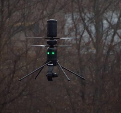
Vantis provides Unmanned Aircraft System (UAS) operators with repeatable access to the NAS through safety-critical services and shared-use infrastructure. Through the Radar Data Pilot Program, we can assess how traditional aviation surveillance systems can help expand UAS access beyond specific geographic areas of the country.
This work is complex, with special attention paid to three critical challenges: security, capacity, and utility. For example, how do we use the data to promote integration while protecting the data and dissemination of it at the same time?
What’s Next?
The FAA anticipates expanding the release of FAA surveillance data, which up to this point was only intended for North Dakota’s Vantis, to more UAS third-party service suppliers by early next year, as required by the legislation.
Vantis is a case study for operator-friendly, BVLOS-enabling shared-use UAS infrastructure. NPUASTS is seeking state and operator partners who are interested in sharing progress and lessons learned by adapting the Vantis model and advancing true BVLOS in their communities.