Drones Facilitate Construction in Departments of Transportation throughout U.S.

State departments of transportation use drones for construction related tasks and face challenges related to new allowable drone manufacturers.
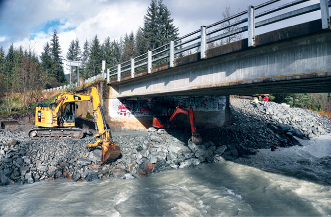
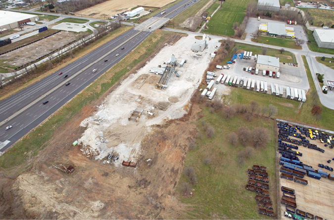
By far the most common construction use is for road construction, particularly road widening, repair and rerouting, as some states are tackling entirely new roads right now for both budget and capacity reasons. Drone tasks also include material volume moved and stockpile monitoring, bridge replacement and repair and railroad expansion track for new lines. Each state has its own uses as well. Construction takes place in both rural and urban areas, each with its own set of challenges.
Different states structure drone management differently. Some manage drones from a central aviation office, deploying as needed on request; while, in others, functional departments manage their own drone program. In at least one state, drones are “owned” by individual pilots who fly on request.
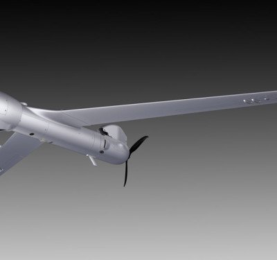
For most state Departments of Transportation (DOTs) and those who contract with them, the workhorse drones for construction and other tasks are varieties of DJI. While the federal government, and some state DOTs, haves taken steps to ban purchase and some operation of Chinese drones, most DOTs we spoke with felt the situation was still murky and they hadn’t found comparable drones on the federally allowed “blue” list to match the capability and price point of DJI. As of today, DJI drones are in ongoing use, although one state had cut off their connection to the internet. Other drone companies in use or being considered for various tasks include San Mateo, California based Skydio. Most states use the camera payloads packaged with the drones although some have added capability. Some have also begun to use or are acquiring LiDAR.
“Our bread-and-butter are construction update progress flights – that’s 85-90% of what we do.”
– J.D. D’Arville, UAS program administrator, Alabama Department of Transportation
Frank Segarra, managing director of the Unmanned Services Group at Toronto based Volatus Aerospace Corp. (formerly Connexicore), a turnkey provider of drones and services, notes that in their practice, civil engineering is the prime construction application. “That’s where LiDAR plays a pivotal role,” he said.
Volatus too uses DJI 99% of the time, he said, although they also use Skydio drones and might make a specialty craft themselves. When they need to go underground, such as in a sewer or sinkhole, during construction, they use a caged drone with a range extender for telemetry.
While Segarra can’t name most Volatus DOT clients because of confidentiality concerns, he’s able and likes to talk about work they did for the NYDOT Long Island Railroad. “It’s one of the very large projects we’ve done, and it involved building a north-south rail route across Long Island, where, traditionally, railroads ran east and west. “We did the pre-construction surveying including the contours of the existing rail, the overhead electricity, the over bridges and the tunnels that went underneath the bridges. “We provided the project managers with kind of a three-dimensional viewpoint of progress,” he said, as well as geospatial metadata that shows locations on the earth.
While not all state DOTs use drones for construction, here is a sampling of some other states, how they use drones, and what kinds of equipment they use:
ALABAMA
The Alabama DOT (ALDOT)’s UAS program goes back to 2016, said J. D. D’Arville, the UAS program administrator who founded it. “Our bread and butter are construction update progress flights—that’s 85-90% of what we do,” he said. He added, “We fly every day of the week if the weather is good, and last year, we did 4,200 flights.” Most of ALDOT’s construction work involves roadways, although in one case involving litigation, they were able to show that flooding in a business was not coming from an ALDOT construction site. They also do volume and stockpile construction work.
D’Arville oversees seven pilots. “We’re basically a DJI house flying Mavic 3 enterprises or Mavic 2 Pros with a few other drones. We’re working on transitioning away from DJI, but it will be a two-year process. The program is about to purchase LiDAR and an unmanned surface vehicle for survey work including construction sites.
They essentially use the cameras and other payload that come with the drones. And they use DJI Go, San Francisco based DroneDeploy and other software, including 3D software to show a community group how an expressway interchange will function.
ALASKA
The Alaska DOT (AKDOT) drone program is about three years old. “We just started implementing drones to document the progress of construction as a visual aid,” said Travis Watkins, engineering technician. Most of the work was road construction rehabilitation, but there were some airport and marine projects as well. The work might involve documenting asphalt replacement or a sidewalk installation.
“We usually use the drones to generate an orthomosaic for documentation and to be sure that the work is being done according to plan, so we’ll overlay the drone imagery with the plans to make sure of that,” he said.
He estimated that in the south coast region, where he works, there might be a dozen or so projects a year, but only three or four “I’d call big,” he added.
AKDOT does not have dedicated pilots and calls on people who have licenses, but each region has their own drones. Most are DJI with the standard camera set-up.
INDIANA
“We’re using drones in all phases of construction. We just do what people ask us to do,” said James Kinder, UAS manager at Indiana DOT (INDOT).
“We started using drones around 2016. I’m with the Department of Aviation and I’m an (airplane) pilot. I used to do airport inspections. I had bought a drone myself and when I saw the drone imagery that cost a small fraction of what it would be in an aircraft, it was amazing to me,” Kinder said.
INDOT pilots do mapping and 3D modeling for construction, including a recent 3D modeling project of an interchange on I-65 north of Indianapolis, and another on the same highway where the lanes were being reworked and moved to different locations. The mapping images gave the GIS (geographic information systems) office accurate lane locations. Another highway project involved ongoing reconstruction on Interstate 465, which goes around the city. Historically, the route had a lot of accidents and drone imagery helped adjust the lane configurations for mitigation of that. INDOT drones also take images for stockpile analysis, Kinder said.
“We also have some external contractors that are do videos and calculations for moving earth,” Kinder added. “We’ve done a little bit on volumetrics ourselves—we had a construction project where we determined how many cubic yards of each of several aggregate piles there were.” They’ve done mapping, photogrammetry and they have LiDAR, which is fairly new.
Their drones are mostly DJI, Kinder said, and they have a GoPro Karma, and a Swiss WingtraOne with vertical liftoff. Their DJI M300s have the standard payload including thermal imagery and normal, wide and zoom lenses. They use DJI Flight Planning Pilot 2 software and ArcGIS from Redlands, California based Esri, for overlays. Most of their districts have small drones.
“We’re already not allowed to purchase DJI,” Kinder said. They’ve disconnected from the DJI cloud and process images on a standalone computer, which is also disconnected from the internet. He did note none of the drones on the “blue” list have ADS-B (Automatic Dependent Surveillance-Broadcast), which is an advanced surveillance technology they use for mapping.
IOWA
Matthew Miller, director of new and emerging transportation technologies for Iowa DOT, described how much of their construction work involved graphic manipulation of drone images.
“We’re building a flyover bridge on an intersection called the Mixmaster where routes 80 and 35 come together,” he said. He overlays Google Earth images with the drone images of real-time construction to see how the work is proceeding and create an e-ticket (an electronic record with job information and test results) for the construction crews. They were also able to bring in a design model of a bridge, and using a program called Propeller from Sydney-based Propeller Aero, used drone images to see where the grade was and what kind of asphalt load was needed.
In another project involving mapping and modeling, he used Exton, Pennsylvania based Bentley Systems’ SYNCHRO construction-infrastructure software. In one case, a giant pothole was causing motorists to drive on the road’s shoulder. He was able to bring the drone map over the model and generate area, volume and linear measurement during and after the repair. “Rather than closing lanes, we were able to fly the drone over the site and share the information with the contractor,” he said
Iowa DOT also uses software from Swiss company Pix4D.
Before actual road construction, when the route is excavated, the drone makes an initial flight and takes images that show, for example, utilities. The augmented reality images show how the road will overlay what is in the ground, which is valuable information for construction crews.
Iowa DOT’s drone fleet includes a variety of DJI drones. They have about a dozen licensed people throughout the state that fly drone missions when needed.
NEW JERSEY
“NJDOT UAS help to establish a baseline of the actual pre-construction conditions at a project site,” said Steve Schapiro, press manager for the New Jersey Department of Transportation in a written response.
“This can resolve future disputes and helps ensure that construction contracts are consistent with the actual site conditions. UAS photos and video also provide the construction team and offsite supervisors with a high-resolution reference to assist with situational awareness during the project.”
Schapiro also said drone images are used for reporting purposes and to demonstrate a project’s scope and progress to community stakeholders. In addition, UAS images help evaluate traffic management plans for large construction projects, as well as analyze recurring road congestion issues and develop construction projects to correct the situation. UAS also assist in conformation of materials delivered to a work site, and to evaluate the percentage of construction completed prior to authorizing progress payments.
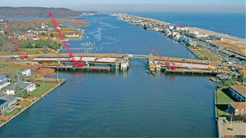
For example, NJDOT is overseeing the construction of the Sea Bright Bridge S-32 Project. The proposed structure will be a movable bridge at the same profile as the existing bridge. The Division is using UAS technology to document the progress of the project. “This allows us to see the progress in areas that we might not otherwise have access to,” Schapiro said.
NJDOT’s fleet consists of 18 drones with a wide array of sensors and software including LiDAR, HD cameras and infrared (IR) cameras. They are looking at 3D mapping software but as yet haven’t purchased a package. Most of the drones in their fleet are DJI, with two Skydios and a Parrot Anafi AI from Paris based Parrot, manufactured in Boston.
OREGON
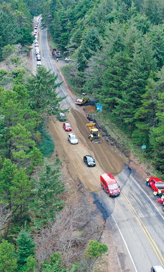
Oregon has something of a perpetual need for construction, with more than 4,000 rockslides or landslides a year, especially on U.S. 101, the heavily traveled coastal tourist route from Washington to California. UAS take images of these events to guide construction crews in rebuilding sunken areas of highway, as well as for safety and planning.
“While construction isn’t the main activity for drones in Oregon, we do it,” said Chris Harris, UAS flight operations coordinator. They do pre- and post-construction imagery for topographic documentation. “On some of our larger projects, we’ve also done weekly and monthly construction site monitoring to calculate the quantity and weight of material being moved.” They also do post project mitigation by showing images of material quantities, such as a claim dispute settled in their favor on a curve realignment project, he added.
The department is also documenting an historic bridge replacement near Oregon State University, he said.
“A big thing we’ve done over the past few years is to be part of the construction and recovery efforts after wildfires, helping to see where danger, such as trees, need to be cleared out roads need to be reconstructed,” he added.
The department has also used an uncrewed remote-controlled vehicle to inspect a culvert under a bridge in preparation for replacement or repair.
“Our creative services team also uses drones to map out and communicate to the public what traffic impacts will be during construction,” Harris said. “For example, we had a huge bridge replacement project. We built two temporary bridges, one for construction and one a single lane for traffic. And the drone images let us communicate what the traffic divergence would be.”
The Oregon DOT drone team has no dedicated UAS staff. Each crew needs to find the funds to purchase and maintain their drone. They’re housed all across the state.
Currently, they have about 20 drones including DJI and Autel Robotics (also based in China) models. They have Madison, Alabama based GeoCue TruView 515 LiDAR and software including Context Capture, Open Site Designer and Microstation from from Bentley; St. Petersburg, Russia based Agisoft’s Metashape for point cloud and orthomosaic creation; and Orlando, Florida based TopoDOT for quantities and feature extraction. They have both imagery and LiDAR capability
The department is pretty heavily invested in DJI and Autel, Harris said. “The problem for us is that the approved drones aren’t a great fit for our applications, both in terms of price and capabilities. Being a DOD, our construction projects are 80% federally funded, which is where we’d get the most complications and would have to figure something out. Right now, we barely have enough budget to operate.”
WASHINGTON
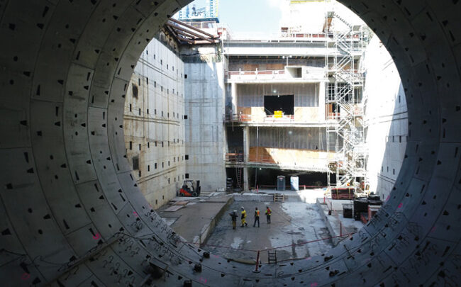
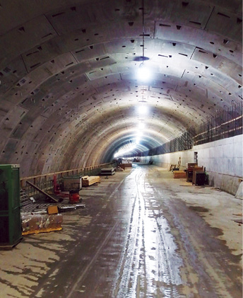
When “Big Bertha”, the boring machine designed to dig the massive Washington State DOT (WADOT) automobile tunnel under Seattle, drilled underground, drones played a role, flying over the site and through the tunnel to document construction.
While little since has been as dramatic, Eddy Hensley, WADOT UAS program manager said they’ve been slowly growing the drone program.
Construction projects might include redoing the road surface on a bridge, which starts with a drone survey as part of the planning process, as well as progress monitoring, Hensley said. We also use drones for visualization during construction, he added. “We’ll take drones out at the beginning of a project and then impose imagery of what the final state might be.”
WADOT has 31 drones and a little more than 40 operators. Their fleet is “a gamut of DJI products” and a few specialized machines. They also have a Skydio CO 2. Some of their cameras are standard to the drone, and they do have some infrared capability but they don’t use that for construction. They are currently procuring LiDAR capability. Hensley is not sure they could easily or quickly transition away from DJI cost effectively. One company he said might do the job is Freefly from Woodinville, Washington. For software, they use ArcGIS and Westminster, Colorado based Trimble products as well as software bundled with the drone.
More and more, wherever it is construction season in states across the U.S., there are drones there to help.