UAS are becoming a common tool in emergency services, with more agencies using the technology to increase efficiencies and help keep both personnel and the public safe.
When the Wayne Township Fire Department first started deploying drones a few years ago, pilots were flying the systems just about every day. Beyond their community, they traveled across Indiana to support agencies that didn’t have drone programs, helping out during emergency situations from pursuing suspects during foot chases to locating fire hot spots.
 Back then, the department received calls around the clock from agency leaders asking for assistance, the department’s Public Information Officer Captain Michael Pruitt said. That doesn’t happen anymore, but it’s not because interest has waned. The calls stopped because more agencies have developed programs in-house; recognizing the benefits UAS provide, they decided to purchase drones of their own—a trend that’s being seen across the country.
As noted in the Market Map on page 16, at least 910 state and local police, sheriff, fire and emergency services agencies in the U.S. now have drones, according to data the Center for the Study of the Drone at Bard College collected in 2018. That’s up about 82 percent from the previous year, and many expect drones to become a tool found in every police and fire department, no matter how big or small.
Why the sudden interest in deploying drones for public safety? There are several reasons, said Gene Robinson, vice president of flight operations for Drone Pilot Inc., of Austin, Texas, including the fact UAS are now seen as a proven tool. Public safety leaders wanted drones to be vetted for improved efficiencies and safety before they started building programs in their communities. Now they know.
First responders UAS training in South Carolina.
It also helps that the systems being deployed, typically DJI products such as Mavic Pros and lower-end Matrices, are affordable and easy to use. And as they see the technology’s benefits, the public is becoming more accepting of drones and less worried about being spied on—which was a huge concern that limited adoption, particularly by police departments early on.
“Talk about a quantum leap from even two years ago,” Robinson said. “We have more agencies that are looking into using drones or are already using drones than ever, and almost every agency I have spoken to is considering putting drones in their toolkits. Public safety has embraced the technology and will continue to push it.”
CREATING PROGRAMS
In the beginning, the public safety agencies deploying drones didn’t really have programs in place, said John Fernandez, U.S. chief instructor for the UK management and training company Consortiq. Typically, someone on the force with experience flying drones would offer to deploy his system for a mission, most likely search and rescue (SAR); if that was deemed successful, ideas for applications would follow. Drones were used sporadically and weren’t seen as something that needed to be managed. That’s changing.
UAS are becoming part of everyday operations for public safety agencies, making it vital to create standard operating procedures (SOPs) and to ensure pilots are properly trained, even beyond what’s required through Part 107.
“In the law enforcement sector there are regulations and procedures for everything, but they’re finding out they don’t have an already-defined area for this type of tool to be grouped in. It doesn’t fi t into aviation or infrastructure but it has elements of both. It takes understanding what key issues need to be addressed early on.”- John Fernandez, U.S. chief instructor, Consortiq
Public safety officials also continue to focus on building a positive public perception, said Anthony DeMolina, CEO and founder of Tactical Drone Concepts, which is based in Sheridan, Wyoming. Privacy remains a concern for some citizens, and image-building includes providing education about why and how drones are being used. Civil liberties training is becoming a common part of these programs, which helps to make the public more comfortable with drones flying in their communities.
THE APPLICATIONS
Law enforcement, fire departments and other public safety agencies are finding innovative ways to deploy UAS while still reaping the benefits of use cases that saw success in the early days.
Search And Rescue (SAR)
SAR is the “original and oldest” use for drones in public safety, said Dan Gettinger, co-director at the Bard College center. UAS give searchers a view they can’t get on foot, and their thermal cameras also help locate missing persons.
While there really isn’t much new about how drones are used in SAR missions, there have been changes on the post processing side, Robinson said. Robinson developed techniques to analyze images collected during UAS flights, but they were labor-intensive and time-consuming. Now, software makes this process a lot quicker, specifically Loc8’s image scanning software, which was released in April.
How does it work? Let’s say searchers know the missing person is wearing blue jeans. In about four minutes, the software can go through hundreds of images and pull out every one with something blue—a capability Robinson calls a game changer.
Defining and refining the information to give to ground search teams has come a long way as well, Robinson said. Access to real-time video feeds and images tells teams the distance, compass bearing and obstacles between them and a victim. Solid data saves both time and resources.
As far as sensors, the FLIR camera is probably one of the most successful night-time search aides, Robinson said, enabling searches to go on long after they would have been stopped in the past.
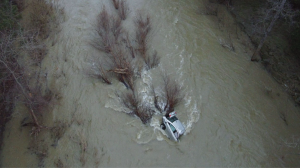
Delivering supplies to victims is another way drones support SAR, said Matt Sloane, CEO of Atlanta-based Skyfire. Drop mechanisms allow some drones to deliver a radio or bottle of water to stranded hikers, or to
carry a lifejacket to someone in need of a water rescue. In other situations, such as if a police officer is hurt and barricaded somewhere, the drone can bring in medical supplies.
Law Enforcement
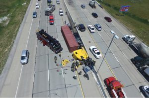
Crime scene photography and accident scene reconstruction are among the most common ways drones are used in law enforcement, Gettinger said.
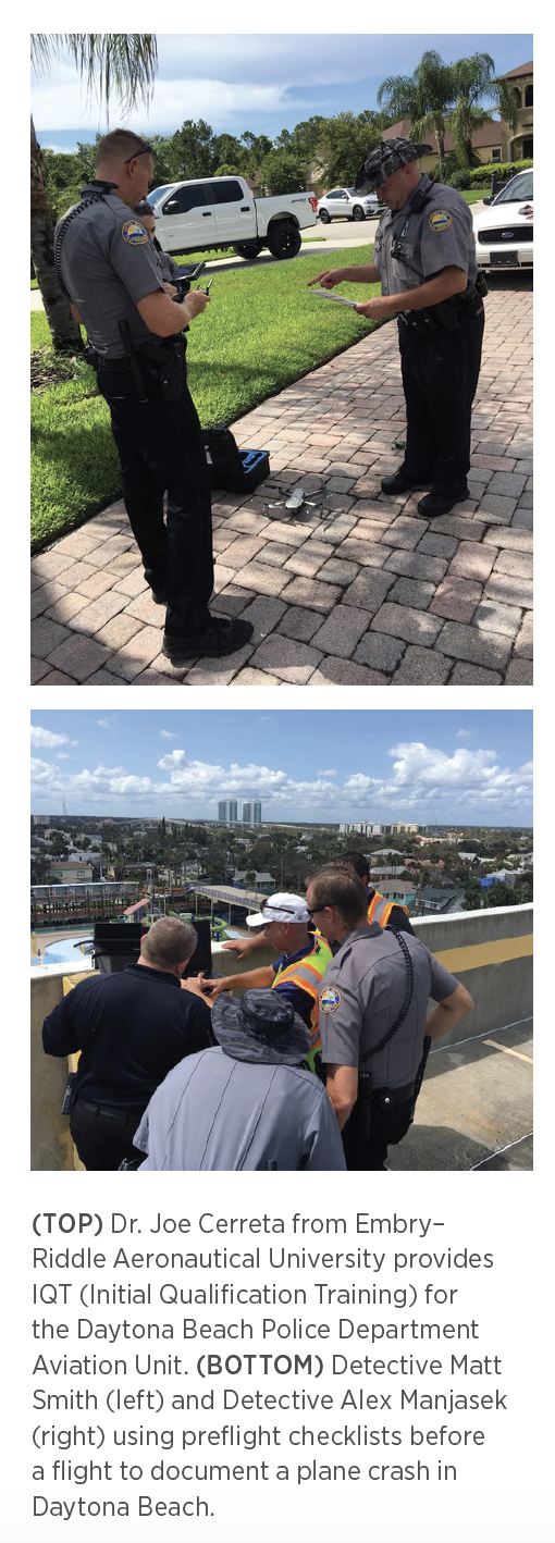
With UAS, officers can collect 4K aerial video of a scene, as well as generate a 3-D orthomosiac map, said Anthony Galante, an assistant professor in the UAS program at Embry Riddle Aeronautical University and an officer for the Daytona Beach (Florida) Police Department. This saves officers time; instead of closing down a highway for hours when investigating a crash, they can
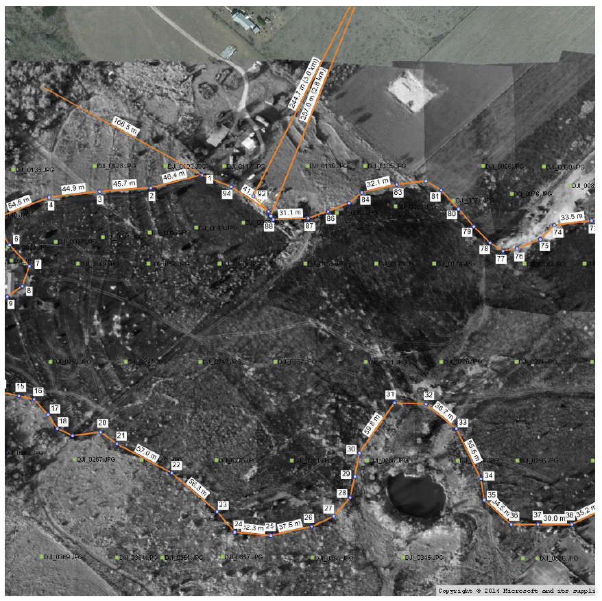
collect everything they need in about 20 minutes.
“If you have an accident scene or homicide or anything you need to record in high detail, you want to do that before everyone gets there and stomps around and messes it up,” Robinson said. “If you send a drone in, nobody touches a thing and you have a nice baseline to begin with. DAs and lawyers love it because it’s irrefutable photographic evidence that can be quantified, making it acceptable in a court of law.”
Traffic management via drone is similarly gaining traction. In Daytona, for example, officers look at traffic flow during large events, Galante said. During one such event, the police chief asked his officers to obtain traffic footage via drone. After looking at the live video streamed back to him, he quickly saw there were barely any cars on the street. Sending officers home early saved the city about $10,000 in overtime pay.
One of the more recent trends is to use drones in tactical situations, DeMolina said. This creates a new dynamic because such
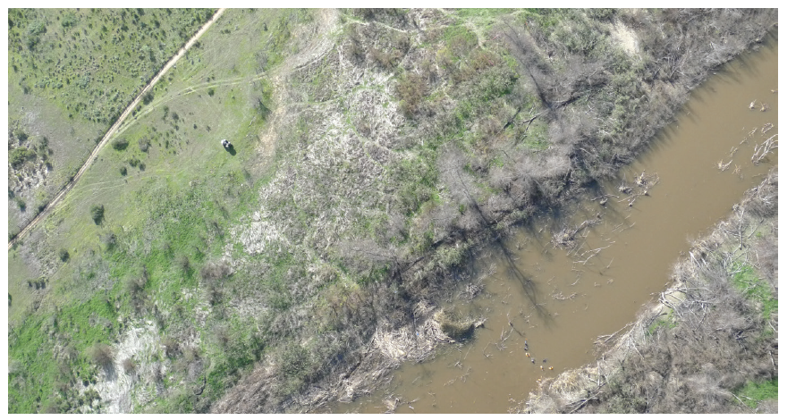
(TOP) Image of a wildland fi re taken via drone to
calculate the number of acres burned. (BOTTOM)
Drone over watch of a dive team searching for a
missing person.
operations often happen inside structures where there’s no GPS, which means it takes a more skilled pilot to manage the drone.
These missions might include a barricaded suspect, or any kind of situation where it’s dangerous for police to respond, Gettinger said. The drone can provide situational awareness so there are no surprises.
That’s one of the many ways Jeff Kleven and his team at the Fremont Fire Department in California have used drones to help the local police department (the two agencies have a joint program and often fly for each other). “Giving them eyes inside,” they’ve checked out building perimeters and indoor environments ahead of tactical teams, and they’ve surveilled warehouses converted into drug labs, getting the layout and letting officers know if anyone is there. The department also has used drones to pursue suspects on foot.
Bomb squads are starting to see the advantages of UAS over ground robots, DeMolina said. Ground robots may have trouble getting near an explosive device if there are obstacles in the way. A UAS can fly overhead and send images back to the team, providing vital information before officers arrive on scene.
Cold case investigation is another new and interesting use for law enforcement. Using near-infrared imagery, drones can identify shallow graves that are up to four years old, Robinson said. This can aid in closing unsolved missing person cases.
“Talk about a quantum leap from even two years ago. We have more agencies that are looking into using drones or are already using drones than ever, and almost every agency I have spoken to is considering putting drones in their toolkits. Public safety has embraced the technology and will continue to push it.” – Gene Robinson, Vice President of flight operations, Drone Pilot Inc.
Fire
Drones are also proving their worth to fire departments. Kleven, who is the UAS program manager in Fremont, has flown UAS for better views of fires engulfing single-story homes, multi-story apartment complexes and commercial buildings. Via images captured from the FLIR infrared camera, firefighters can gather significant intelligence before sending anyone in, such as which
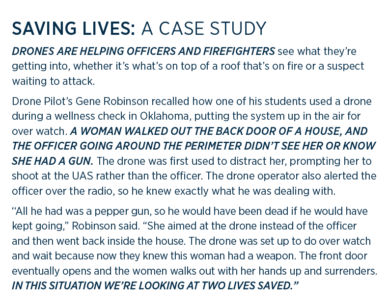
Saving Lives: A Case Study
areas of the roof have been weakened by the flames.
“As incident commander, I used to rely on traffic radio to make a plan to attack a fire,” Kleven said. “Depending on who I asked, the answer could come back a little different every time. With the drone we can see so many things. We can see where the hose lines are going in, we can see where most of the heat generation is coming from and we can see smoke production. The amount, color and velocity tells us a lot about what the fire is doing. We can join radio feedback with the visual, so tactically we’re light years ahead of where we’ve ever been before.”
Structural images allow for pre-planning before a fire ever happens, Pruitt said, as well as post-fire overhead views to help determine what caused it. Pruitt’s team is also deploying drones for hazmat incidents; spotting markings or whatever is leaking gives firefighters an idea of what they’re dealing with before they ever get to the scene. Responding to train derailments and water rescues are also on a long list of how fire departments are deploying drones to serve the public.
Fremont Fire has been exploring several upgrades. While optical and thermal sensors are the most popular imaging tools, Kleven is looking into multispectral as well. This sensor can be used to help with pre-planning for wildland fire management, enabling teams to predict where a fire is going to go and the rate of speed it will travel.
While most departments rely on DJI products that are easy to deploy and operate, Fremont Fire recently invested in a SkyRanger, Kleven said. This fixed-wing option offers more flight time (45 minutes instead of 25) and can handle inclement weather better. It’s also waterproof, he noted, so if it’s flown into a contaminated area and it can be cleaned after, whereas the other systems would need to be discarded.
UAS are quickly becoming an everyday tool, Kleven said, so much so that he’s starting to see fire engine manufacturers give departments the option to integrate a drone right into the truck. “You’re going to see drones on fire engines as frequently as you see hoses on them now,” Kleven said. “It’s becoming more affordable and systems are starting to be built that are specific to police and fire. Without a doubt it’s the biggest trend in fire service in the last 20 years.”
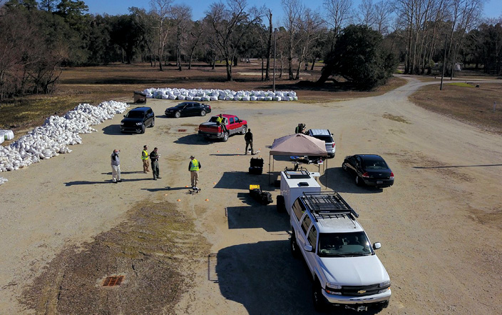
Disaster
Hurricane Harvey, which hit in 2017, marked the first time drones were widely used after a disaster, said Robinson, who was part
of a team that spent 21 days flying missions. The drones mostly collected images for damage assessment, leaving manned aircraft to do bigger jobs like rescuing people from roofs. The pilots were happy for the help, which shows they’re becoming more accepting of UAS and how they can complement manned aircraft—another factor that has helped move UAS forward for public safety operations in general.
Galante flew UAS before and after Hurricane Irma, which wreaked havoc in Florida just a few weeks after Harvey did its damage in Texas. Before the storm, Galante captured imagery of critical infrastructure so they could be compared with post-storm displays. This helped speed up the time it took for FEMA to fund the recovery process.
After the hurricane, drones also were used to assess flooding and tell first responders where they’d run into downed trees and power lines. UAS sped responses and ensured limited resources were sent where they were needed most.
Ben Miller, director for the The Center of Excellence for Advanced Technology Aerial Firefighting in Colorado
is working on innovative ways to deploy drones against wildland fires. Right now, the main use is situational awareness, with drones helping responders determine the direction a fire will travel. But the center’s team is working on several other applications: using drones to carry objects to firefighters—whether a gallon of water, lunch or a line of one-inch fire hose—or increasing payload weight and providing firefighters better cell coverage through a local area network. They’re using goTenna Pro tactile mesh networking radios and testing the technology with a SAR group.
“They put the radios over the search area via drones and they were connected,” Miller said. “We’re looking to have a fixed-wing drone carry a radio repeater and connecting everybody on the ground.”
THE FUTURE
As drones become more integrated into daily public safety operations, standards will be created and uses will become more sophisticated.
For example, today the model is to put a drone in the vehicle with the officer heading out to the scene, Sloane, of Skyfire, said. In the future, drones will automatically deploy from the dispatch center—a capability the Chula Vista, California, Police Department is already exploring (see the profile of this department, starting on page 36).
The department has been deploying drones this way for about a year, Sloane said. Recently, it obtained beyond visual line of sight (BVLOS) authorization and can now fly three miles in any direction. An officer is positioned on a nearby roof to make sure the drone flies safely and has the ability to take control if necessary.
The average drone response time is a little more than two minutes, where it might take an officer several more minutes to arrive. Officers have made dozens of arrests using this drone in a box solution and have cleared multiple calls without an officer ever going to the scene.
Drones also could be mounted on top of patrol cars, Fernandez said, automatically activating during an incident and keeping officers in view during a foot chase, for example. This would enable officers to communicate with dispatch even if they lose their radios, while also providing a location if they end up hurt and unsure of where they are.
Miller predicts first responders will actually ride drones in the future. Many advancements must be made before this can happen, such as getting an unmanned traffic management (UTM) system in place, but “what the technology has demonstrated today totally supports that future,” he said.
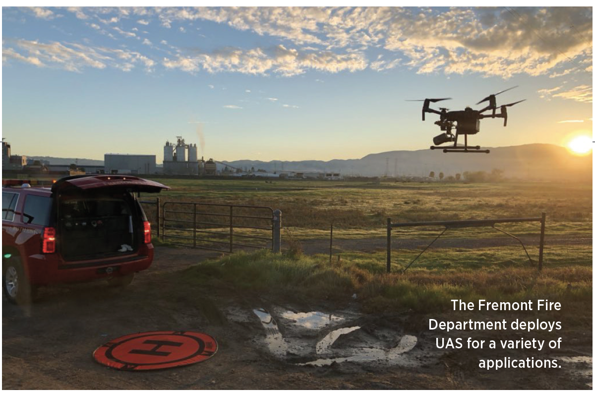
The Fremont Fire Department deploys UAS for a variety of applications.
Then there are the sensors. While first responders typically use high resolution optical cameras with zooming capability and infrared cameras today, Pruitt, of Wayne County, Indiana, said drones will soon fly sensors that can meter an area during a hazmat incident. They’ll also be able to lift more, opening up opportunities around the type of sensors they can carry and what they’re able to deliver.
As drones become part of everyday operations, public safety personnel will need to keep up with necessary training, develop SOPs and educate the community about the benefits they provide. Setting up solid programs and continuing to look for innovative ways to use the technology will increase efficiencies and save money—and, most importantly, improve safety for both first responders and the communities they serve.
A RANGE OF USE CASES
Police and fire departments continue to seek innovative ways to deploy UAS technology:
- AERIAL FORENSICS. Using infrared imagery, drones can detect what sort of insect infestation might happen to a dead body, as well as how animals might interact with it, said Gene Robinson, vice president of flight operations for Drone Pilot Inc. Last summer, he was part of a study to see how far bones are scattered by animals.
- COMMUNICATION. Some new drones have speakers on them, and departments are using them to broadcast messages over a large area or to talk to suspects, said Je Kleven, UAS program manager for the Fremont Fire Department.
- THE TEAM AT SKYFIRE is also taking on missions, such as delivering medical supplies and event over watch, CEO Matt Sloane said. Skyfire provided surveillance during the Super Bowl in Atlanta earlier this year.
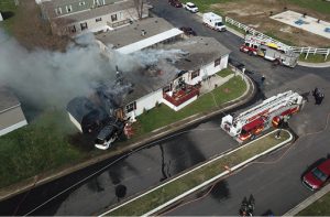
BELOW: Police and fire departments use drones for a variety applications, including accident reconstruction, water rescues and flying over structure fires.