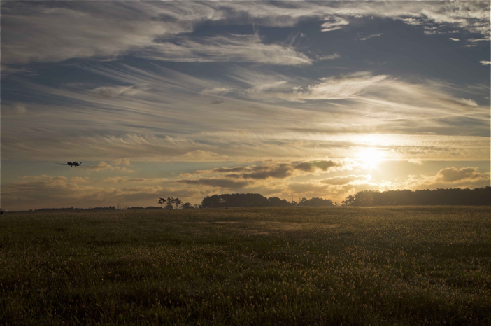
NASA’s Global Hawk takes off into the sunset after mission wrap-up at NASA Wallops and heads back to NASA Armstrong.
Image Credit: NASA
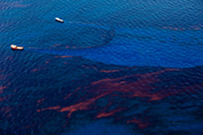
For the last three years, NASA’s Global Hawk Unmanned Aircraft have flown over hurricanes and tropical storms in an effort to help scientists learn more about these systems and how to better forecast their intensity before they make landfall—information that could help people better prepare for these storms, reducing the amount of damage they cause and saving lives.
NASA’s Hurricane Severe Storms Sentinel, or HS3 mission, completed its final year studying storms in the Atlantic Ocean basin after the 2014 hurricane system, but that doesn’t mean this important research is over. The National Oceanic and Atmospheric Administration will continue to use Global Hawks to study severe storms through a new project, known as Sensing Hazards Through Operational Unmanned Technology, or SHOUT, said Lieutenant Commander and Global Hawk pilot Jon Neuhaus, who worked on the HS3 mission.
NOAA was among one of NASA’s partners during the HS3 missions and will use the data collected during these flights to continue the research. NOAA-funded missions are slated to begin during this year’s hurricane season.
“This is something that hasn’t been done before because we never had a platform that could stay for any length of time,” Neuhaus said of the HS3 mission and the benefits the unmanned Global Hawks bring to severe storm research and forecast prediction. “With the Global Hawks we could spend 12 to 18 hours on station, depending on where the storm was. That was one of the benefits of using the Global Hawks, being able to take those payloads to the target locations and spend an enormous amount of time on station, profiling the hurricane from a very high level to the surface.”
The HS3 Mission
Planning for the HS3 mission began in 2010, with missions first taking off in 2012. Researchers used two Global Hawk Unmanned Aircraft to study these storms and what factors make them intensify, said Gerry Heymsfield, the principal investigator for NASA’s HIWRAP radar and research meteorologist at NASA’s Goddard Space Flight Center. HIWRAP was one of the weather instruments used to study the storms.
Scientists plan to use data from the Global Hawk flights to answer three main questions—what role does the large-scale environment, particularly the Saharan Air Layer (SAL), have on intensity change, what is the role of storm internal processes such as convective towers, and to what extent are these intensification process predictable, according to NASA.
“We basically want to know what makes hurricanes intensify rapidly,” Heymsfield said. “We don’t know why they intensify in 6 to 12 hours or what causes a hurricane to really strengthen. Say a storm gets near the coast. Then we’re worried about if it will intensify or not. This information will help better predict that.”
The two Global Hawks were equipped with different payloads during the HS3 mission flights—environmental and over-storm.
The environmental payload monitored the environment around the storms to look for conditions that were “favorable for storm formation and intensification,” according to NASA, and carried a variety of weather instruments including the scanning High-resolution Interferometer Sounder (S-HIS), the AVAPS dropsonde system, the TWiLiTE Doppler wind lidar, and the Cloud Physics Lidar (CPL). This Global Hawk was used to study the role the Saharan Air Layer has on storm formation and intensification.
The over-storm payload repeatedly flew directly over the storms to “collect data on the inner-core structures that lead to storm intensity change,” according to NASA. This Global Hawk collects field measurements with HIWRAP conically scanning Doppler radar that works in conjunction with the HIRAD multi-frequency interferometric radiometer, and the HAMSR microwave sounder.
Last Year’s Mission
While the team used two Global Hawks for the HS3 mission in 2012 and 2013, mechanical issues left them with one Global Hawk for the 2014 flights. This Global Hawk, equipped with the environmental payload, studied three storms, while a manned aircraft was sent to study a fourth. The storms affected land areas in the Atlantic Ocean Basin and were at different stages during the investigations.
The Global Hawk flew over tropical storms Cristobal, Dolly and Edouard. Edouard eventually developed into a hurricane. During these flights the Global Hawk’s instrumentation took various measurements, including wind, temperature, pressure and humidity.
Researchers flew the Global Hawk over the Edouard storm during different stages, including when it was reaching its highest intensity and as it was weakening to a tropical storm. They were able to gather data from the eye of the strengthening storm—exactly the kind of information researchers can use to better predict these systems and their intensity.
Among their findings was that, compared to an earlier NOAA P-3 Orion flight, the Global Hawk data showed a pressure fall at the center of more than 11 millibars and an increase in maximum winds of at least 10 knots (11.5 mph/18.5 kph) in just four hours.
Why Global Hawk
Global Hawks are ideal for this type of application because of the high altitudes they can reach and their high endurance, Neuhaus said. They can reach altitudes of about 65,000 feet, which is about twice as high as commercial airliners, and can fly as far as 12,600 miles for as long as about 26 hours, according to NASA. This gives researchers the altitude, distance and time they need to collect the continuous, high-resolution measurements necessary to better predict a storm’s intensity.
A piloted plane is limited to about eight hours of flight time, Heymsfield said, making it difficult to study storms over the Atlantic Ocean, not to mention the danger involved for pilots flying manned aircraft.
The Global Hawk’s endurance gives researchers the time they need to get to a storm, fly over it and then fly back. The high altitude makes it possible to get a better look inside the storms with the weather instruments onboard the Global Hawks, enabling them to measure the storm’s structure and better understand how a storm intensifies.
“Through HS3 we were able to expand out further for hurricane surveillance,” Neuhaus said. “We looked at the Saharan Air Layer and the genesis of the actual hurricanes themselves.”
What’s Next
NOAA will continue to work with NASA and other partners to study these intense storms through SHOUT, and scientists will use a combination of instruments from both Global Hawk payloads for the research, Neuhaus said. Flights are planned for the 2015 and 2016 hurricane seasons, and possibly beyond.
Neuhaus will be involved with this NOAA-led mission as well, and said he’s hoping this year’s hurricane season will bring them a few good storms to study. They’re expecting to run between 10 and 16 missions during this year’s hurricane season in both the Atlantic and Pacific basins.
Neuhaus has been working with Global Hawks since 2012, and is excited about the possibilities they bring to severe weather research and storm prediction.
“The Global Hawks can take payloads out for long durations,” he said. “You can spend an enormous amount of time on station. That’s what Global Hawks bring to airborne science—endurance, range and high altitude.”