RICHFIELD, Ohio—Event 38 Unmanned Systems, which manufactures American-made mapping drones, said its E400 fixed-wing drone was used to collect aerial imagery and mapping data in Turks and Caicos.
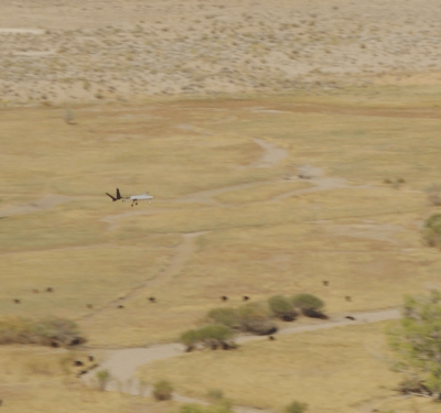
The drone captured enough data to produce orthomosaics of two entire islands, totaling 238 square kilometers, in a matter of days, the company announced.
The project was conducted by PLACE, a global nonprofit technology organization dedicated to solving the inefficiencies of modern-day mapping and democratizing mapping data by providing hyperlocal, accurate, detailed optical imagery. The organization had been actively searching for a better aerial imaging solution when they were connected with Event 38.
“It can be difficult and expensive to get an airplane into the geographies where we work,” said Peter Rabley, founder of PLACE. “Satellite imagery is quite complicated to order and process the data, and many of these geographies have intense cloud cover, which can disturb the imagery.”
The logistics of data capture weren’t the only challenge. “Some countries dislike the fact that they have to pay an external satellite company for one-time use of their mapping data and can’t create derived works without paying more for a new license,” Rabley said.
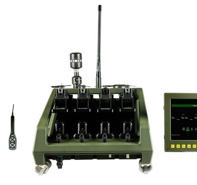
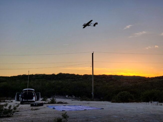
“PLACE was looking for a fixed-wing, VTOL drone with a long flight time that could map large areas and capture high-resolution imagery,” said Jeff Taylor, founder and CEO of Event 38. “The E400 fulfilled all of their requirements, including an industry-leading flight time of 90 minutes, plus vertical takeoff and landing capabilities. We were also intentional about making the E400 as user-friendly as possible, including a hot-swap payload, a low maintenance electric powertrain, and open-source integrations, so we could remove any barriers to entry that might prevent someone from using it for important surveying and data collection projects.”
PLACE’s first mapping project with the E400 took place in Turks and Caicos, an archipelagic island nation in the Caribbean. Turks and Caicos’ previous mapping data was at least a decade old, and existing satellite data wasn’t detailed enough for local applications such as hurricane preparedness and mitigation. The Event 38 team joined PLACE to provide training on using and maintaining the drone, which the team used to map two entire islands.
The E400 gave the Turks and Caicos government the accuracy and resolution of data it needed to green-light multiple critical projects, including a major upgrade to the property tax system and improved climate mitigation modeling and planning. The data is already being used for the upcoming census and other key activities.
Event 38 is working on additional modifications to the E400 to support PLACE and other future customers. “Based on what we learned during our time in Turks and Caicos with PLACE, we’re making a lot of exciting modifications to both the E400 and the workflow to make the entire platform better suited to remote locations, where there may be limited cell service, repair facilities, and accessible weather data,” said Taylor. “We’ve already invested in a lighter carrying case and an ADS-B transponder and improved the image geotagging workflow for large missions, and further upgrades are in the works.”
PLACE has already purchased two additional E400s.
“Event 38 is incredibly proud to be supporting PLACE’s important work and mission,” Taylor said. “We look forward to seeing what our other clients do with the E400.”