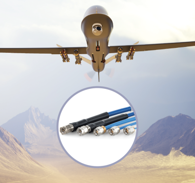
Times Microwave’s Levitate family is built for the middle market in military UAS: lighter than legacy aerospace practice, stronger than…
Product News
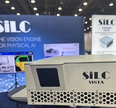
Farsighted: SiLC’s Eyeonic Vista Perimeter Detector
Nefarious actors wield increasingly sophisticated UAS that move quickly, fly low and blend into complex backgrounds and infrastructure. SiLC Technologies…
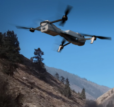
Teledyne FLIR Upgrades Rogue 1 Block 2 with Extended Range, Larger Warhead
Teledyne FLIR has unveiled an improved Block 2 variant of its Rogue 1 quadcopter enabling the loitering munition to strike…

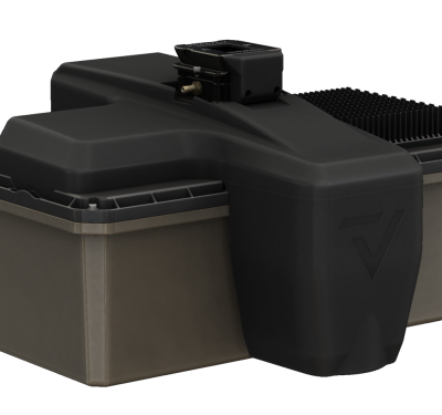
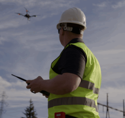
Trimble Targets Drone Delivery Integration with Smart Antenna Enclosure for PX-1 RTX
Trimble has released a smart antenna enclosure option for its PX-1 RTX positioning solution, packaging centimeter-level GNSS-inertial hardware with an…
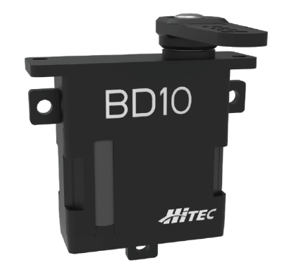
Hitec Commercial Solutions Announces Next-Gen Servo for Small UAS
Hitec Commercial Solutions is excited to announce the next generation in brushless drone servo technology: our high-performance BD10BL. Designed specifically…
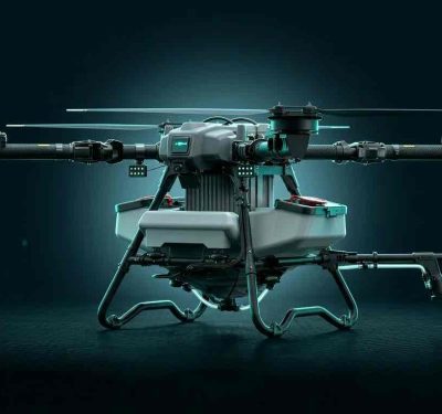
DroneDash and GEODNET Launch GEODASH Aerosystems with Heavy-Lift Agricultural Spraying Drone
DroneDash Technologies and GEODNET have formed a joint venture to bring a new class of autonomous agricultural spraying drone to…
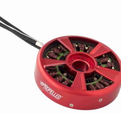
ePropelled Expands Hercules Starter Generator Line for Multi-Domain Hybrid Missions
ePropelled has announced a significant 2026 expansion of its Hercules starter generator product line, extending the platform’s reach across uncrewed…

RIEGL Still Rising at InterGEO 2025
RIEGL’s newly released VQ-1060 marks a significant evolution in airborne LiDAR for corridor mapping. Unveiled at InterGEO 2025 in Frankfurt,…
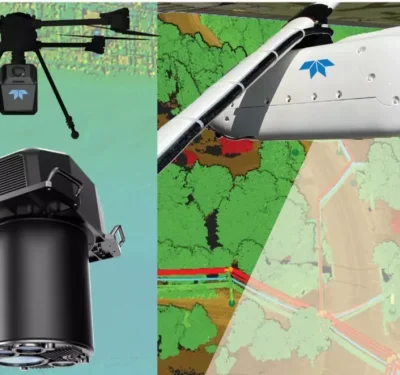
Teledyne Optech Highlights Advanced LiDAR and Marine Mapping Systems at INTERGEO 2025
Teledyne Optech introduced an expanded lineup of LiDAR, imaging, and marine-mapping technologies at INTERGEO 2025, underscoring the company’s focus on…
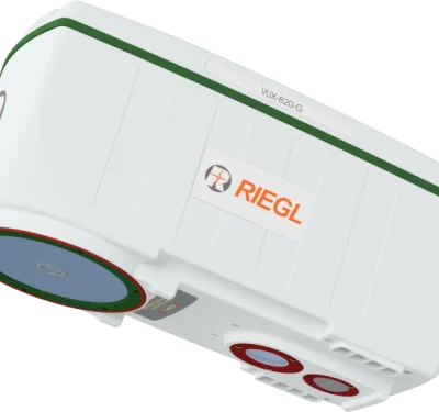
RIEGL Debuts UAV-Optimized “Ultimate LiDAR” at INTERGEO 2025
New airborne and bathymetric sensors extend range, precision, and real-time georeferencing for drone-based mapping and inspection. At INTERGEO 2025, RIEGL…
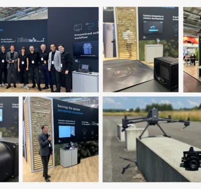
Phase One Unveils Drone-Ready Imaging Stack at INTERGEO 2025
At INTERGEO 2025, Phase One rolled out a suite of new innovations explicitly aimed at aerial mapping and inspection applications. The upgrades,…
GeoCue Announces New, NDAA-Compliant TrueView 3D LiDAR Sensor at INTERGEO 2025
GeoCue has introduced its TrueView 641, a new NDAA-compliant airborne LiDAR sensor, at INTERGEO 2025. The announcement positions the 641 as a more…
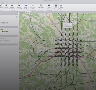
New Trimble Software Enhances Mobile Mapping Workflows
Trimble has announced its next-generation post-processing software, Trimble Applanix POSPac Complete. The solution combines Trimble’s cutting-edge, industry-leading technologies: Trimble ProPoint®…
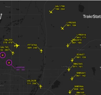
uAvionix Releases Trakr: Low-Altitude Airspace Awareness Extension to FlightLine Platform
uAvionix today announced the launch of Trakr, a new suite of hardware and services that extends its FlightLine airspace surveillance platform to…
uAvionix Launches skyAlert Wearable Aircraft Alerting Device for UAS Operators and Visual Observers
uAvionix, committed to radically innovating to keep the skies safe for all airspace users, today announced the release of skyAlert, a…
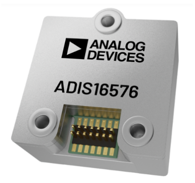
Precision, Performance, and Integration: The ADIS16576 Sets a New Standard for MEMS IMUs
In the fast-moving world of autonomous systems and advanced navigation platforms, precision and reliability are paramount. From unmanned aerial vehicles…
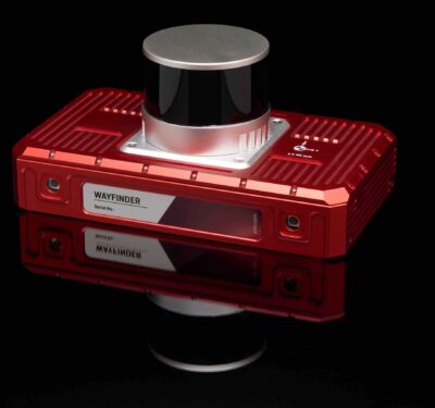
OxTS Launches WayFinder and LiDAR Boost for GNSS-denied Localization
OxTS has launched WayFinder, a complete localisation solution for any environment, even GNSS-denied spaces. Functioning out of the box with…
