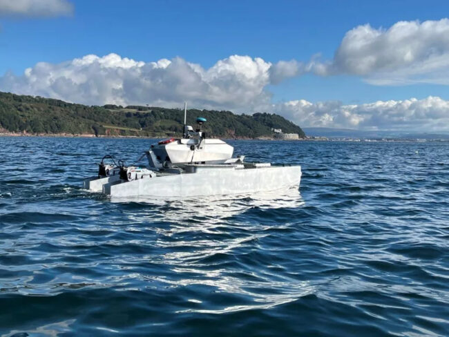
HydroSurv has won funding from Innovate UK to continue working with the University of Plymouth to enhance its technique of using unmanned surface vessels to map seagrass coverage on the seabed.
Building on previous collaborations with the university and Valeport, the project aims to generate a comprehensive picture of seagrass meadows as well as to characterize the environment in which they are growing, enabling ecosystem health to be determined from the same survey campaign.
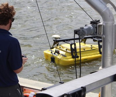
The project will see HydroSurv’s low impact, fully electric USV data acquisition platform developed further to deliver comprehensive, seagrass monitoring using an Acoustic Ground Discrimination System coupled with video and environmental data collection from new hull-mounted and underwater sensor arrays. These include two specialist cameras and a laser range finder, which is deployed to a constant altitude using an intelligently controlled cast winch on the HydroSurv REAV-28 USV.
A macro lens camera on the underwater skid will be lowered into sediment for close-up, high-resolution photographs. Using an algorithm to ascertain grain size from the images, the type of ground in which the seagrass is growing can be determined. This enables stakeholders to monitor critical environmental parameters of seagrass habitats and to quantify meadow biomass and carbon sequestration potential, in turn informing better understanding of these habitats and their restoration.
The vessel’s sensor payload will also measure sound velocity, turbidity and chlorophyll levels, while machine learning algorithms, developed by the university, will objectively classify the seagrass beds using acoustic envelopes.
Processed data will be provided to coastal practitioners and scientists using an enhanced cloud-based data hosting and visualization application developed by HydroSurv. This will enable them to create an enhanced picture of seagrass coverage, density and canopy height alongside improved environmental measurements and ground truthing video files, making actionable seagrass data wholly accessible.
“The use of a non-invasive USV system to work in these sensitive environments reduces the risk of damage to the very habitat we are trying to protect,” said HydroSurv COO Ian Godfrey. “Beyond that, improved accuracy, low carbon emissions and reduced cost make uncrewed platforms an attractive proposition for survey and characterization of seagrass meadows, even in waters that are difficult to access. HydroSurv is focused on providing a turnkey solution covering robotics and data processing in a single package that is readily accessible to industry stakeholders.”
The six-month project will culminate in a system demonstration involving key UK natural capital stakeholders actively involved in seagrass conservation projects and strategy, including co-funder DEFRA, Natural England and the Environment Agency.
“Collecting and processing ground truth images of seagrass habitats is currently an essential, but costly and time-consuming, activity,” said Tim Scott, associate professor at the University of Plymouth. “This project will dramatically improve our ability to monitor these critical ecosystems effectively and economically, facilitating the collection of regular and spatially comprehensive datasets that would not be possible without leveraging marine autonomy and advanced data analysis techniques.”


