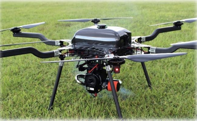
Photo: courtesy of LiDARUSA.
LiDARUSA has announced the integration of its UAV-scanning systems with the Harris Aerial H4/H6 Hybrid multicopters.
As surveyors and mappers experience growth they assume larger and larger projects making longer flight times increasingly important. The extended flight times become increasingly important. The Harris Hybrid can provide such flights with LiDAR and industrial grade cameras allowing for far greater coverage in a single flight, according to LiDARUSA.
“The beauty of the Harris Hybrid is that the pilot continues to enjoy the flexibility of a multi-copter, availability of fuel, and relatively compact packaging at an affordable price,” says Jeff Fagerman, CEO of LiDARUSA, “While it is louder than an all-electric system, for particularly large, rural projects it is a very nice solution.”
Related reading: LiDARUSA Puts Safety First With Drone Rescue Systems
Harris Aerial, an innovative drone manufacturer near Orlando, Florida, builds and sells heavy-lift hybrid multicopters. These copters use a small generator running on 95 (or higher) octane fuel to power the UAV for up to 5 hours. The Carrier H6 can carry an A-series HD LiDAR system of 3 kilograms for 2.5 hours and a V-series of 5 kilograms up to 1.5 hours. The benefit of this system is the multicopter is designed to meet and exceed all the benefits the user expects.
For the LiDAR operator this translates into most projects requiring only one or two flights at most. On projects that are relatively flat with a clear LOS to the horizon in all directions, these systems can cover everything legally possible in a single flight.
LiDARUSA is committed to promoting LiDAR mapping and imaging around the globe—visit www.lidarusa.com for more information and sample data sets.