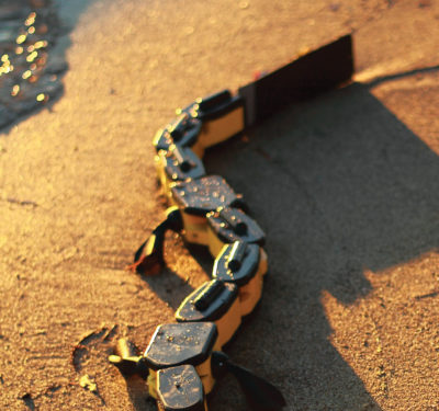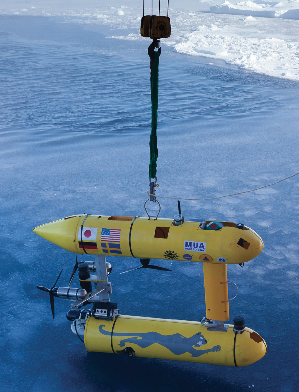
Woods Hole Oceanographic Institution Puma. Woods Hole Oceanographic Institution
As researchers scramble to understand the Arctic many are developing unmanned technologies to make it easier and safer to operate in one of the world’s most inhospitable regions.
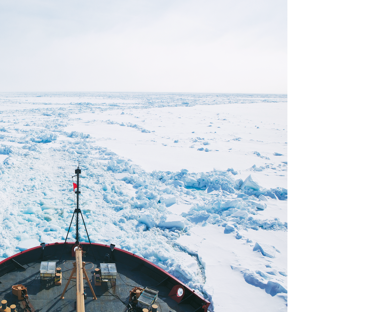
Making travel through the ice less onerous is one of the first challenges.
“Until you actually go out and do it you don’t really appreciate how hard it is for the people who are driving the icebreaker. We can’t just say ‘Hey I want to go there,” said Hanumant Singh, senior scientist for applied ocean physics and engineering at the Woods Hole Oceanographic Institution. “It’s not like the open ocean where you can just drive the ship over there. They have to break the ice—and they can’t break all the ice. They have to look for channels and leads to follow.”
The sea ice they are traversing is not the smooth glassy expanse so enticing to skaters and ice fishermen. Ocean currents break the ice into massive sheets that crash into each other like tectonic plates, pushing meters-thick ridges above and below the surface.
Ice breakers can’t get through the thicker ridges, which makes finding the leads, open-water cracks between the ice sheets, crucial to a successful crossing. Ships contract for satellite images to help them weave their way through, said Ro Bailey, associate director for policy at the Alaska Center for Unmanned Aircraft Systems Integration (ACUASI), but the resolution may not be fine enough to identify the fissures, which may only be a meter wide.
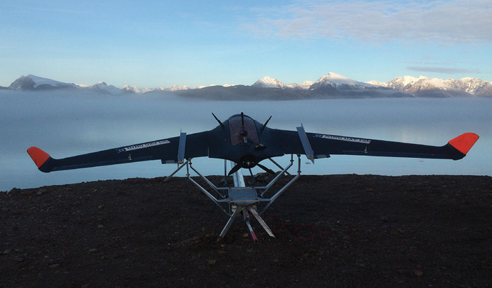
Skywalker Technology X8 Flying Wing. Kim Sorensen, Norwegian University of Science and Technology
Ice Navigation
ACUASI, which is located at the University of Alaska-Fairbanks, has looked at using Unmanned Aircraft Systems (UAS) to help ship captains look ahead and plan their course.
“The idea is, if I can get a little more elevation can I improve my path”, Bailey said.
Baily told Inside Unmanned Systems a resolution of 5 to 7 cm was realistic with an unmanned aircraft, but testing was needed to determine costs and practical operational details such as how high and far ahead the UAS would need to fly to provide useful information.
The Coast Guard is actively studying UAS for ice navigation, said Rich Hansen, chief of the Surface Branch at the Coast Guard Research and Development Center and a chief scientist for many of its arctic projects.
“You may want to work through the various leads in the ice …kind of zigzag your way through it on the easiest path,” Hansen said, “so you would use the aerial asset to give you an idea what’s up ahead.”
Though the concept has promise, the rules for flying remotely piloted aircraft are limiting progress.
“The restriction that applies to the planes is they can’t go beyond the line of sight, so we haven’t been able to research what’s the optimal distance ahead of the ships to be looking with an unmanned aircraft,” explained Lt. Keely Higbie, project manager and public affairs officer for the Surface Branch.
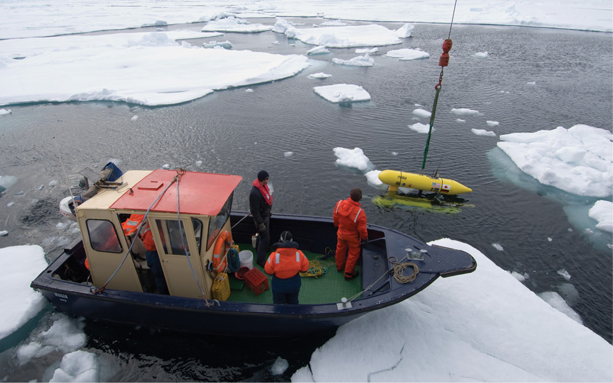
A small boat is used to push ice floes out of the way as the Puma is lowered for a test drive. Woods Hole Oceanographic Institution
Countering Icing
The center is also working on ways to counter icing, as any ship relying on a UAS to scout ahead could lose the aircraft to icing on the wings and engine, especially when fog forms around the leads, increasing the risk.
“Right now we are working with NOAA to test an ice prediction system on one of their aircraft,” Higbie said.
The agencies are assessing a sensor that attaches to the aircraft and gathers temperature, humidity and pressure data. It then compares that data to a database of previous experience to determine, in real time, the likelihood of icing.
“We look at 10 million previously recorded observations and we give you an indication of the icing potential of the air mass that you’re flying in,” said John Shepley, the program manager for the ISR Weather NOWcasting system at the firm PEMDAS Technologies and Innovations.
The Navy has flown the PEMDAS system on an Insitu ScanEagle to assess carburetor as well as wing icing risks.
“They took precautionary actions based on the data to ensure the engine didn’t freeze over,” Shepley said, “Basically they ran the throttle wide open.”
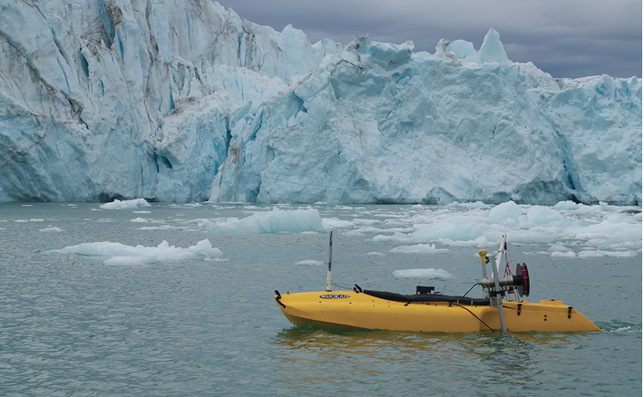
The autonomous Jetyak can bring sensors into dangerous areas cost efficiently. Woods Hole Oceanographic Institution
In another approach to the problem, a team at the Norwegian University of Science and Technology is developing a paint made of a carbon-based nano material that can be heated to prevent or counter icing.
Their system uses copper strips affixed to the top and bottom of the leading edge of the wing. The strips and the wing edge are coated with the nano-paint, enabling a current sent from a battery through the strips to heat the area.
“(Icing) has some really, really bad impacts on the aerodynamics of the airfoil”, explained researcher Kim Sorensen, a doctoral candidate at the university’s Autonomous Marine Operations and Systems (AMOS) program. “So this is why we want to heat up the wings, so the ice never forms there or, when it forms, we can shed it pretty quickly.”
The Coast Guard Cutter HEALY cuts through the Arctic ice. Woods Hole Oceanographic Institution
Autonomous Landing
While staying aloft in Arctic conditions can be a challenge, getting the drone back on the ship can be just as difficult. Some drones have had to land in the frigid waters and then be recovered by the crew.
The National Oceanic and Atmospheric Administration (NOAA) is working on a net capture system to automate capture and reduce the risk involved in water landings while still keeping the space required on deck to a minimum.
“One of the things with unmanned systems is you want to make them as autonomous as possible in order to lessen the workload on the operator and also to increase its reliability,” NOAA affiliate John Coffey said. “By automating the capture system we’re able to go from having to kind of hand fly (the aircraft) into the net to (where) you just push a recovery button and it comes in.”
NOAA tested the system earlier this year using AeroVironment’s Puma UAS, and Coffey was very pleased with the results. “We were a perfect 10 for 10 doing the net capture testing,” he said.
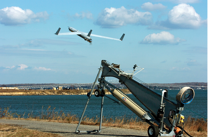
The Navy used a ScanEagle to test a new sensor designed to predict icing conditions. Insitu
Designing for Risk Taking
Reducing risk was also a factor in the development of an autonomous surface vehicle being used to assess glaciers.
“Looking at the front side of a calving glacier, where big blocks of ice are falling off, you don’t want to go there with a small boat—or any boat,” Singh said.
Singh helped develop the Jetyak, a regular kayak with an attached engine that they loaded with sensors. The programmable craft makes it possible to sidle up to the ice face without risk to the scientists. Total price? About $5,000.
“So what we did is we took a kayak and made it autonomous and again put the same sonars on it, so we can drive it right up to the face of the glacier. The idea is that it’s so cheap that if a big block of ice falls on it and crushes it and sinks it—that’s okay. We’d still have a lot of data.”
That don’t-be-afraid-to-use-it design philosophy is also at the heart of Woods Hole’s SeaBED-class vehicles. Two of these, the Jaguar and the Puma, are currently being used to study the marginal ice zone for the Office of Naval Research.
“They are very interested in looking at how waves form,” said Singh, “how ice is formed during the onset of winter in the Arctic.”
Each vehicle looks like two torpedoes linked together. The double-hull design gives the craft the ability to maneuver through the water like a helicopter as opposed to a plane.
“So we can go straight up and down and we can hover. That also gives us flexibility in terms of how we can separate out our loads,” Singh explained.
Like the Jetyak the vehicle is designed to keep the cost down. At around $500,000 each, Singh said, they are half the cost of some built elsewhere. The objective, he explained, is to have top-notch sensors (the team is currently working with optical cameras, spectral cameras, chemical sensors and multi-beam sonar systems for precise mapping) but have them on a vehicle that is not so expensive that researchers are afraid to explore.
“The Arctic is a very harsh environment to work in,” Singh said, “…that’s why we built two vehicles in the first place. If we lose one it’s okay as long as we get good data.”