AeroVironment is working with the National Park Service Inventory and Monitoring Program to assess the environmental impact of the Woolsey wildfire, which burned more than 96,949 acres in the Santa Monica Mountains National Recreation Area of Southern California. The fire destroyed more than 616 park structures and consumed about 88% of National Park Service land within the recreation area.
AeroVironment Commercial Information Solutions Unmanned Aircraft Systems flight operations and Geographic Information Science teams, in collaboration with park rangers and scientists, have initiated a comprehensive drone-based aerial imaging and environmental impact study to assess fire damage in key areas of the park, according to a news release. Data collected will be used to quantify oak tree mortality and vegetation stress. It also will document changes to the park visitor experience.
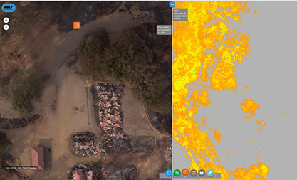
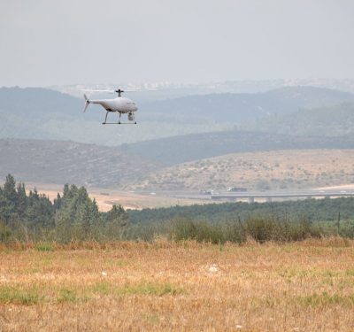
The team flew AeroVironment’s Quantix hybrid drone and Decision Support System (AV DSS) data analytics platform to capture and analyze high-resolution imagery, enabling them to quickly map the burn area.
As part of this support, the team flew AeroVironment’s Quantix hybrid drone and Decision Support System (AV DSS) data analytics platform to capture and analyze high-resolution imagery, enabling them to quickly map the burn area. This insight into the scope of the damage helped with immediate disaster response and damage assessment. The data also will be used to develop a long-term environmental recovery and park rebuilding strategy.
The Quantix features vertical take-off and landing (VTOL) technology and can survey up to 400 acres in 45 minutes. Its integrated sensors capture high-resolution RGB color and multispectral imagery using dual 18MP cameras. The solution’s on-board processing delivers true color and normalized difference vegetation index (NDVI) maps on the Quantix control tablet as soon as the unmanned aircraft system (UAS) lands. This makes it possible for teams to ground-truth potential issues immediately. The AV DSS performs advanced image processing and data analysis, offering insights into environmental damage and vegetation health.
“Reaching just a few miles from our operations, the Woolsey fire directly impacted numerous AeroVironment team members and families in our community,” said Kirk Flittie, vice president and general manager of AeroVironment’s Unmanned Aircraft Systems business, according to the release. “Within hours of receiving National Park Service clearance, our flight operations team began flying Quantix over the affected burn area, collecting invaluable aerial imagery data – and providing any support needed to help the park’s disaster assessment and recovery efforts.”