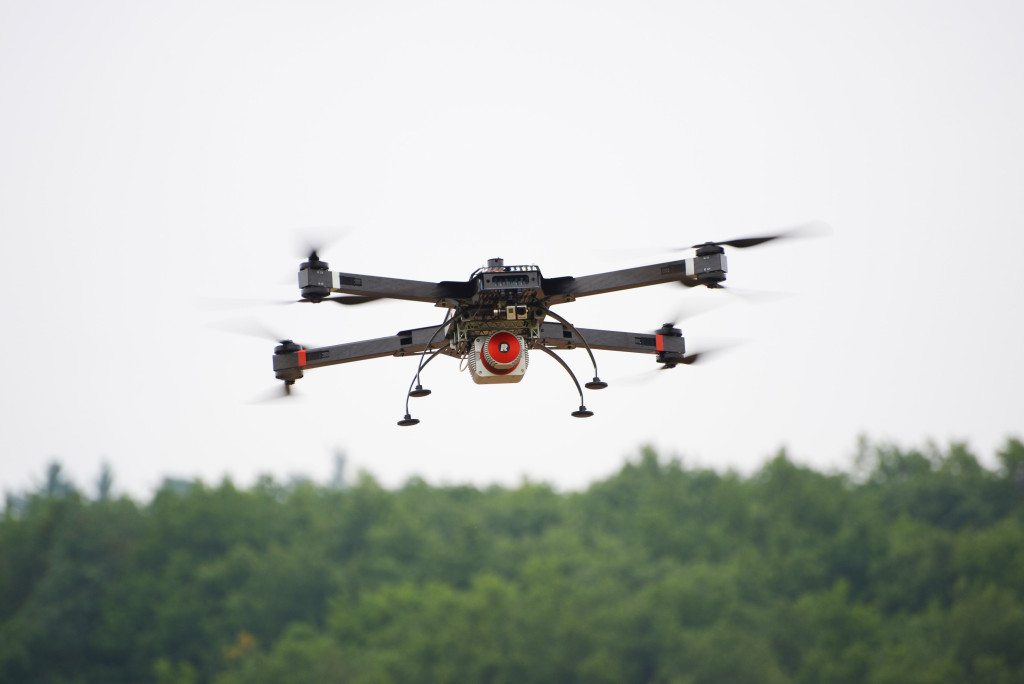
RiCOPTER, the ready to fly remotely piloted airborne laser scanning system from RIEGL USA, can be used for a variety of demanding applications including corridor, power line and railway mapping.
This high-performance UAV can be equipped with the RIEGL VUX-1 survey-grade LiDAR sensor, offering a fully integrated turnkey solution, according to the company. The platform design includes a fully integrated RIEGL VUX LiDAR sensor, IMU/GNSS unit with antenna, control unit, and up to four optional cameras featuring 330deg Field of View, 500,000 measurements/sec., and 10 mm accuracy.
RiCOPTER can be flown at a maximum operating altitude of 550 meters with a maximum take-off mass of up to 25kg and a max payload of 16kg. It has a flight endurance time of 30 minutes.
For more information on RiCOPTER, visit rieglusa.com.