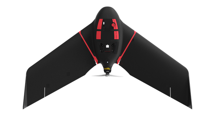
 Switzerland-based senseFly recently added the eBee Ag fixed-wing mapping drone to its eBee X series.
The user-friendly solution is designed to help farmers, agronomists and service providers capture aerial data and plant health, leading to faster decision-making and ultimately an improvement in crop yields and potential profit, according to a news release.
The solution is based on the company’s flagship eBee X drone. The new drone makes it easier to field scout, ground-truth potential problem areas and gain insights into crop health.
The drone can be used for “intensive and repeated crop mapping missions.” It can fly for up to 45-minutes on a standard battery and up to 55 minutes on an endurance battery, covering 395 acres in one flight.
The eBee Ag comes equipped with the lightweight Duet M dual-sensor fixed payload, which includes the senseFly S.O.D.A. RGB and Parrot Sequoia+ multispectral cameras. This payload makes it possible to capture accurate RGB and multispectral data. Multispectral data can help users better assess crop health, optimize inputs and spot early indicators of pests, diseases and weed infestations. Accurate index maps also make it possible for ag professionals to understand each acre while managing problematic areas field-wide.
The solution also has available Real-Time Kinematic (RTK) functionality for enhanced mapping precision. It can achieve absolute accuracy down to 2.5 cm (1 in) with RGB. This position data can then integrate into existing GPS-enabled machinery and/or farm management systems.
The eBee Ag also comes with the company’s new eBee X series backpack.
Agriculture professionals who purchase eBee Ag get access to sesneFly’s eMotion flight planning software, technical support and various resources.
“The agriculture industry has been lacking a viable mapping solution that offers professional results at a more accessible price,” senseFly Head of Marketing Michael O’Sullivan said, according to the release. “The launch of the eBee Ag introduces an affordable fixed-wing solution that delivers the long flight times, range and efficiency—as well as the data quality, accuracy and resolution—that agriculture mapping projects require.”