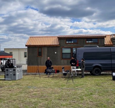
Initial BVLOS trials of the Martin UAV V-BAT UAS in the US were monitored in real-time over the horizon in…
Kongsberg Geospatial

Flirtey Implements Kongsberg Geospatial IRIS Airspace Awareness Technology
Kongsberg Geospatial IRIS enables a single operator to control multiple Flirtey Eagle drone delivery systems simultaneously for Beyond Visual Line…

Canadian Coast Guard Experiment Will Push The Bounds Of SAR Surveillance
The Canadian Coast Guard (CCG) will pair a multi-sensor, rapidly deployable VTOL drone with a portable sensor data management system…
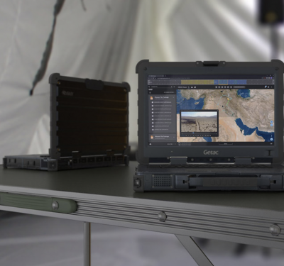
Kongsberg Geospatial Announces New Tactical UAS Sensor Data Management Solution
Kongsberg Geospatial, creators of the TerraLens geospatial map-engine Software Development Kit (SDK), announced today the release of the Modular ISR…
