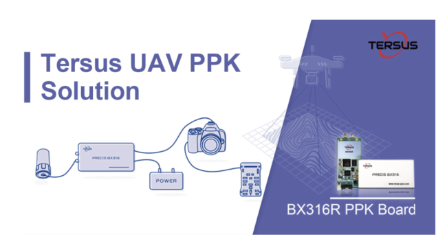
Shanghai, China-based Tersus GNSS Inc., recently introduced a new solution for UAV PPK applications — the Tersus UAV PPK solution that includes a BX316R PPK Receiver, AX3705 Helix Antenna, and Tersus GeoPix Software. Combined with the forward and backward filter during post-processing, this Tersus PPK solution is designed to provide more reliable positioning and higher fixing rate.
The BX316R PPK Receiver supports multi-constellations and dual-frequencies and has built-in 4G memory for GNSS observation data recoding. The small and light AX3705 Helix Antenna is designed for UAV applications. Tersus GeoPix integrates the functions of GNSS observation post processing, Event Mark interpolation and geotagging in EXIF. By clicking one button after inputting all the necessary data, the software will provide the result directly as input for image processing software.
The Tersus PPK solution can dramatically reduce time, cost and also reduce ground control points (GCPs) or even eliminate the demand for GCPs. There is no need for real-time RTK correction in this solution, according to the company.
Tersus GeoPixFeatures Include:
· Simple software interface and simple workflow
· Automatic processing GNSS data and geotagging images by one button click
· Shows the result in trajectory plot and the images on online map
· Provides PPK result in both EXIF and text file
· The result can be directly used by image processing software, i.e., Pix4D, Agrisoft, etc.
· Supports Base Station data from CORS or other brands GNSS Receiver, i.e., RTCM3 and RINEX format.
UAV PPK Solution Item List
· BX316R PPK Receiver with cables of power supply, event mark and serial port
· AX3705 Helix Antenna
· Hot Shoe adaptor
· Tersus GeoPix Software
· Tersus GNSS Base Station Receiver (Optional)