Mosquito control involves multiple UAS; security considerations spur a search for substitutes
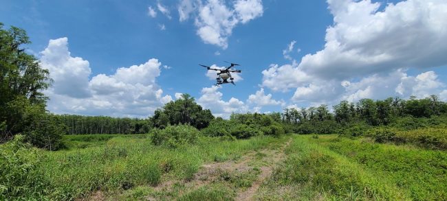
Photo courtesy of Peter Brake, Collier Mosquito Control District.
Florida hosts 50-plus species of mosquitos, more than any other state, and things can get fast and furious when temperature and humidity rise. Moreover, hard-to-reach infestations can defy pest controllers who try to reach them on foot or in ground vehicles. That’s why Peter Brake, director of technical development for the Collier Mosquito Control District, started a drone program there in late 2017.
“We don’t serve the whole county; our District is 401 square miles, the county is about 2,300 square miles,” the Naples-based Brake said. “So, we’re more of a niche.” But when Brake joined the District in 2013, the former helicopter mechanic and aircraft crew chief saw “a huge need and a huge increase in capabilities, in payload, flight time and so forth. Now we have seven drones, four helicopters and four planes” [an eighth drone was just sold off].
Brake detailed the advantages UAS bring to mosquito control. “It could be something as simple as increasing the efficiency of the technicians,” he told Inside Unmanned Systems. “That way, they don’t have to travel through the swamps and the habitat, encountering snakes, spiders and all that good stuff. They’ve got a huge safety aspect. But also from an efficiency point of view, if he has to go through all that stuff and the area is dry, he’s wasted all that time, and he has come back to the truck and go to next site.
“From a drone point of view, what he has to do is open the case, set up the drone, take off and use the camera platforms to see whether the area is wet or dry. If it’s dry, just land and move on, increasing time efficiency. We do drone inspections, drone mapping, drone treatments, so there’s a wide use of drones within our District.”
Varied uses have led to a varied fleet. For mapping and inspection, there’s a Mavic Pro Platinum, a Phantom 4 with an NDVI camera and an off-the-shelf Skydio. “Our habitat has few people, so Google isn’t inclined to update its maps on a regular basis,” Brake explained. “A Quantum-Systems Trinity fixed wing provides further mapping capability. “The Trinity is designed for 90 minutes of flight time, and I can do a square mile of mapping with the Trinity alone in 60-90 minutes.”
But,” Brake added, “my workhorse is the Mavic Pro because of the precision and ease of use. It takes a long time to set up a Trinity; it’s just a much larger platform. And even though it has the vertical takeoff capabilities, it still needs a good flight line. The Mavics, I don’t have to worry about that as much.”
Additionally, a DJI Matrice 600 has provided heavy-lift capability. And the application drone is a Hylio AG-110. “It carries 20-25 pounds worth of material.”
Brake outlined the aerial control process. “If operations come to me and says, ‘We have high numbers here,’ I’ll first ask, ‘Okay, so do you want to do the larval control or the adult control?’ If it’s adult control, I make the polygon or the block for that as well”; for larval work, Brake decides whether a helicopter or a drone will be more efficient. “I’ll send up either an inspection drone or a mapping drone, whether it be the Trinity or the Mavics, to map it out. I make my treatment polygons based on that.”
“Heavy vegetation, steep embankment, gators—the drone is able to pick up that trap and put it on location.”
Peter Brake, director of technical development, Collier Mosquito Control District
When there’s just no access to be had, the SwellPro Splashdrone comes into play. “It’s a waterproof drone with a camera underneath,” Brake explained. “Once it’s landed on the water, the fish or the larvae will swim into the camera’s view. If we see fish, we won’t make a treatment because the fish eat the larvae. If we see a reduced number of larvae, we can either reduce our application rate or just let nature take its course, because that’s preferable. But if we see larvae in the normal amount, we can make a decision for treatment from either drone or by helicopter.”
Brake summarized the value of UAS variety: “Each drone has its unique role in the District.”
Double-edged Security
Those roles are changing, Brake noted, as political considerations cast their own net. Federal restrictions on exports from China are increasing, with programs such as Blue UAS certifying which drones have security clearance. Florida is following suit, with operational consequences.
Florida has enabled Florida Statute 934.50, a set of surveillance and security rules defining legitimate drone use. The Statute limits how police can use UAVs over “privately owned real property.” But it also calls on governmental agencies to purchase only those drones found on a list of approved manufacturers, which “must provide appropriate safeguards to protect the confidentiality, integrity and availability of data collected, transmitted or stored by a drone.” It also requires those agencies to submit “a comprehensive plan” for discontinuing use of unlisted drones.” By January 1, 2023, it concludes, “all governmental agencies must discontinue the use of drones not produced by an approved manufacturer.”
Brake explained the Statute’s effect on his department’s control operations. “It specifies what drones we can buy as a government agency. Skydio was on that list, and that’s why I purchased that.”
“China is a foreign country of concern for Florida’s Statute,” he continued, “so we have to replace the Mavics, the Phantom 4, the Matrice. The Matrice 600 is my heavy lifter; it can carry up to 13 pounds, and we have some traps that weigh 9 pounds. I have these traps picked up by the drone, set in the canal on the water, get my collection and then bring it back with the drone. Heavy vegetation, steep embankment, gators—the drone is able to pick up that trap and put it on location.”
“To clarify, the Florida Statute doesn’t ban DJI; it bans everything that’s not on that list.”
Peter Brake, director of technical development, Collier Mosquito Control District
Nevertheless, adjustments are imminent. “As it currently states in the Statute, I have until the end of this year,” Brake said. “None of these permitted drones have the capacity to convert to be applications drones. We need to have the capability of carrying 20-25 pounds with the control material. The Blue List 2.0 has something where it can carry, you know, 20-30 pounds. If I were to replace it right now, it would either be the ALTA X or the Inspired Flight 1200.” (For more on DIU and the Blue UAS program, see https://insideunmannedsystems.com/a-good-day-for-the-blues/)
“To clarify,” he added, “the Florida Statute doesn’t ban DJI; its bans everything that’s not on that list. But if I have a DJI doing the granular application, that’s banned.”
Another wrinkle involves the District’s Hylio. “It’s built, designed and manufactured in Texas,” Brake said. “It’s banned too, but the good thing is I can get a waiver because there’s a special need that’s focusing on public health.” Still, it could face grounding at the end of this year.
Under Control
Aerial substitutes are being sought and the Statute allows for vegetation management on publicly owned land or water, wildlife monitoring and activities permitted under an entity’s license. Consequently, Brake sees the District continuously improving its ability to update, map and control. That’s important, since the agency is contemplating expansion to 600 square miles over the next couple of years.
“We’re looking at multiple different platforms,” Brake said. “We’re looking at something that can do 40 miles from our location. I want to be able to do LIDAR collection for multiple hours at a time. My current project is working on five hours with LiDAR collection.”
Why? “The Everglades is wet year-round. So I need to know the elevation of the areas that are close to the Everglades, and in residential areas. If I know that elevation, I can have my operational technician conduct mosquito surveillance in that area. If there are larvae, I can focus my treatment polygons on the area that’s going to get wet first, and stay wet longer.”
A case study involved coastal areas after 2017’s Hurricane Irma. “If I do LIDAR collection, I can find out how the hurricane is changing the environment. We saw a huge population increase before, and when the hurricane came through, the species we were focusing on in a shoreline area dropped significantly. The habitat changed. The theory around here in District Two is, that because the hurricane wind and rain bring up so much tidal flow, it moved sand and soil on top of the breeding ground.
“My idea with LiDAR is to evaluate those elevations pre-hurricane, post-hurricane, year after year, to see how the habitat changes on a regular basis.”
More commonly, LiDAR can aid the District in seeing through the vegetative canopy. “With DroneDeploy, or the programs I use for mapping, the canopy was the biggest factor. LiDAR is able to go through the leaves to get my ground elevation. However, even with the LIDAR technology, there’s still areas where I cannot see the ground because the canopy is just so thick.
“That’s what I’m still trying to figure out.” But, he concluded, technology is improving. “At $25-$50,000, it’s not a toy—it’s a tool.”