Denver, CO- From the floor of Geo Week 2023, LiDAR mapping hardware & software company GeoCue announced new products for geospatial professionals. Frank Darmayan, CEO of GeoCue explains “Our new TrueView 535 builds upon the success of our best-selling TrueView 515 with several improvements; the upgraded LiDAR sensors adds a 3rd return which increases our ability to map below the canopy. The added 3rd nadir camera gives another critical point of view and improves photogrammetry quality.” He added, “With a longer useable LIDAR range and increase in track field of view, TrueView 535 gives our customers more flexibility in planning and flying their data collection projects. Lastly, we are introducing a new quick connection to the drone which makes the sensor plug and play without a wired connector. This is also convenient for our DJI drone users, where integration with this sensor now leaves the skyport free for other payloads.”
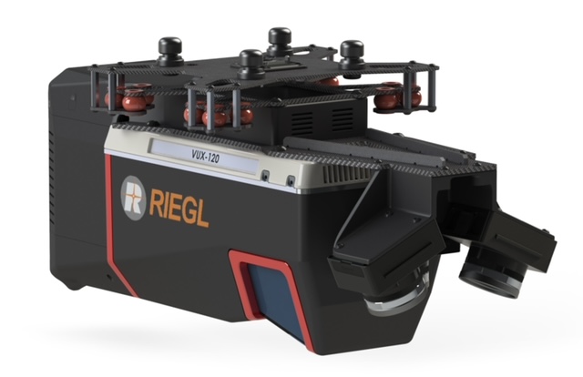
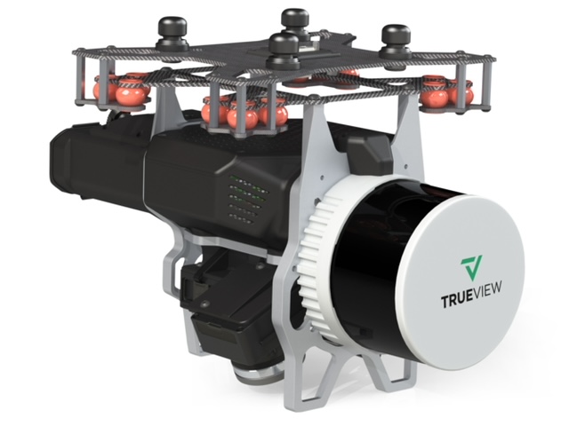
GeoCue also announced a new flagship system, the TrueView 720. VP of Special Projects Martin Flood says, “This is our fourth generation RIEGL integration and it does not disappoint. This is the system for high point density corridor mapping. Using the RIEGL VUX-120 with 3 laser beam orientations (Nadir, +10 degrees Forward and -10 degrees Backward) and 3 oblique/nadir cameras allows data collection from more surfaces in one flight path.”
A practical application of this technology is found in scanning power lines. Users will be able to capture the poles vertically, front and back. Because of the extreme range of this system, it can be integrated with drones, airplanes, or helicopters. Regardless of aircraft deployed, TrueView 720 features a simple workflow bringing data into our LP360 software for processing and visualization.
In addition to these two new sensor payloads, GeoCue is innovating with new surveying equipment, specially designed to work with its LP360 Drone software. Darrick Wagg, VP of Customer Success for GeoCue demonstrated a new LP360 add-on called 3D Accuracy and presented the new Accuracy Star hardware from the GeoCue booth. According to Wagg, “When used together, Accuracy Star and the 3D Accuracy add-on provide automated horizontal and vertical checks. You can automatically find a 3D target on a drone dataset. The software will calculate the correction for any 3D target and provide a seamless workflow to apply the correction on the point cloud.”
Vincent Legrand, VP of Sales for the company added, “This announcement is very well received as it aligns with what our customers have been telling us that they need from our next gen hardware and software. These products will be available for purchase starting on March 1st, but we are certainly having the initial discussions and planning with distributors and customers today.”
As Geo Week participants and press crowded the booth for a closer look at the new products, mdGroup (parent company of GeoCue) CEO Vivien Heriard-Dubreuil stated, “The development of our new hardware and software is based on continuous customer feedback. We value strong relationships with our users and distributors in the field, and use their suggestions to prioritize new products, both for our LiDAR survey equipment and software. We’re building the company around our customers… and we’re just getting started.”